Back to West Cornwall & The Lizard walks
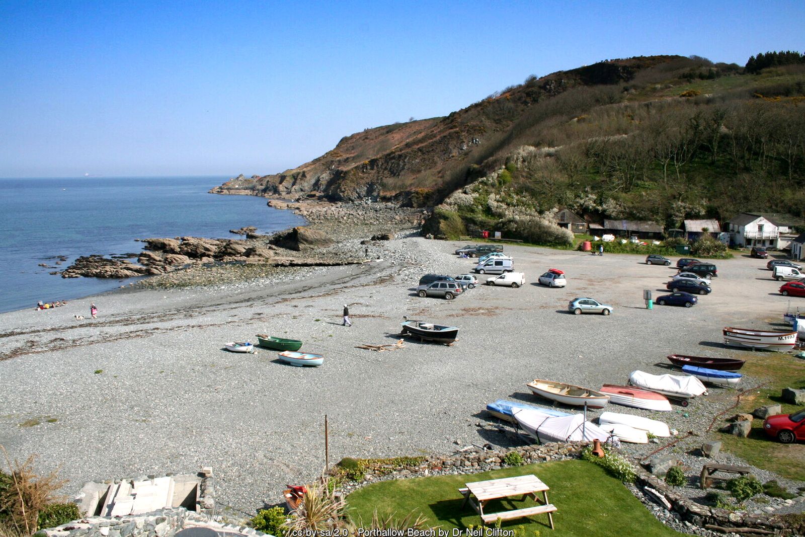
Views across Falmouth Bay, dramatic cliffs, old quarries and two fishing coves – a varied circuit from the village of St Keverne.
This attractive circular walk takes in views of Falmouth Bay, dramatic cliffs, disused quarries and two fishing coves – a varied terrain, occasionally steep. Wear stout shoes, or wellingtons after prolonged rain.
Part of the route crosses Porthkerris beach and the old quarry tramway, so check the tide times before you set out. The coast path between Porthallow and Porthoustock has recently been realigned as part of the England Coast Path – where the waymarks differ from these directions, follow the waymarks. The coast path between Porthallow and Porthoustock has recently been realigned as part of the England Coast Path – where the waymarks differ from these directions, follow the waymarks.
Walk at a glance
- Distance
- 4 miles
- Grade
- Moderate, occasionally steep
- Map
- OS Explorer 103 – The Lizard
- Start
- The Square, St Keverne
- Terrain
- Field paths, stiles, lanes, shingle beach and old quarry tracks – muddy after rain
Parking
Parking in St Keverne village.
Facilities
Pubs, shops and toilets in St Keverne; refreshments at Porthallow.
Disabled access
This walk is not suitable for wheelchairs or anyone with limited mobility: it has stiles, steep climbs out of the coves, a shingle beach and muddy field paths. The Square in St Keverne, with its church, pubs and shops, is fairly level, and Porthallow and Porthoustock both have parking close to the beach for views of the coves without the walk.
Places to stay
The route
St Keverne to Trenoweth
Leave St Keverne square with the White Hart on your left and immediately turn right down Well Lane to the Parish Hall. The path continues downhill to a bridge over a stream. Cross the stile ahead, turn right down to a water treatment plant hidden by hydrangeas, cross the stile right of the gate and follow the path with pittosporum trees on your right until it bears left into the old daffodil fields of Trenoweth.
Tregaminion and down to Porthallow
Follow the hedge on your left through two fields to the road. Bear right across the road and over the stile a short way up, cross the fields diagonally right to the farm buildings, and turn right between them onto the Tregaminion Farm lane. Follow the lane left, then right to a three-way junction and take the centre track downhill across a stream, into a field and through a wood to the road. Turn left down to Porthallow, where there are places for refreshments.
Porthkerris
Pick up the coast path just past the café and climb steeply to the cliff top. Head across the field, bearing left to a gate onto the road. If the tide is not very high, turn left down to Porthkerris beach (otherwise turn right along the road to a track on the left that leads to the top of the quarry).
The quarry tramway to Porthoustock
Head south along the shingle and climb onto the old quarry tramway at the foot of the cliffs. Follow the grassy track up past a spectacular quarry to the top of the old loading docks (do not take the path that branches left near the top – it goes too close to the cliff edge). At the top, look on your left for steps down to the lower level and follow the track round to Porthoustock and its derelict stone loading jetties.
Back to St Keverne
At Porthoustock, with your back to the sea, take the road up to the right. Where it bends sharply right, carry straight on in front of the cottages with the stream on your left, to the road at Trenoweth Mill. Turn left, and where the road bends left over the stream keep straight on up the valley between stone hedges. Where the path divides take the left fork over a stile and across the stream, past the gardens of Trenoweth, then across fields and the drive to Tregonning Mill to the gate into St Keverne churchyard and back to the square.
All information is given in good faith and for guidance only. Always carry the OS map and check the South West Coast Path website for diversions.
Highlights along the way
Porthallow
A shingle fishing cove, marking the halfway point of the South West Coast Path.
Porthkerris
A shingle beach with views across Falmouth Bay.
Porthoustock
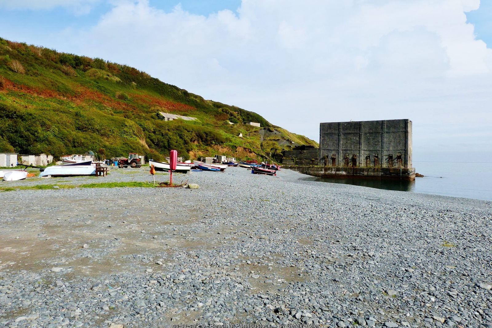
A working cove dominated by the remains of stone-loading jetties.
St Keverne church
A landmark spire long used by sailors to steer clear of the Manacles.
Nearby
Beaches
Places to visit
Towns & villages
Photos

Where the walk starts
The marker shows the start of the walk.
Before you set out
Carry the OS map – paths and signs can change and mobile signal is patchy.
Check the weather and tide times before you set out.
Keep to the path and well back from cliff edges.
Keep dogs under close control near livestock and cliffs.