Back to West Cornwall & The Lizard walks
Engine houses, sandy coves, sheer cliffs and a hilltop beacon – a walk through the heart of the Cornish mining landscape.
An interesting and varied walk following the coast path south-west from St Agnes past the famous engine houses of Wheal Coates to Chapel Porth and Porthtowan, then inland along lanes to the foot of St Agnes Beacon and back down into the village.
This is part of the Cornwall and West Devon Mining Landscape World Heritage Site, and the cliffs are dotted with the remains of tin and copper mines.
Walk at a glance
- Distance
- Main walk about 8¾ miles (about 4½ hrs)
Shorter walk via Beacon Cottage Farm about 5¾ miles (about 3 hrs) - Grade
- Moderate – steep steps at the start and a climb to the Beacon
- Map
- OS Explorer 104 – Redruth & St Agnes
- Start
- Trevaunance Cove, St Agnes
- Terrain
- Coast path, quiet lanes, moorland and field paths; beach at low tide
Parking
Several car parks in St Agnes and at Trevaunance Cove.
Facilities
Toilets in the car park by the library and down by the beach. Cafés, pubs and shops in St Agnes, and a pub and café at Trevaunance Cove. Refreshments at Chapel Porth (seasonal) and Porthtowan.
Disabled access
This walk is not suitable for wheelchairs or limited mobility: the road down to Trevaunance Cove is very steep, the walk starts up steep steps, and much of the coast path is rough and uneven near unfenced cliffs. Trevaunance Cove has toilets with disabled provision, and the Trelawny Road car park in St Agnes has disabled bays. For a shorter outing, the National Trust car park at Wheal Coates has a designated disabled space, and the engine houses are about 300–500 m away along a fairly level but stony, uneven path; beyond the first buildings it becomes very steep and rough.
The route
Numbers in circles match the points on the route map and the waypoint table below. Distances are approximate and measured between points.
Main walk – Trevaunance Cove, St Agnes Head, Wheal Coates, Porthtowan and St Agnes Beacon (about 8¾ miles)
Trevaunance Cove to St Agnes Head
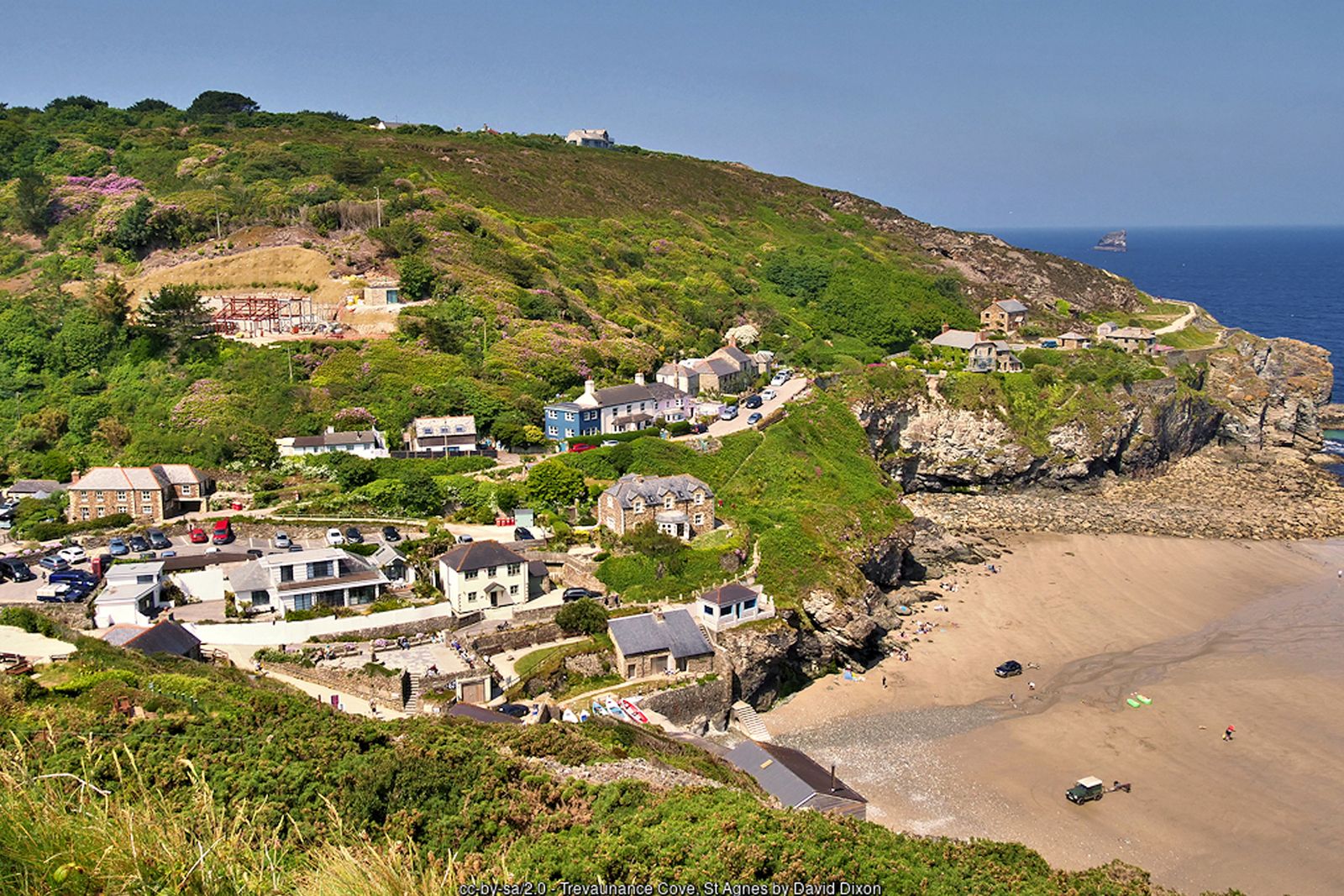
From the car parks walk down to the beach at Trevaunance Cove. The heaps of granite blocks on the western side are all that remain of the harbour that the Tonkin family and later investors tried again and again to build here between the 1630s and the 1790s, each one wrecked by Atlantic storms. Facing the sea, turn left past the old Watch House and climb the steep steps onto the South West Coast Path. Follow the acorn waymarks west with the sea on your right, crossing open heath and passing fields above Newdowns Head. Ignore paths off to the left and keep to the cliff-top path. Look out for seals around Bawden Rocks (“Man and his Man”) offshore. The cliffs here are high and unfenced – keep dogs and children close.
Point 2: St Agnes Head (National Trust car park by the coast path) – 50.31709, -5.23286 (SW 699 513 (approx.))
Round St Agnes Head to Wheal Coates
At St Agnes Head the coast turns south. A short fork to the right leads to the white National Coastwatch lookout, where volunteers are often happy to chat. Continue south along the coast path past the St Agnes Head car parks and the capped mine shafts on the heath, with the sea still on your right. As the chimneys of Wheal Coates come into view, the path divides: leave the acorn waymarks and take the left-hand path uphill to the mine buildings, where you can explore the stamps and whim engine house, the calciner (used to roast arsenic out of the tin ore) and the lone chimney.
Point 3: Wheal Coates – stamps and whim engine house – 50.30529, -5.23187 (SW 69963 50035)
Down to Towanroath
From the mine buildings take the rocky zigzag path down towards the sea to rejoin the coast path at Towanroath, the famous engine house perched on the cliff edge. Built in 1872 to pump water from the mine, it has a grating over the shaft beside it where you can peer down. Keep to the path – the ground around the engine houses is uneven and the cliff edge is unfenced. (For the shorter walk back over the Beacon, see the option below.)
Point 4: Towanroath engine house – 50.30503, -5.23309 (SW 699 500)
On to Chapel Porth
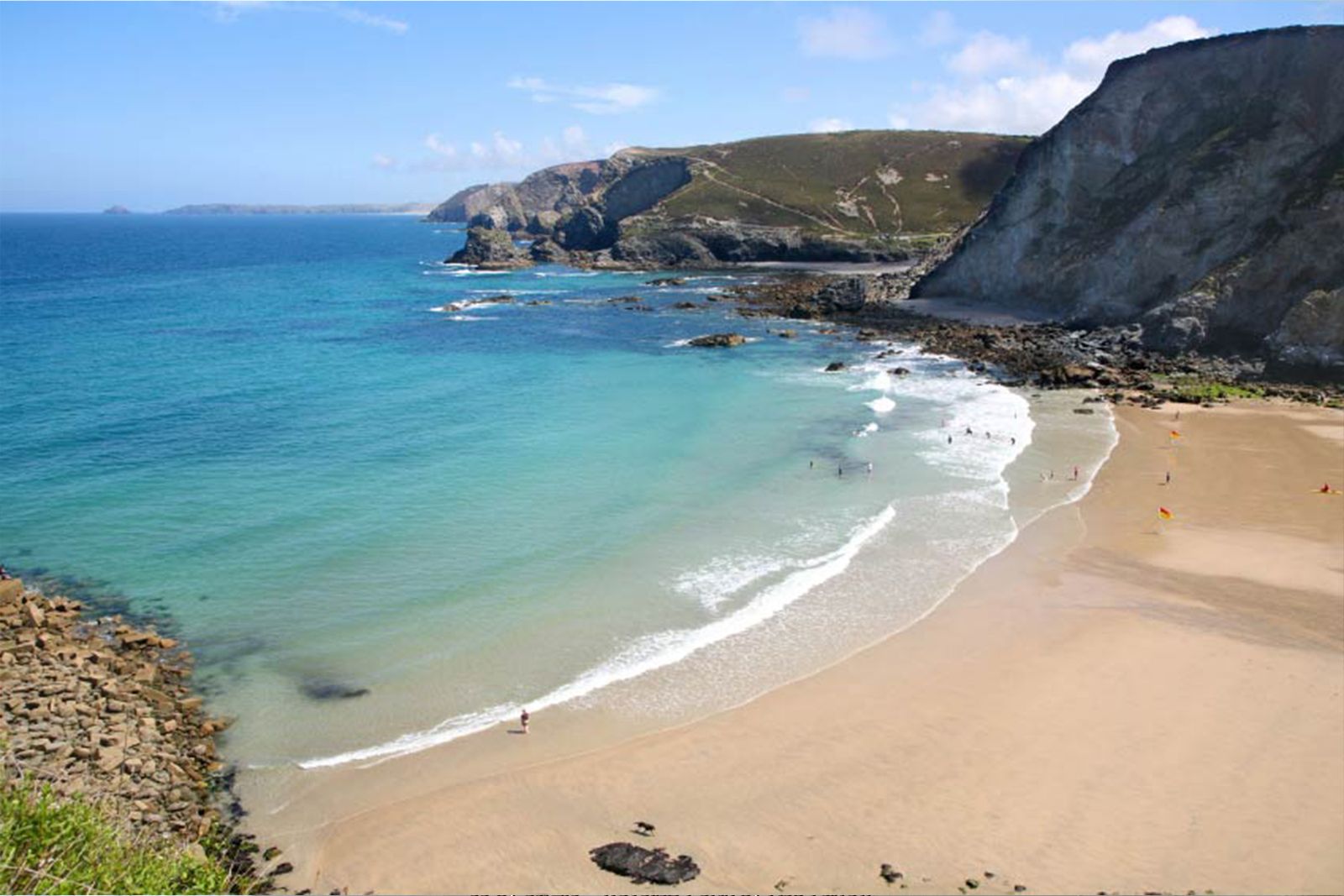
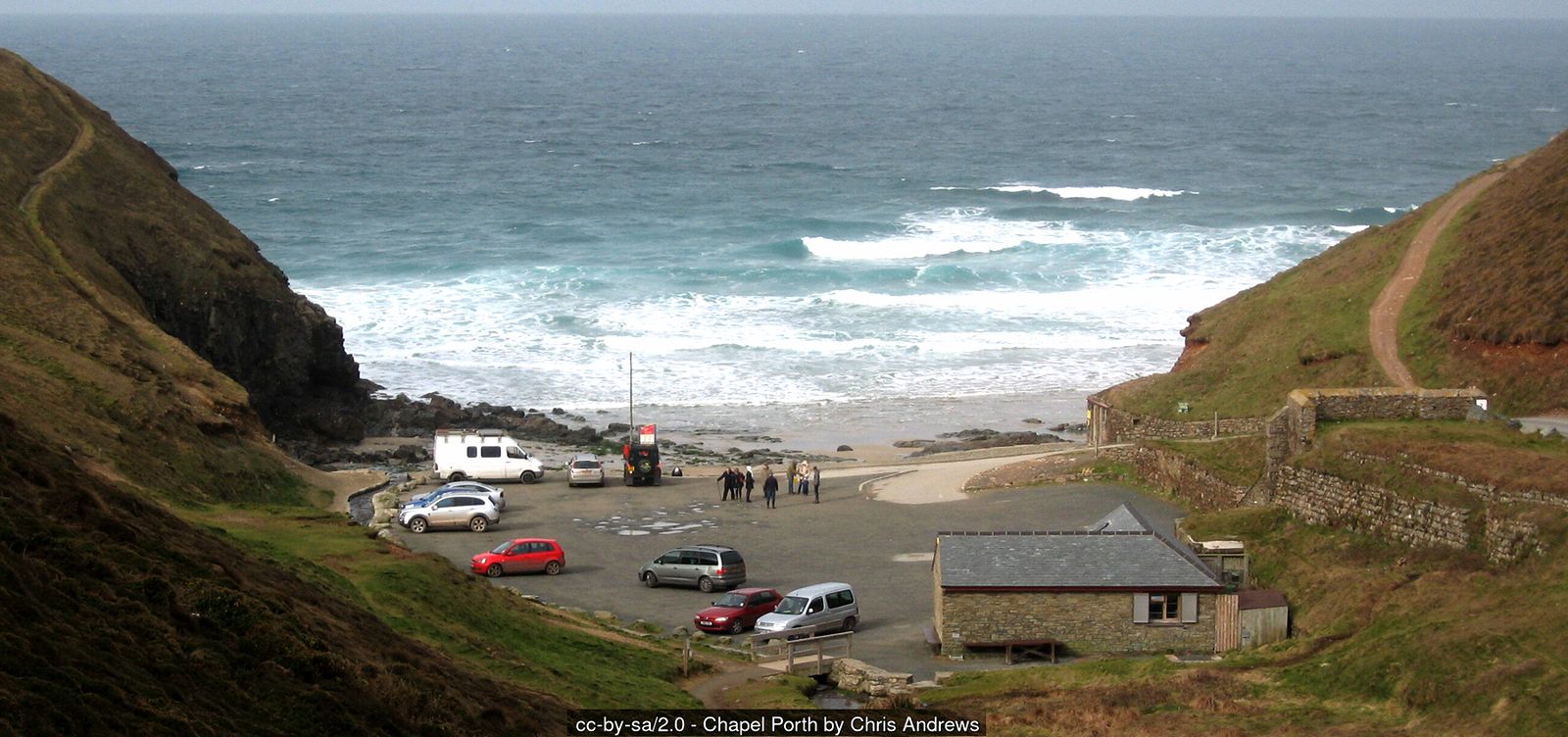
Continue south along the coast path, sea on your right, descending into the steep valley of Chapel Porth. The National Trust car park has toilets (including a RADAR accessible toilet) and a seasonal beach café. At low tide the beach reveals caves and rock pools, including Vugga Cave.
Point 5: Chapel Porth (National Trust car park and café) – 50.30005, -5.23415 (SW 69776 49460)
Chapel Porth to Porthtowan
Cross the stream behind the beach and follow the acorn waymarks as the coast path climbs steeply up the southern side of the cove, then continues along the cliffs, sea on your right, before descending into Porthtowan. At low tide you can walk along the sand from Chapel Porth to Porthtowan instead (about 20 minutes), but check the tide times carefully – the beach is cut off as the tide comes in and there is no way up the cliffs.
Point 6: Porthtowan Beach long-stay car park (TR4 8AA) – 50.28707, -5.24009 (SW 69289 48035)
Inland along Towan Road
From Porthtowan beach walk inland along Beach Road, passing the long-stay car park and toilets on your left. Take the left turn just past the car park; a track signed as a public byway climbs uphill on your left. Follow it, ignoring turnings to the right. It becomes the lane known as Towan Road and passes Towan Farm before meeting a road on the edge of Towan Cross. Turn left into Towan Cross, where the Victory Inn is a good stop for refreshments.
Point 7: Victory Inn, Towan Cross – 50.29070, -5.22172 (SW 70616 48382)
Towan Cross to Mingoose
Opposite the Victory Inn turn left down the quiet lane and follow it as it drops towards the hamlet of Mingoose at the head of Chapel Coombe. There is no pavement – walk in single file and face oncoming traffic.
Point 8: Mingoose – lane across the head of Chapel Coombe – 50.29445, -5.20810 (SW 71603 48757)
Up to St Agnes Beacon
Cross the valley and climb north towards St Agnes Beacon. Ignore a turning to the right and continue to a crossroads. Go straight over and take the first track on the left signed to the Beacon (a private track – keep dogs on leads). The path contours round the hill before climbing to the summit, a Bronze Age burial mound later used as a fire beacon. The toposcope on top names the landmarks you can see – on a clear day the view stretches along the north coast to St Ives Bay and inland across the mining country.
Point 9: St Agnes Beacon summit (barrow and toposcope, 192 m) – 50.30733, -5.21730 (SW 71010 50217)
Down to St Agnes church
From the summit take the right-hand of the paths down the hill, through a farm gate and along a track to a minor road. Turn left, and just past a few houses take the footpath on the right, which leads down into St Agnes village beside the parish church.
Point 10: Church of St Agnes, Churchtown – 50.31237, -5.20334 (SW 72028 50734)
Back to Trevaunance Cove
Just past the church turn left down Stippy Stappy, the steep terrace of former sea captains’ cottages. Near the bottom bear left and turn left into Quay Road, following it down the valley back to Trevaunance Cove. Quay Road is steep and narrow with little or no pavement – take care of traffic.
Point 1: Trevaunance Cove car parks, below the Driftwood Spars – 50.31857, -5.20269 (SW 72104 51422)
Option Shorter walk via Beacon Cottage Farm (about 5¾ miles)
Follow the main walk to the Wheal Coates engine houses (step 2) and down to Towanroath if you wish (step 3), then climb back up to the mine buildings and:
Wheal Coates to the car park
Leave the mine buildings on the gravel path to the left of the lone chimney, heading east towards St Agnes Beacon, which rises ahead of you. The path leads across the heath to the National Trust’s Wheal Coates car park.
Point A1: Wheal Coates car park (National Trust, TR5 0NT) – 50.30304, -5.22067 (SW 707 497 (approx.))
To Beacon Cottage Farm
Walk through the car park to the road (Beacon Drive) and turn left for a short distance, then take the first turning on the right, the lane to Beacon Cottage Farm. There is no pavement – watch for traffic.
Point A2: Beacon Cottage Farm – 50.30552, -5.22450 (SW 70489 50038)
Up to the Beacon
Walk between the farm buildings and leave through the signed gate. Cross the field to a stone stile, then bear left uphill to the summit of St Agnes Beacon. Continue from step 9 of the main walk.
Point 9: St Agnes Beacon summit (barrow and toposcope, 192 m) – 50.30733, -5.21730 (SW 71010 50217)
All information is given in good faith and for guidance only. Always carry the OS map and check the South West Coast Path website for diversions.
Highlights along the way
Wheal Coates
One of the most photographed engine houses in Cornwall, perched above the sea (National Trust).
Chapel Porth
A small sandy cove at the foot of a steep valley, with rock pools at low tide.
St Agnes Beacon
A 192 m hill giving panoramic views over the north coast.
Trevaunance Cove
St Agnes’ own beach, with the remains of its lost harbour.
Nearby
Places to visit
Towns & villages
Photos
Route map and waypoints
Latitude and longitude (WGS84, as used by phones and sat-navs) with OS grid references. The markers show key points only – follow the waymarked paths between them.
| Point | Place | Lat, long | Grid ref |
|---|---|---|---|
| 1 | Trevaunance Cove car parks, below the Driftwood Spars | 50.31857, -5.20269 map | SW 72104 51422 |
| 2 | St Agnes Head (National Trust car park by the coast path) | 50.31709, -5.23286 map | SW 699 513 (approx.) |
| 3 | Wheal Coates – stamps and whim engine house | 50.30529, -5.23187 map | SW 69963 50035 |
| 4 | Towanroath engine house | 50.30503, -5.23309 map | SW 699 500 |
| 5 | Chapel Porth (National Trust car park and café) | 50.30005, -5.23415 map | SW 69776 49460 |
| 6 | Porthtowan Beach long-stay car park (TR4 8AA) | 50.28707, -5.24009 map | SW 69289 48035 |
| 7 | Victory Inn, Towan Cross | 50.29070, -5.22172 map | SW 70616 48382 |
| 8 | Mingoose – lane across the head of Chapel Coombe | 50.29445, -5.20810 map | SW 71603 48757 |
| 9 | St Agnes Beacon summit (barrow and toposcope, 192 m) | 50.30733, -5.21730 map | SW 71010 50217 |
| 10 | Church of St Agnes, Churchtown | 50.31237, -5.20334 map | SW 72028 50734 |
| A1 | Wheal Coates car park (National Trust, TR5 0NT) | 50.30304, -5.22067 map | SW 707 497 (approx.) |
| A2 | Beacon Cottage Farm | 50.30552, -5.22450 map | SW 70489 50038 |
Before you set out
Carry the OS map – paths and signs can change and mobile signal is patchy.
Check the weather and tide times before you set out.
Keep to the path and well back from cliff edges.
Keep dogs under close control near livestock and cliffs.