Back to West Cornwall & The Lizard walks
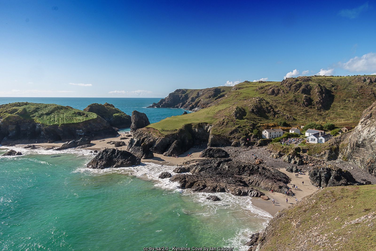
Turquoise water, white sand and red-and-green serpentine rock at Kynance, then the dramatic cliffs of the most southerly point of mainland Britain – one of the classic walks of the Lizard.
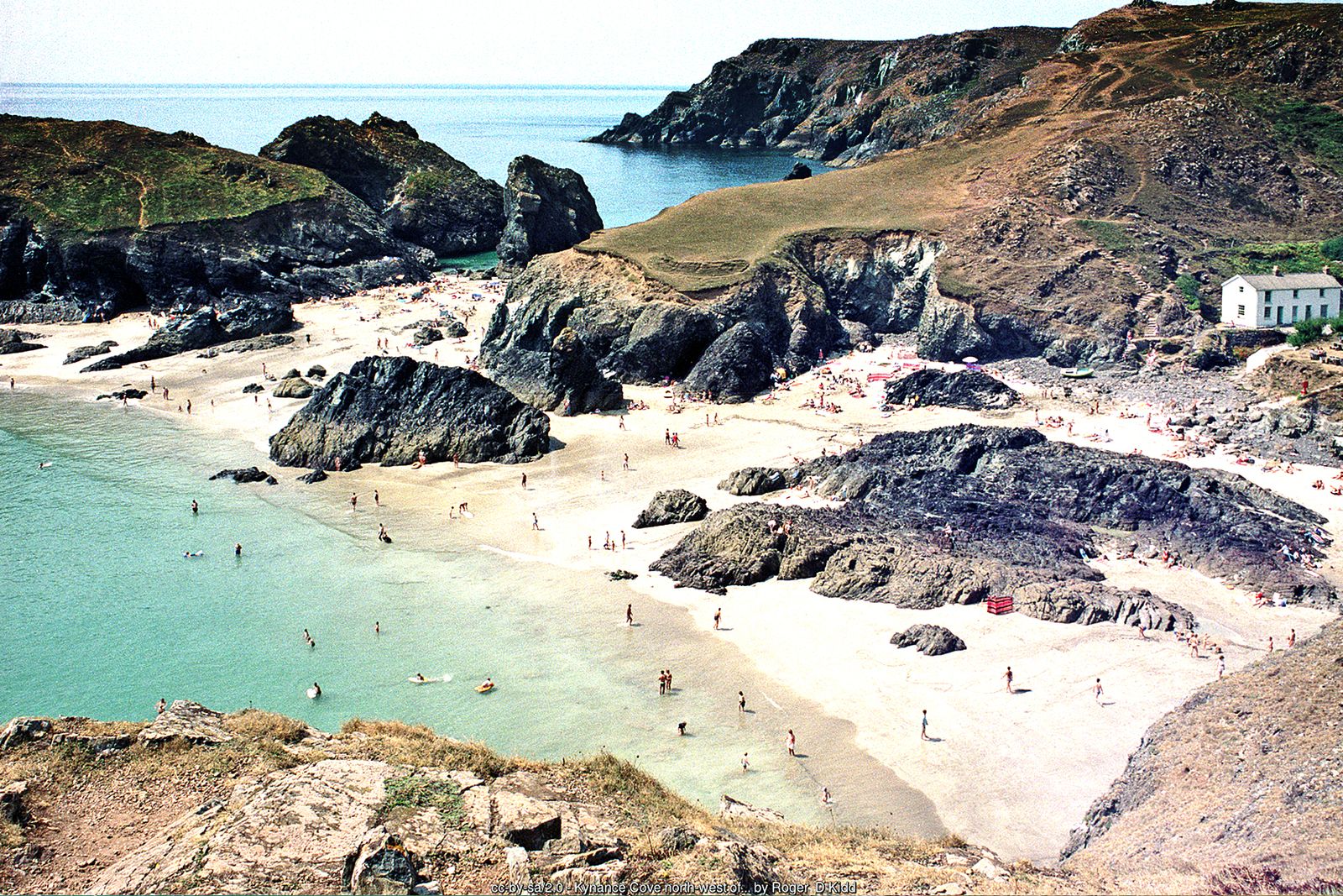
Kynance Cove is one of the most photographed places in Cornwall – a small sandy cove framed by stacks and islands of dark serpentine rock, with water of an extraordinary colour on a sunny day. This circular walk follows the South West Coast Path south from Kynance around Old Lizard Head to Lizard Point, the most southerly point of mainland Britain, then continues east past the lighthouse and the Lion’s Den to Bass Point before returning inland through Lizard village.
The cove is tidal and the beach disappears at high tide, so check the tide times if you want time on the sand. The cliffs are unfenced and some sections are steep, so wear walking boots and keep children and dogs close.
Walk at a glance
- Distance
- About 6½ miles (allow 3–4 hrs)
Shorter option: start from Lizard village (about 6 miles) - Grade
- Moderate to challenging – steps at Kynance and Caerthillian, some steep climbs and unfenced cliff edges
- Map
- OS Explorer 103 – The Lizard
- Start
- National Trust car park above Kynance Cove, TR12 7PJ
- Terrain
- Stony cliff-top coast path, steps, grassy headlands, field paths and a short stretch of lane
Parking
National Trust pay and display car park above Kynance Cove (postcode TR12 7PJ) – free for National Trust members. It is not large and fills early on fine summer days. You can also start the walk from the car park in Lizard village, or from the National Trust car park at Lizard Point.
Facilities
Toilets, including accessible toilets, at the Kynance car park and at the cove, and at the Lizard Point car park. Café at Kynance Cove and cafés at Lizard Point. Pubs, cafés and shops in Lizard village. Dogs are not allowed on Kynance Cove beach from 10am to 6pm in July and August.
Disabled access
This walk is not suitable for wheelchairs or anyone with limited mobility: the path down to Kynance Cove is steep with steps onto the beach, and the coast path has steps, stiles and steep, stony sections close to unfenced cliff edges. The National Trust car park at Kynance has disabled parking, accessible toilets and a wheelchair-accessible viewing platform looking over the cove. At Lizard Point, a short sloping gravel and tarmac path from the National Trust car park avoids steps and is suitable for wheelchairs and pushchairs, with accessible parking and toilets at the car park.
Places to stay
The route
Kynance car park to the cove
From the National Trust car park follow the well-used path down towards the cove – it is steep in places, with steps near the bottom. At low tide you can explore the beach between Asparagus Island, Steeple Rock and the mainland cliffs; keep an eye on the tide, which comes in quickly around the islands.
South along the cliffs
Climb back up the eastern side of the cove and pick up the coast path heading south along the cliff top. The path runs high above Pentreath beach, then drops steeply by steps into the little valley at Caerthillian Cove and climbs out again on the far side.
Old Lizard Head to Lizard Point
Continue round Old Lizard Head, where the views open up along the coast, and past Pistol Meadow, said to be the burial place of drowned sailors from a shipwreck. The path then descends towards Polpeor Cove, with its disused Victorian lifeboat station, and reaches Lizard Point, where there are cafés and serpentine workshops.
The lighthouse and the Lion’s Den
Keep to the coast path east past the Lizard Lighthouse, whose white towers date from the 1750s. After dropping down and climbing out of Housel Bay, look out for the Lion’s Den – a huge fenced hollow in the cliff top formed when the roof of a sea cave collapsed in 1847. Keep to the path.
Bass Point
The path continues to Bass Point and the old Lloyd’s Signal Station, where passing ships once reported by flag signals. Nearby is the Lizard Wireless Station, where Guglielmo Marconi carried out pioneering radio experiments in the early 1900s, now cared for by the National Trust.
Inland to Lizard village and back to Kynance
From Bass Point leave the coast path and follow the lane inland to Lizard village, a good place for refreshments. From the village green take the signed footpath west across the fields and heath back towards Kynance, following signs for Kynance Cove to return to the car park. There are several paths across this land, so carry the OS map.
All information is given in good faith and for guidance only. Always carry the OS map and check the South West Coast Path website for diversions.
Highlights along the way
Kynance Cove
White sand, turquoise water and islands of serpentine rock – best enjoyed at low tide.
Lizard Point
The most southerly point of mainland Britain, with seals and choughs often seen below the cliffs.
The Lion’s Den
A dramatic hole in the cliff top left by the collapse of a sea cave in 1847.
Bass Point
Home to the Victorian Lloyd’s Signal Station and the Lizard Wireless Station of Marconi’s early experiments.
Nearby
Towns & villages
Photos
Where the walk starts
The marker shows the start of the walk.
Before you set out
Carry the OS map – paths and signs can change and mobile signal is patchy.
Check the weather and tide times before you set out.
Keep to the path and well back from cliff edges.
Keep dogs under close control near livestock and cliffs.