Back to West Cornwall & The Lizard walks
A granite quarry cove loved by artists, a sheltered nature reserve of old flower gardens, and one of Cornwall’s prettiest fishing villages – a classic circuit on the south coast of Penwith.
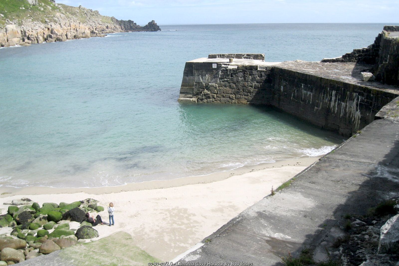
Lamorna Cove is a small, rocky cove at the foot of a wooded valley. Granite was quarried here from 1849 until 1911 – the waste tips can still be seen on the eastern side – and the quay dates from the late 19th century. In the early 1900s the valley became home to artists of the Newlyn School, among them S. J. “Lamorna” Birch, Laura and Harold Knight and Alfred Munnings.
This circular walk follows the South West Coast Path east from Lamorna through the Kemyel Crease nature reserve to Mousehole, then returns inland along old field paths via Raginnis and Kemyel. Wear boots – the coast path is rough in places, and the fields can be very wet in winter.
Walk at a glance
- Distance
- About 5 miles (allow 2½–3 hrs)
- Grade
- Moderate to challenging – rocky coast path with plenty of ups and downs
- Map
- OS Explorer 102 – Land’s End
- Start
- Lamorna Cove car park, TR19 6XJ (or start in Mousehole)
- Terrain
- Rocky coast path with boulders and low trees to duck under, village streets, field paths, stiles and woodland – muddy after rain
Parking
Pay car park beside the quay at Lamorna Cove (postcode TR19 6XJ) – carry change and put enough time on your ticket, as the car park is enforced. The lane down the Lamorna valley is narrow. Alternatively park in Mousehole, where the car parks on the harbour are small and busy in summer.
Facilities
Café at Lamorna Cove (seasonal). Pubs, cafés, shops and toilets in Mousehole, about halfway round. Mousehole has a regular bus service from Penzance.
Disabled access
This walk is not suitable for wheelchairs or anyone with limited mobility: the coast path between Lamorna and Mousehole is rocky, with boulders, steep ups and downs and low branches, and the inland return crosses stiles and often muddy fields. At Lamorna the quay is right beside the car park and gives views across the cove. In Mousehole the area around the harbour is the flattest part of the village, although the streets away from it are narrow and steep.
Places to stay
The route
Lamorna Cove onto the coast path
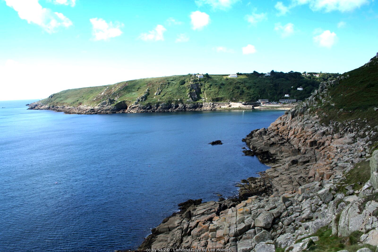
From the car park walk towards the quay and pick up the coast path heading east, signed towards Mousehole. It climbs around the headland of Carn Du, with views back across the cove and west towards Tater Du lighthouse.
Kemyel Crease
The path continues over rocky ground around Kemyel Point and into the Kemyel Crease nature reserve, managed by Cornwall Wildlife Trust. Here the path runs through the remains of more than a hundred tiny Victorian market gardens, known as quillets, sheltered by windbreaks of Monterey pine and cypress. The trees grow low over the path, so watch your head.
Into Mousehole
Beyond the reserve the path comes out above Mousehole and joins the road down Raginnis Hill into the village. Just before the harbour you pass Spaniard’s Point, where Spanish raiders landed in 1595 and burned much of Mousehole. Offshore is St Clement’s Isle.
Mousehole harbour
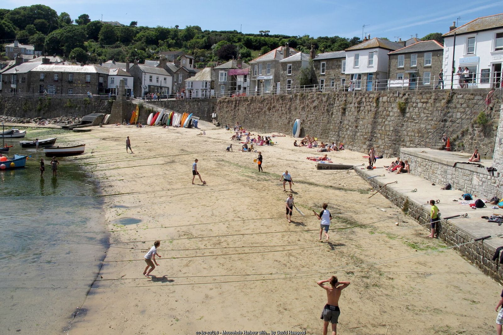
Take time to explore the granite harbour and narrow streets – a good place for a break. The Penlee lifeboat station, from which the Solomon Browne and her eight crew were lost in December 1981, is a short walk north along the coast road towards Newlyn.
Up to Raginnis
For the return, head back from the harbour and climb up through the village streets to pick up the field path known as Love Lane. It leads across several fields to the hamlet of Raginnis, with wide views over Mount’s Bay towards St Michael’s Mount.
Kemyel and back to Lamorna
Continue west across the fields and stiles to Kemyel Drea, skirting the farmyard, and on past Kemyel Mill. The path then zig-zags down through woodland to the lane in the Lamorna valley; turn left and follow it back down to the cove and the car park.
All information is given in good faith and for guidance only. Always carry the OS map and check the South West Coast Path website for diversions.
Highlights along the way
Lamorna Cove
A former granite quarrying cove with a listed quay, much painted by the Newlyn School artists.
Kemyel Crease
A sheltered nature reserve among the remains of Victorian flower and potato gardens.
Mousehole
A granite fishing village with a snug harbour, famous for its Christmas lights.
Mount’s Bay views
Across the bay to Penzance, Newlyn and St Michael’s Mount from the field paths above Raginnis.
Nearby
Photos
Where the walk starts
The marker shows the start of the walk.
Before you set out
Carry the OS map – paths and signs can change and mobile signal is patchy.
Check the weather and tide times before you set out.
Keep to the path and well back from cliff edges.
Keep dogs under close control near livestock and cliffs.