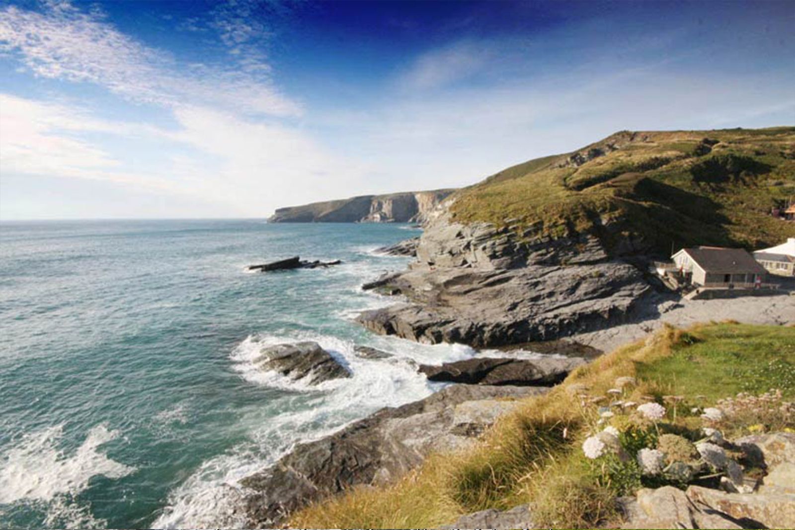
Old quarrymen’s paths, a clifftop Norman church and the legendary headland of Tintagel – with a golden beach to finish.
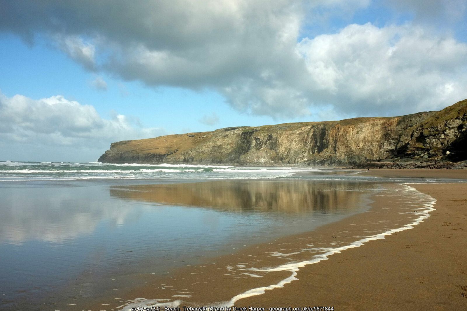
Trebarwith Strand is one of the finest beaches on the North Cornwall coast – a long stretch of golden sand at low tide, backed by dark slate cliffs and watched over by the island of Gull Rock. It is also the start of a classic short walk north along the cliffs to Tintagel.
The path follows ledges and tracks cut by slate quarrymen, passing the abandoned workings of Lanterdan and other clifftop quarries, before reaching the lonely church of St Materiana on Glebe Cliff. From here you can continue down to Tintagel Castle, with its legends of King Arthur, and into the village, before returning inland across the fields via Treknow.
Walk at a glance
- Distance
- Main walk (church loop) about 3½ miles (1¾–2 hrs)
With Tintagel Castle and village about 4¾ miles (2½–3 hrs) - Grade
- Moderate – a steep climb out of Trebarwith Strand, then mostly level clifftop
- Map
- OS Explorer 111 – Bude, Boscastle & Tintagel
- Start
- Trebarwith Strand car park, near Tintagel PL34 0HB
- Terrain
- Clifftop coast path along old quarry workings, steps, field paths with some stiles and quiet lanes
Parking
Large Cornwall Council pay and display car park in the valley at Trebarwith Strand (PL34 0HB), a short walk from the beach, with some smaller parking closer to the shore. Alternatively start in Tintagel, where there are several car parks including the council long-stay car park at the Visitor Centre on Bossiney Road.
Facilities
The Port William pub and a café at Trebarwith Strand (check seasonal opening). Pubs, cafés, shops and public toilets in Tintagel village. Tintagel Castle (English Heritage) has its own café and toilets – admission charge, booking advised.
Disabled access
The full circuit is not suitable for wheelchairs or limited mobility because of the steep climb and steps out of Trebarwith Strand, stiles on the inland paths and uneven clifftop ground near unfenced drops. St Materiana’s church can be reached by road, and the clifftop around the churchyard gives fine coastal views with little walking. Tintagel Castle itself involves steep paths and many steps; check the English Heritage access page before visiting for current arrangements.
The route
Numbers in circles match the points on the route map and the waypoint table below. Distances are approximate and measured between points.
Main walk – Trebarwith Strand, Glebe Cliff church and Treknow (about 3½ miles)
Car park to the beach
From the Cornwall Council car park turn right out of the entrance and walk down the narrow valley lane towards the sea. There is no pavement, so keep to the side and watch for cars. At the foot of the lane the Port William pub stands above you on the left, and the slipway leads down onto the beach. The sand is only uncovered around low tide and the incoming tide cuts people off below the cliffs every year – check tide times before going onto the beach.
Point 2: Foot of the lane at Trebarwith Strand, below the Port William – 50.64424, -4.76101 (SX 04889 86367)
Up onto the cliffs to Lanterdan
At the bottom of the lane look for the South West Coast Path acorn sign on the right (north side of the valley), signed to Tintagel. The path climbs steadily up steps and a zigzag onto the cliff top, with Gull Rock out to sea behind you. Once on top the path levels out along old quarry tracks. After about half a mile you reach Lanterdan Quarry, where a tall slate pinnacle stands on its own in the middle of the cliff workings – the quarrymen left it because the rock was too poor for roofing slate. The quarry edges are sheer and unfenced: keep to the path and keep dogs and children close.
Point 3: Lanterdan Quarry and pinnacle – 50.65025, -4.75922 (SX 050 870 (approx.))
Bagalow Cliff above Hole Beach
Keep on the coast path north past the quarry. Below on your left is Hole Beach, named after a cave cut by the quarrymen in the cliff face; at low tide it joins up with Trebarwith Strand. Pass the National Trust sign for Bagalow, cross a stile and go through a gap in the old wall on Bagalow Cliff. Ignore the path on the right heading inland across the fields to Trevillick and keep straight on along the coast.
Point 4: Hole Beach and Bagalow Cliff – 50.65307, -4.76165 (SX 048 873 (approx.))
Round Penhallic Point
Bear left over another stile and follow the path round Lower and Higher Penhallic Point. On the grassy slope below you can make out the zigzag track that donkeys and carts used to take slate down to boats at Penhallick Wharf. There are wide views back south over Hole Beach, Trebarwith Strand and on towards Port Isaac.
Point 5: Lower Penhallic Point – 50.65504, -4.76587 (SX 0459 8758)
Along the quarry cliffs to the Youth Hostel
Continue north along the cliffs past the Gull Point and Lambshouse quarry workings. The path joins a broad track which leads to Tintagel Youth Hostel, a former quarry office in a spectacular spot above Dunderhole Point. When there is a big swell running, waves boom and spout in the inlet below.
Point 6: Tintagel Youth Hostel, Dunderhole Point – 50.65979, -4.76406 (SX 04738 88104)
Glebe Cliff and St Materiana’s church
Walk past the hostel and stay on the coast path across the open National Trust land of Glebe Cliff, with Tintagel Island and the castle ruins coming into view ahead. Where the church appears on your right, bear right to it. St Materiana’s dates from the late 11th and early 12th centuries and sits alone in its windswept churchyard. For the longer walk with Tintagel Castle and the village, follow “Longer walk via Tintagel Castle” below and rejoin here.
Point 7: St Materiana’s Church, Glebe Cliff – 50.66303, -4.75967 (SX 05061 88452)
Church lane to the B3263 at Tregatta
From the church gate follow the lane inland. Leave Vicarage Hill (which runs into Tintagel village) to your left and keep on the lane heading south-east, past the houses at Trevillick, for about half a mile until it meets the main B3263 road at Tregatta, just by Trewethen Barn.
Point 8: Lane end on the B3263 at Tregatta (by Trewethen Barn) – 50.65462, -4.75322 (SX 05482 87500)
Through Treknow
Turn right along the B3263 for about 60 m (200 ft) – there is no pavement, so walk in single file facing the traffic – then take the first road on the right, signed to Treknow. Follow this quiet road south for about half a mile into Treknow, past the village hall.
Point 9: Treknow village – 50.64922, -4.75124 (SX 056 869 (approx.))
Treknow back to Trebarwith Strand
Keep south on the road through Treknow and bear right where it forks. A short way on, take the signed public footpath on the right, which drops south-west down the side of the valley to the car park at Trebarwith Strand. If the tide is out, walk on down to the beach to finish; the Port William and the beach café are close by.
Point 1: Trebarwith Strand car park (PL34 0HB) – 50.64483, -4.75519 (SX 05302 86417)
Option Longer walk via Tintagel Castle and village (about 4¾ miles)
Follow the main walk to St Materiana’s church (step 6), then:
Glebe Cliff down to Tintagel Castle
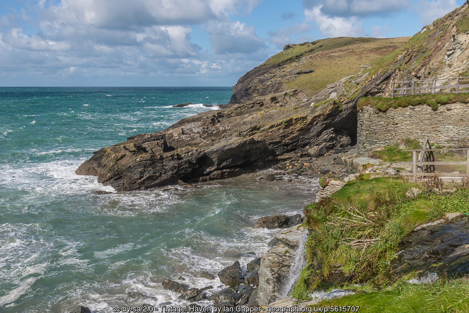
From the church go back to the coast path and turn right along the seaward wall of the churchyard. Cross a stile and follow the coast path north as it drops steeply down the cliff side, past old earthwork defences, to the valley bottom at Tintagel Haven by the castle entrance and English Heritage visitor centre. The footbridge (opened in 2019) crosses to the island, where the castle ruins date from the 13th century but the site was a major stronghold centuries earlier. Castle admission is charged; booking is advised in busy periods. The paths on the island are steep with many steps. At low tide you can see Merlin’s Cave from the beach.
Point A1: Tintagel Castle entrance and visitor centre, Tintagel Haven – 50.66800, -4.75800 (SX 05200 89000)
Up the castle track to Tintagel village
From the visitor centre walk up the steep tarmac track (the private road used by the castle Land Rover service) that climbs the valley side into Tintagel. It comes out at the western end of Fore Street; turn right along the street for the National Trust’s Old Post Office, a 14th-century stone house, with pubs, cafés and shops around it.
Point A2: Tintagel Old Post Office, Fore Street – 50.66335, -4.75168 (SX 05627 88467)
Vicarage Hill back to the church
Walk back along Fore Street and turn left down Vicarage Hill beside the Cornishman Inn, signed “Parish Church – Glebe Cliff”. Follow this lane west out of the village for about a third of a mile back to St Materiana’s church. Continue from step 7 of the main walk (“Church lane to the B3263 at Tregatta”) – you meet the lane to Tregatta just before the church.
Point 7: St Materiana’s Church, Glebe Cliff – 50.66303, -4.75967 (SX 05061 88452)
All information is given in good faith and for guidance only. Always carry the OS map and check the South West Coast Path website for diversions.
Highlights along the way
Trebarwith Strand
A wide sandy beach at low tide below slate cliffs, with Gull Rock offshore.
Lanterdan Quarry
Dramatic clifftop slate workings with a lone rock pinnacle left standing in the workings.
St Materiana’s church
A clifftop church with Norman origins, standing alone on Glebe Cliff above Tintagel.
Tintagel Castle
The legendary birthplace of King Arthur – medieval ruins on a spectacular headland, reached by a footbridge.
Nearby
Photos
Route map and waypoints
Latitude and longitude (WGS84, as used by phones and sat-navs) with OS grid references. The markers show key points only – follow the waymarked paths between them.
| Point | Place | Lat, long | Grid ref |
|---|---|---|---|
| 1 | Trebarwith Strand car park (PL34 0HB) | 50.64483, -4.75519 map | SX 05302 86417 |
| 2 | Foot of the lane at Trebarwith Strand, below the Port William | 50.64424, -4.76101 map | SX 04889 86367 |
| 3 | Lanterdan Quarry and pinnacle | 50.65025, -4.75922 map | SX 050 870 (approx.) |
| 4 | Hole Beach and Bagalow Cliff | 50.65307, -4.76165 map | SX 048 873 (approx.) |
| 5 | Lower Penhallic Point | 50.65504, -4.76587 map | SX 0459 8758 |
| 6 | Tintagel Youth Hostel, Dunderhole Point | 50.65979, -4.76406 map | SX 04738 88104 |
| 7 | St Materiana’s Church, Glebe Cliff | 50.66303, -4.75967 map | SX 05061 88452 |
| 8 | Lane end on the B3263 at Tregatta (by Trewethen Barn) | 50.65462, -4.75322 map | SX 05482 87500 |
| 9 | Treknow village | 50.64922, -4.75124 map | SX 056 869 (approx.) |
| A1 | Tintagel Castle entrance and visitor centre, Tintagel Haven | 50.66800, -4.75800 map | SX 05200 89000 |
| A2 | Tintagel Old Post Office, Fore Street | 50.66335, -4.75168 map | SX 05627 88467 |
Before you set out
Carry the OS map – paths and signs can change and mobile signal is patchy.
Check the weather and tide times before you set out.
Keep to the path and well back from cliff edges.
Keep dogs under close control near livestock and cliffs.