
Towering cliffs, deep combes and the driftwood hut of Cornwall’s most eccentric parson – a tough but unforgettable circuit on the county’s remote northern edge.
Morwenstow is Cornwall’s most northerly parish – a scatter of farms and hamlets on high ground above some of the wildest cliffs in the county. Its church, dedicated to St Morwenna and St John the Baptist, stands in a sheltered combe just inland from the sea, and was for over forty years the parish of the Reverend Robert Stephen Hawker, poet, eccentric and the man credited with creating the modern harvest festival service in the 1840s.
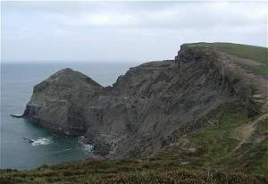
This circuit visits the little driftwood hut Hawker built on the cliff edge, then follows the South West Coast Path south over a succession of headlands and deep valleys – Higher and Lower Sharpnose Points, Stanbury Mouth and Steeple Point – to the pebbly cove at Duckpool. The return heads inland up the wooded Coombe valley and back north across farmland and quiet lanes. It is one of the most demanding stretches of the whole coast path, so allow plenty of time.
Walk at a glance
- Distance
- About 8 miles (allow 3½–4 hrs)
Total ascent roughly 1,870 ft (570 m) - Grade
- Strenuous – a switchback coast path with several very steep descents and climbs
- Map
- OS Explorer 126 – Clovelly & Hartland
- Start
- Morwenstow church / Rectory Farm, Crosstown, Morwenstow EX23 9SR
- Terrain
- Unfenced clifftop coast path with steps, wooded valleys, field paths with stiles and quiet lanes – very muddy after rain
Parking
Small informal car park beside Morwenstow church and Rectory Farm (National Trust area, donations welcome, no overnight parking). Limited spaces – arrive early in summer. There is also a small National Trust car park at Duckpool if you prefer to start the circuit from the south.
Facilities
Rectory Farm Tearooms by the church and the Bush Inn at Crosstown, a few minutes’ walk away – both are seasonal, so check opening times before you travel. Seasonal toilets (April to October) at the National Trust car park at Duckpool, roughly halfway round. There are no shops on the route, so carry water and food.
Disabled access
This walk is not suitable for wheelchairs, pushchairs or anyone with limited mobility: the coast path drops steeply to sea level at several points, with steps, stiles, unfenced cliff edges and paths that are often muddy. Hawker’s Hut itself is reached down a short flight of steps set into the cliff. Morwenstow church and the tearooms are close to the parking area, and the National Trust car park at Duckpool (which has a RADAR-key accessible toilet in season) gives views of the beach and Coombe valley with little walking.
Places to stay
The route
Numbers in circles match the points on the route map and the waypoint table below. Distances are approximate and measured between points.
Main walk – Hawker’s Hut, Stanbury Mouth, Duckpool, Coombe and Woodford (about 8 miles)
Church to the cliffs and Hawker’s Hut
From the parking area, walk past the lychgate of Morwenstow church (the churchyard, with the replica Caledonia figurehead, is worth a look) and follow the track at the far end of the parking area to a gate with a coast path sign. Go through into the field and keep along its top edge, through two gateways, to a third gate at the cliff edge. Go through and turn left (south) on the South West Coast Path, signed towards Stanbury, with the sea on your right. A short way along, a signed detour leads down a few slate steps below a walled entrance to Hawker’s Hut, built into the cliff from shipwreck timbers. The hut sits right on the cliff edge – keep children and dogs close.
Point 3: Hawker’s Hut – 50.90700, -4.56322 (SS 19884 15078)
Tidna Shute and Higher Sharpnose Point
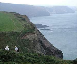
Climb back to the coast path and carry on south. Go through the kissing gate at the end of the field; the path then zigzags steeply down into the valley of Tidna Shute, drops nearly 100 m to a footbridge over the stream (a waterfall spills over the cliff here after rain) and climbs just as steeply up the far side. The path was realigned with new steps and kissing gates after a cliff fall in 2017 – follow the waymarks. At the top you pass the old coastguard lookout hut on the back of Higher Sharpnose Point, a fine place to look back north towards Hartland. The cliffs here are unfenced and unstable in places – obey any diversion signs.
Point 4: Old coastguard lookout, Higher Sharpnose Point – 50.90364, -4.56565 (SS 197 147 (approx.))
Along the cliffs to Stanbury Mouth
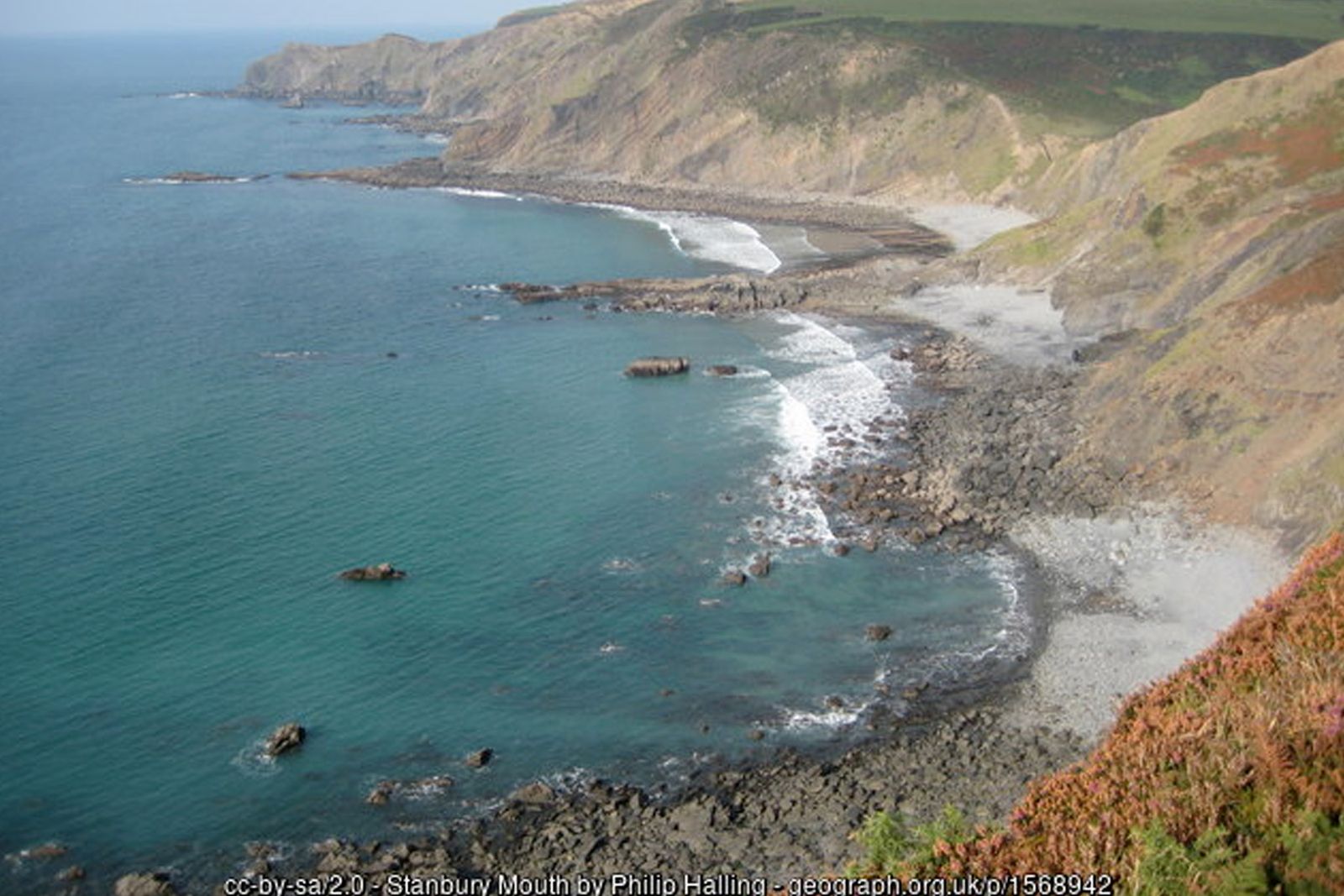
Continue south along the clifftop with the sea on your right, past the rocky coves of Greenaway and the site known as Oldwalls. The satellite dishes of GCHQ Bude come into view ahead. The path then makes a sharp, steep descent to sea level at Stanbury Mouth, where a small stream reaches the beach (sandy at low tide). The valley path inland from here is signed to Eastaway and Stanbury if you need to shorten the walk.
Point 5: Stanbury Mouth – 50.88942, -4.56312 (SS 1982 1312)
Past Lower Sharpnose and GCHQ
Cross the stream and tackle the very steep climb out of Stanbury Mouth. At the top the path runs along the seaward side of the GCHQ satellite station, above Lower Sharpnose Point, where fins of hard rock jut out into the sea. Go through the kissing gate near Lower Sharpnose Point and keep to the cliff path.
Point 6: Kissing gate near Lower Sharpnose Point (below GCHQ Bude) – 50.88313, -4.56154 (SS 199 124 (approx.))
Harscott High Cliff and Steeple Point
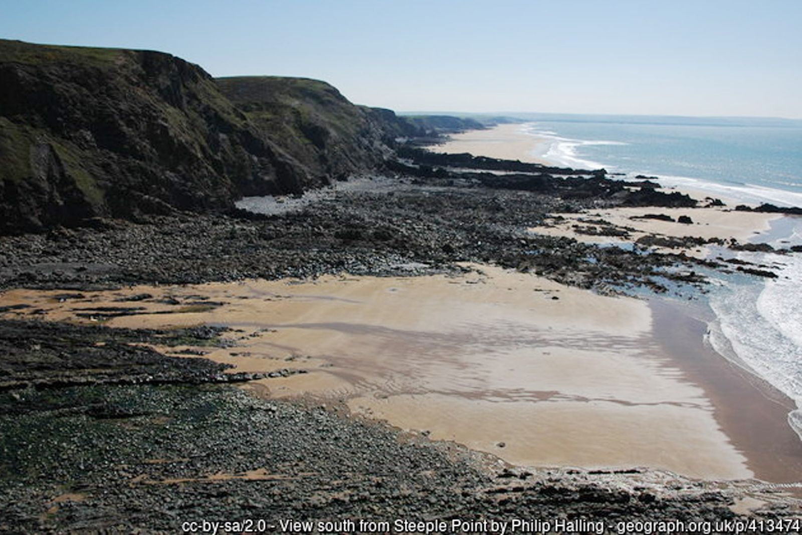
Carry on south over Harscott High Cliff, past the small rocky inlet of Wren Beach below, and out to Steeple Point, about 90 m (300 ft) above the sea, with views over Duckpool, the Coombe valley and down the coast to Bude. At the waymark on the summit bear right to keep away from the cliff edge.
Point 7: Steeple Point – 50.87606, -4.56016 (SS 199 116 (approx.))
Down to Duckpool
The path swings round and descends steeply into Duckpool, a pebbly cove at the mouth of the Coombe valley with sand at low tide. The National Trust car park here has seasonal toilets (April to October, including a RADAR-key accessible toilet) and is the halfway point. Do not try to walk round the headlands on the beach – the rising tide cuts them off.
Point 8: Duckpool National Trust car park – 50.87654, -4.55745 (SS 20172 11677)
Up the valley to Coombe
Leave the coast and walk inland along the lane from the car park, past Duckpool Cottage, following the valley of the Coombe stream. At the junctions keep to the lane signed for Coombe, bearing right past the houses into the hamlet. Much of Coombe belongs to the Landmark Trust; the tall stone building by the stream is Coombe Mill, a watermill of 1842 with its iron wheel still in place. This is a narrow lane with no pavement – walk in single file and face oncoming traffic.
Point 9: Coombe Mill, Coombe – 50.87707, -4.54575 (SS 20997 11708)
Through the woods to Woodford
At the mill, take the public footpath that leaves the lane and follows the stream upstream into the woods – broadleaf woodland of birch, oak and sycamore, full of wild garlic and bluebells in spring. Where the path turns sharply right away from the stream, follow it along the edge of the trees to a junction; turn left here and cross the stream. Climb steadily through Parishpark Wood, ignoring a path joining from the left, and leave the wood onto farmland. Follow the field edges (first with the hedge on your right, then through a gap and with the hedge on your left) to reach a lane. At the road turn left, ignore the first lane on the left and take the next one, the lane past Shears Farm. At its end turn left onto the lane heading north towards Woodford.
Point 11: Woodford (hamlet) – 50.89426, -4.53411 (SS 21882 13591)
Across the fields to Eastaway
Just before the houses of Woodford, look for the signed public footpath on the left (west). Cross the fields with the hedge on your left, dropping to cross a small stream and climbing again, and continue along the hedge above Eastaway to come out on the lane opposite Eastaway Manor. Several stiles on this section are about 1 m high – dogs may need lifting over.
Point 12: Eastaway – 50.89485, -4.54251 (SS 21293 13677)
Eastaway to Stanbury Manor
Cross the lane to the field gate opposite (the path straight ahead down the hedge leads to Stanbury Mouth). Bear right across the field to a stile, then into the next field and on into the yard at Stanbury Manor, a Grade II* manor house of the late 1500s. Turn right between the rose hedges, past the ornamental lily pond, and follow the drive down to the lane.
Point 13: Stanbury Manor – 50.89684, -4.54695 (SS 20989 13909)
Stanbury to Tonacombe
Turn left along the lane, then almost immediately right over a stile into the field. Head north across the fields, keeping to the left of the farm buildings, to pass the gated entrance of Tonacombe, a remarkable Tudor manor house (Grade I) that has changed little since the 1500s. It is a private home – please keep to the path.
Point 14: Tonacombe Manor – 50.90219, -4.54815 (SS 20925 14506)
The Tidna valley and back to the church
Beyond Tonacombe follow the tree-lined path down through gates to the stream in the Tidna valley. Cross the footbridge (a post here is marked Tonacombe) and turn left along the valley. Then follow the Tidna Valley path uphill along the field edges to a lane; cross it and continue on the waymarked path over the fields, stiles and a farm track to the courtyard of Rectory Farm Tearooms, right beside the parking area. Alternatively, for the Bush Inn, take the right-hand branch where paths divide in the valley bottom, cross the last footbridge and climb the steep hill to the pub’s garden, then follow the lane left and right back to the church.
Point 1: Parking area by Morwenstow church and Rectory Farm (EX23 9SR) – 50.90919, -4.55458 (SS 205 153 (approx.))
Option Short walk – Hawker’s Hut and the Tidna valley (about 2¼ miles)
Follow the main walk to Hawker’s Hut (step 1), then:
Down into Tidna Shute
Continue south on the coast path through the kissing gate and follow the zigzags steeply down into the valley of Tidna Shute. Unfenced cliff edges – stay on the path.
Point 3: Hawker’s Hut – 50.90700, -4.56322 (SS 19884 15078)
Inland along the Tidna valley
At the foot of the zigzags, leave the coast path and turn inland on the path beside the stream, through heath, scrub and woodland – a stronghold of the rare large blue butterfly. At the waymarked junction turn left, signed Rectory Farm, and climb over the stiles and across the fields back to the tearooms and parking area; or keep ahead up the valley to the Bush Inn and follow the lane back to the church.
Point A1: The Bush Inn, Crosstown – 50.90690, -4.54957 (SS 20843 15033)
All information is given in good faith and for guidance only. Always carry the OS map and check the South West Coast Path website for diversions.
Highlights along the way
Hawker’s Hut
A tiny driftwood shelter on the cliff edge where the Reverend R.S. Hawker wrote his poetry – the National Trust’s smallest building.
Morwenstow church
An ancient church in a sheltered combe, with a Norman font and the figurehead of the wrecked Caledonia.
Stanbury Mouth & Duckpool
Two remote coves at the foot of deep valleys, with sand at low tide and dramatic reefs of folded rock.
Coombe valley
A wooded valley of ancient oaks, streams and wildflowers leading inland from Duckpool.
Nearby
Places to visit
Towns & villages
Photos
Route map and waypoints
Latitude and longitude (WGS84, as used by phones and sat-navs) with OS grid references. The markers show key points only – follow the waymarked paths between them.
| Point | Place | Lat, long | Grid ref |
|---|---|---|---|
| 1 | Parking area by Morwenstow church and Rectory Farm (EX23 9SR) | 50.90919, -4.55458 map | SS 205 153 (approx.) |
| 2 | Church of St Morwenna and St John the Baptist | 50.90932, -4.55451 map | SS 20505 15315 |
| 3 | Hawker’s Hut | 50.90700, -4.56322 map | SS 19884 15078 |
| 4 | Old coastguard lookout, Higher Sharpnose Point | 50.90364, -4.56565 map | SS 197 147 (approx.) |
| 5 | Stanbury Mouth | 50.88942, -4.56312 map | SS 1982 1312 |
| 6 | Kissing gate near Lower Sharpnose Point (below GCHQ Bude) | 50.88313, -4.56154 map | SS 199 124 (approx.) |
| 7 | Steeple Point | 50.87606, -4.56016 map | SS 199 116 (approx.) |
| 8 | Duckpool National Trust car park | 50.87654, -4.55745 map | SS 20172 11677 |
| 9 | Coombe Mill, Coombe | 50.87707, -4.54575 map | SS 20997 11708 |
| 10 | Stream crossing in Parishpark Wood | 50.88663, -4.53665 map | SS 21674 12749 |
| 11 | Woodford (hamlet) | 50.89426, -4.53411 map | SS 21882 13591 |
| 12 | Eastaway | 50.89485, -4.54251 map | SS 21293 13677 |
| 13 | Stanbury Manor | 50.89684, -4.54695 map | SS 20989 13909 |
| 14 | Tonacombe Manor | 50.90219, -4.54815 map | SS 20925 14506 |
| A1 | The Bush Inn, Crosstown | 50.90690, -4.54957 map | SS 20843 15033 |
Before you set out
Carry the OS map – paths and signs can change and mobile signal is patchy.
Check the weather and tide times before you set out.
Keep to the path and well back from cliff edges.
Keep dogs under close control near livestock and cliffs.