Headlands, beaches and the Camel Estuary – a classic North Cornwall circuit from the busy harbour of Padstow to the sands of Trevone.
After pottering around Padstow’s harbour, this walk follows the South West Coast Path out along the Camel Estuary to Stepper Point, then along high cliffs to Trevone Bay, before returning inland across open fields.
On a blustery day the cliffs between Stepper Point and Gunver Head are spectacular, with waves crashing into Butter Hole and over Gulland Rock out at sea.
Walk at a glance
- Distance
- About 7½ miles (about 3½ hrs)
- Grade
- Moderate – cliff paths with one steep valley crossing
- Map
- OS Explorer 106 – Newquay & Padstow
- Start
- Padstow harbour (or Trevone Bay)
- Terrain
- Coastal cliff paths, narrow lanes and fields – dogs on leads through grazed fields
Parking
Pay and display car parks in Padstow – busy in summer, with ample space out of season. Alternatively start from Trevone, parking next to the beach.
Facilities
Public toilets by Padstow harbour and a wide choice of cafés, pubs and pasty shops in Padstow. Seasonal toilets and café at Trevone.
Disabled access
The full walk is not suitable for wheelchairs or limited mobility – beyond the war memorial the coast path is uneven, with steps down to St George’s Cove, a steep stream crossing at Gunver Head and field paths on the return. Padstow harbour itself is level, and the short tarmac path from the northern end of the town through the park to the war memorial is suitable for wheelchairs and pushchairs, with good views over the Camel Estuary. There are public toilets by the harbour.
Places to stay
The route
Numbers in circles match the points on the route map and the waypoint table below. Distances are approximate and measured between points.
Main walk – Padstow, Stepper Point, Trevone and Crugmeer (about 7½ miles)
North Quay to the war memorial
From the northern side of Padstow harbour walk along North Quay, with the harbour on your right, past the landing steps used by the ferry from Rock. Look for the acorn waymarks of the South West Coast Path – they will guide you all the way to Trevone. Follow the wide tarmac path up the ramp and through the park to the granite war memorial on St Saviour’s Point, ignoring steps that climb to the left. This first stretch is level or gently sloping and suitable for pushchairs, with fine views up and across the Camel Estuary to Rock.
Point 2: Padstow War Memorial, St Saviour’s Point – 50.54727, -4.93506 (SW 92158 76060)
Above the beaches to St George’s Cove
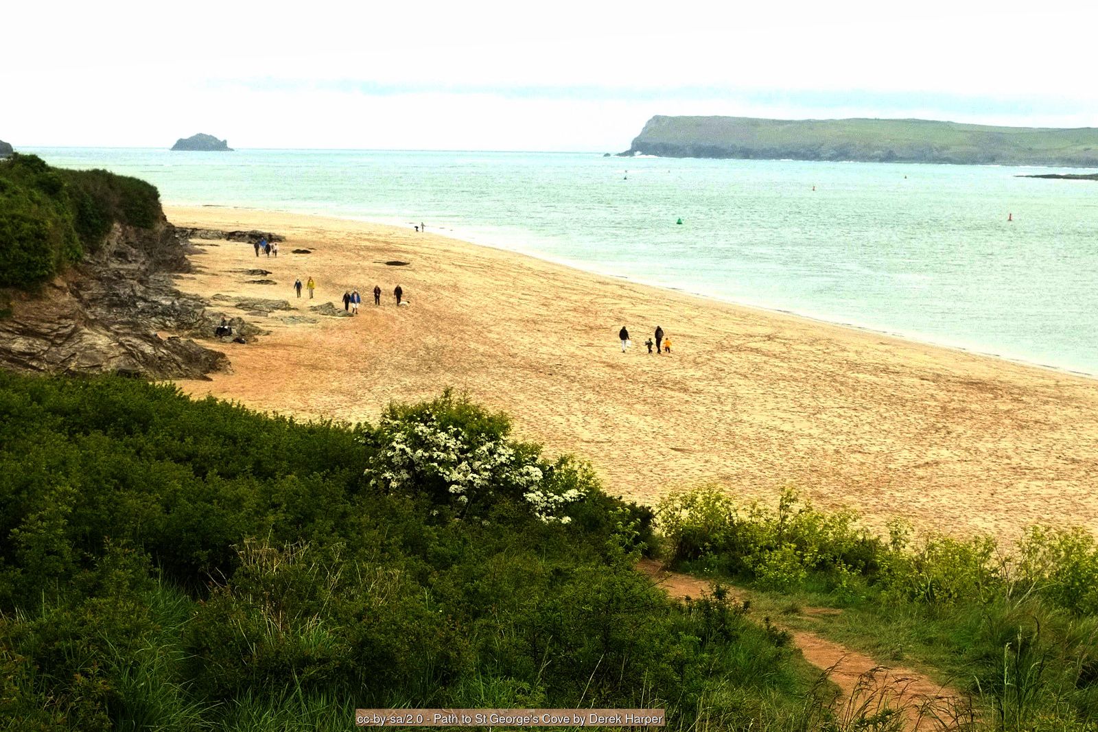
Carry on along the coast path above the sandy estuary beaches, keeping to the main path where smaller tracks lead off through the dunes. Steps drop down on the right to St George’s Cove; the little spring of St George’s Well is hidden in the vegetation just above the beach. At a really low tide you can short-cut across the sands towards Hawker’s Cove, but the tide comes in quickly over the wide flats at the mouth of the Camel – check tide times and do not get cut off.
Point 3: St George’s Cove – 50.55082, -4.93871 (SW 9191 7646)
Gun Point and round Harbour Cove
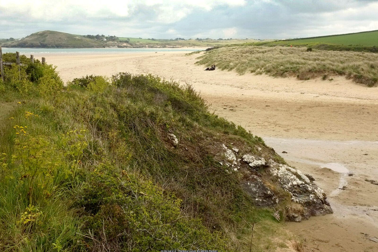
The path continues past Gun Point, where the concrete platforms and magazine of an old coastal gun battery survive, then swings inland around the edge of Harbour Cove. Where a small inlet meets a track coming in from the left (this track leads back to Padstow via Tregirls if you want to cut the walk short), turn right towards the beach for a few metres and look for the acorn waymark half-hidden in the bushes. Follow the narrow path through the scrub and out onto the shoreline path.
Point 4: Harbour Cove – 50.55548, -4.94677 (SW 9136 7700)
Along the shore to Hawker’s Cove
Walk north along the edge of the estuary, with the water on your right, to the hamlet of Hawker’s Cove. The old lifeboat station and its slipway were home to the Padstow lifeboat until silting forced it to move to Trevose Head in 1967; the terrace of former coastguard houses stands above the cove. Ignore the road on the left and follow the waymarks along the path between the houses.
Point 5: Hawker’s Cove and the old lifeboat station – 50.56029, -4.94848 (SW 9126 7754)
Up to Stepper Point and the Daymark
The path climbs steadily towards Stepper Point, with Polzeath, Pentire Point and the notorious Doom Bar sandbank in view across the estuary mouth. At the old quarry ignore the path to the left and keep climbing round the headland to the Daymark, a tall stone tower probably built in the early 19th century to guide ships into the Camel. It is a superb viewpoint in every direction. Keep dogs on leads here in spring and early summer, when seabirds are nesting on the cliffs.
Point 7: The Daymark, Stepper Point – 50.56808, -4.95255 (SW 91011 78422)
Pepper Hole and Butter Hole
From the Daymark follow the coast path south-west along the cliff top, with the open sea now on your right. You soon pass Pepper Hole, a deep shaft by the cliff edge that opens into the sea at its base, and then the rocky inlet of Butter Hole, with Gulland Rock standing out to sea. The cliff edges and the Pepper Hole are unfenced – stay on the path and keep children and dogs close.
Point 8: Pepper Hole – 50.56511, -4.95535 (SW 908 781 (approx.))
The high cliffs to Gunver Head
The path now hugs the high cliffs for over a mile, past rocky islets where seals are sometimes seen. Ignore paths heading inland to the left. Approaching Gunver Head the path turns inland and drops steeply into a narrow valley, crosses a stile and the stream, then zig-zags up the far side past small waterfalls – on a sunny, blustery day look for rainbows in the spray. Climbing out, there are views of the Merope Islands just offshore. Cross a tall slate stile (awkward for small dogs) and continue along the broad grassy path, set back a little from the cliff edge.
Point 9: Gunver Head – 50.55646, -4.97344 (SW 894 771 (approx.))
Round Hole and down to Trevone
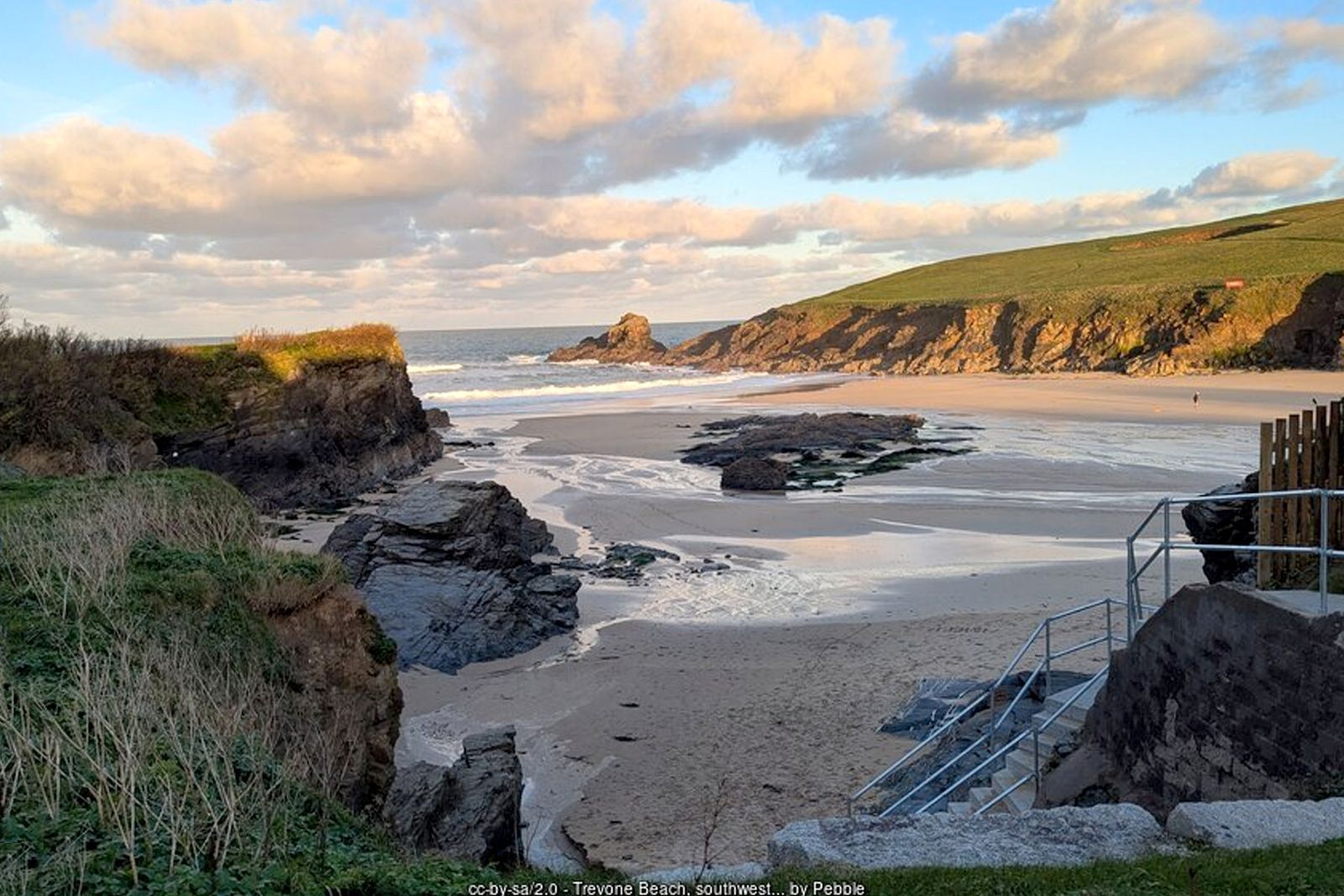
The walking is easier now, through open pasture towards Trevone, with layers of slate and limestone showing in the cliffs. Just inland of the path at Roundhole Point is the Round Hole, a collapsed sea cave some 40 m across and about 25 m deep, with the sea surging in at the bottom. The Round Hole has no fence – admire it from well back from the edge. Cross a stone stile and go down the concrete steps to the lane at Trevone. Turn right for the beach, car park, toilets and café.
Point 11: Trevone beach car park and café (PL28 8QY) – 50.54475, -4.97705 (SW 89172 75898)
Trevone to Crugmeer
From the beach walk back up the lane past the foot of the steps you came down. The lane bends right above the beach and climbs steeply. Where it levels out, keep right at the junction (a track goes off to the left), pass through a gap and follow the surfaced lane across open fields, ignoring other turnings, into the hamlet of Crugmeer. There is no pavement on the lane – walk in single file and watch for traffic.
Point 12: Crugmeer – 50.55095, -4.96364 (SW 901 765 (approx.))
Across the fields from Crugmeer
At Crugmeer turn right, then left by a post box. After about 100 m the footpath leaves the lane on the right over a hedge and heads east across a series of fields, crossing each one diagonally from stile to stile. Follow it for about 1 km (⅔ mile) until it comes out on a narrow tarmac lane just south of Tregirls Farm. Turn right. Keep dogs on leads through the fields, which may hold livestock or crops.
Point 13: Tregirls Farm – 50.54998, -4.94903 (SW 9118 7640)
Down past Prideaux Place
Follow the lane south towards Padstow, passing under a stone bridge that links the grounds of Prideaux Place. The deer park is beside the lane, so look out for deer grazing under the trees. Continue down to the castellated entrance gateway of Prideaux Place, the Elizabethan home of the Prideaux family for over 400 years. The lane is narrow with no pavement.
Point 14: Prideaux Place entrance gate – 50.54268, -4.94536 (SW 91408 75578)
Back to the harbour
Carry on downhill as the lane becomes Church Street, passing St Petroc’s Church, then turn right down Duke Street into the centre of town. Any of the streets leading downhill on your left from here bring you back to the harbour and North Quay.
Point 1: North Quay, Padstow harbour – 50.54282, -4.93660 (SW 92029 75570)
All information is given in good faith and for guidance only. Always carry the OS map and check the South West Coast Path website for diversions.
Highlights along the way
The Camel Estuary
Golden sands and dunes stretching across to Rock and Daymer Bay.
The Daymark
A stone tower on Stepper Point, long used by sailors to find the mouth of the Camel.
Round Hole
A huge collapsed sea cave in the fields near Trevone.
Prideaux Place
An Elizabethan mansion above Padstow, passed on the way back into town.
Nearby
Places to visit
Towns & villages
Photos

Route map and waypoints
Latitude and longitude (WGS84, as used by phones and sat-navs) with OS grid references. The markers show key points only – follow the waymarked paths between them.
| Point | Place | Lat, long | Grid ref |
|---|---|---|---|
| 1 | North Quay, Padstow harbour | 50.54282, -4.93660 map | SW 92029 75570 |
| 2 | Padstow War Memorial, St Saviour’s Point | 50.54727, -4.93506 map | SW 92158 76060 |
| 3 | St George’s Cove | 50.55082, -4.93871 map | SW 9191 7646 |
| 4 | Harbour Cove | 50.55548, -4.94677 map | SW 9136 7700 |
| 5 | Hawker’s Cove and the old lifeboat station | 50.56029, -4.94848 map | SW 9126 7754 |
| 6 | Old quarry above Stepper Point | 50.56879, -4.94512 map | SW 915 784 (approx.) |
| 7 | The Daymark, Stepper Point | 50.56808, -4.95255 map | SW 91011 78422 |
| 8 | Pepper Hole | 50.56511, -4.95535 map | SW 908 781 (approx.) |
| 9 | Gunver Head | 50.55646, -4.97344 map | SW 894 771 (approx.) |
| 10 | The Round Hole | 50.54817, -4.97935 map | SW 8902 7628 |
| 11 | Trevone beach car park and café (PL28 8QY) | 50.54475, -4.97705 map | SW 89172 75898 |
| 12 | Crugmeer | 50.55095, -4.96364 map | SW 901 765 (approx.) |
| 13 | Tregirls Farm | 50.54998, -4.94903 map | SW 9118 7640 |
| 14 | Prideaux Place entrance gate | 50.54268, -4.94536 map | SW 91408 75578 |
Before you set out
Carry the OS map – paths and signs can change and mobile signal is patchy.
Check the weather and tide times before you set out.
Keep to the path and well back from cliff edges.
Keep dogs under close control near livestock and cliffs.