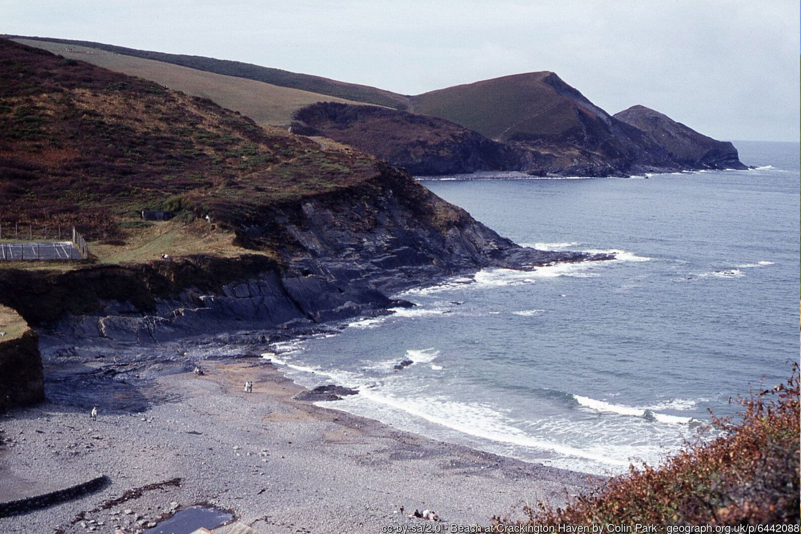
Folded cliffs, waterfalls tumbling to the sea and some of the highest cliffs in Cornwall – two short but rewarding loops from a sheltered cove.
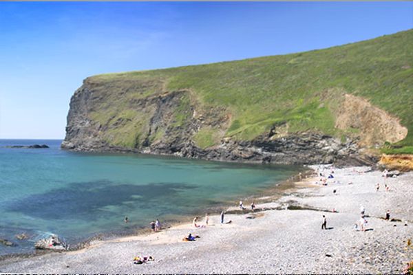
Crackington Haven is a geologist's paradise. Its sandstone and shale cliffs have been folded by great earth movements into dramatic arches (anticlines) and troughs (synclines), and erosion is still very active – rocks fall from overhanging cliffs, and streams carry sand and mud out to sea.
These two loops can be walked separately or together. Loop 1 heads south over the headland of Cambeak towards The Strangles and returns through a wooded valley; Loop 2 climbs north to Pencannow Point and the little church of St Gennys.
Walk at a glance
- Distance
- Loop 1: 3½ miles (about 1 hr 45 mins)
Loop 2: 2½ miles (about 1 hr 15 mins) - Grade
- Loop 1 moderate, Loop 2 easy – some steep, undulating coast path
- Map
- OS Explorer 111 – Bude, Boscastle & Tintagel
- Start
- Crackington Haven, by the bridge
- Terrain
- Coast path, quiet lanes, fields and a wooded valley
Parking
Car park by the bridge at Crackington Haven, and a second car park just inland from the pub. Spaces fill quickly on sunny summer days.
Facilities
Toilets, a café and the Coombe Barton Inn at Crackington Haven.
Disabled access
Neither loop is suitable for wheelchairs or limited mobility: the National Trust describes the paths as mostly uneven natural surfaces with slopes, steps, stiles and unfenced clifftop, and the coast path dips steeply into several stream valleys. The car park, café, pub and beach are close together at the Haven, so the cove and its folded cliffs can be enjoyed with very little walking.
The route
Numbers in circles match the points on the route map and the waypoint table below. Distances are approximate and measured between points.
Loop 1 – Cambeak, The Strangles and the Ludon Valley (about 3½ miles)
Car park to the coast path
From the car park by the bridge walk towards the beach and pick up the South West Coast Path (look for the acorn waymark) on your left. With the sea on your right, it climbs steeply onto the cliffs above Tremoutha Haven, where cattle and ponies graze the heath. The cliff edges are unfenced – keep dogs and children close.
Point 2: Coast path above Tremoutha Haven – 50.73844, -4.63903 (SX 1388 9652)
Hanging valleys to the Cambeak fork
The path follows the cliff top but dips into small hanging valleys, crossing their streams on footbridges where they tumble over the cliff as waterfalls. Below the headland the path forks: straight ahead a very steep path climbs Cambeak, while a less steep permissive path on the left cuts across the neck of the headland if you would rather skip the climb.
Point 3: Fork below Cambeak (steep path or easier path to the left) – 50.73864, -4.64585 (SX 1340 9656)
Detour to Cambeak
Climb the steep path onto Cambeak, a narrow headland about 100 m (330 ft) high with views north to Pencannow Point and south to High Cliff. The contorted, zig-zag folds in the rocks of the Crackington Formation are clearly visible on its flanks. The top is narrow with sheer, unfenced drops – stay on the path and keep well back from the edge. Return to the fork and continue south.
Point 4: Cambeak headland – 50.73844, -4.65094 (SX 1304 9655)
Past Northern Door
Follow the coast path south along the cliff top, crossing slumped ground where old landslips have created sheltered undercliffs rich in wildlife. Look down on your right for Northern Door, a natural arch cut through a fin of rock, with the sandy cove of Little Strand beyond.
Point 5: Northern Door rock arch (below the path) – 50.73428, -4.65159 (SX 12982 96095)
Above The Strangles
Continue past Samphire Rock with The Strangles beach far below on your right. Watch for the signpost pointing inland to Trevigue and the car park, and take the left-hand path. Optional: the path to the right drops very steeply to The Strangles – allow 15–20 minutes each way, and check the tide before going down, as the beach is cut off at high water.
Point 6: Trevigue signpost – path inland above The Strangles – 50.72681, -4.64596 (SX 133 952 approx.)
Road and Trevigue
Follow the enclosed path inland to the lane beside the small National Trust roadside parking area. Turn left along the lane (no pavement – watch for traffic), then take the track on the left into Trevigue, a 16th/17th-century farmhouse set into the hillside out of the westerly gales. Bear left around the north side of the farm towards the pond, pass a white cottage on your right and go through the gate in the stone wall on your left.
Point 7: Trevigue farmhouse (National Trust farm) – 50.72625, -4.64207 (SX 13622 95178)
Down to the Ludon Valley
Descend the open fields, steep in places and slippery when wet, keeping the hedge bank on your right. Cross a stile into the woods at the bottom and turn left at the path junction, following the fingerpost signed to the Haven.
Point 8: Stile and path junction in the Ludon Valley – 50.72614, -4.63600 (SX 140 951 approx.)
Through East Wood back to the Haven
Follow the path downstream through East Wood, a sheltered valley of old oak, ash, hazel and holly with bluebells in spring. The stream is on your right at first; cross it on a footbridge, then cross a second footbridge and go through a gate. The valley floor here was scoured by the flash flood of August 2004. Follow the quiet residential track out to the road and turn left back down to the car park, café and beach.
Point 1: Car park by the bridge, Crackington Haven (EX23 0JG) – 50.74151, -4.63261 (SX 143 968 approx.)
Option Loop 2 – Pencannow Point and St Gennys church (about 2½ miles)
Start from the car park by the bridge (or walk it after Loop 1 for about 6 miles in all).
Up the road to the coast path
With the Coombe Barton Inn on your right, walk up the road away from the beach for a short distance. The road is narrow with no pavement. Look for the South West Coast Path leaving on your left, signed to St Gennys church.
Point A1: The Coombe Barton Inn – 50.74138, -4.63284 (SX 14333 96837)
Climb to Pencannow Point
The path climbs fairly gently across the slope with the sea on your left. Near the top a short spur leads out to Pencannow Point, where there is a superb view back over Crackington Haven to Cambeak and along the North Cornwall coast. Unfenced cliff edges.
Point A2: Pencannow Point – 50.74453, -4.63769 (SX 14004 97199)
Inland to St Gennys church
Continue a little further along the coast path, then leave it on the right through a kissing gate and a field gate, following the signs to St Gennys church. Walk along the field with the boundary on your left; the church tower soon appears ahead, tucked into the tiny churchtown above the sea. The lower stages of the tower are 12th-century and the church has a square greenstone font of the same period.
Point A3: St Gennys Church (St Genesius) – 50.74458, -4.62504 (SX 14896 97173)
Lanes down to the main road
With your back to the church gates turn left along the lane, then take the first right, a steep, narrow lane between high hedges that drops down to the main road into Crackington Haven. Cross the road carefully – traffic comes quickly round the bends.
Point A4: Lane junction on the main road above the Haven – 50.74086, -4.62124 (SX 151 967 approx.)
Lovers Lane back to the Haven
Cross straight over and continue down the lane opposite. Before you reach the valley bottom, take the footpath on the right signed to Crackington Haven – this is Lovers Lane, a leafy sunken track that leads back to the main road. Follow the road downhill to the Haven, the inn and the car park.
Point 1: Car park by the bridge, Crackington Haven (EX23 0JG) – 50.74151, -4.63261 (SX 143 968 approx.)
All information is given in good faith and for guidance only. Always carry the OS map and check the South West Coast Path website for diversions.
Highlights along the way
Folded cliffs
Contorted layers of sandstone and shale make Crackington one of the best places in Britain to see rock folding.
Cambeak
A narrow, dramatic headland just south of the Haven with views along the coast.
The Strangles
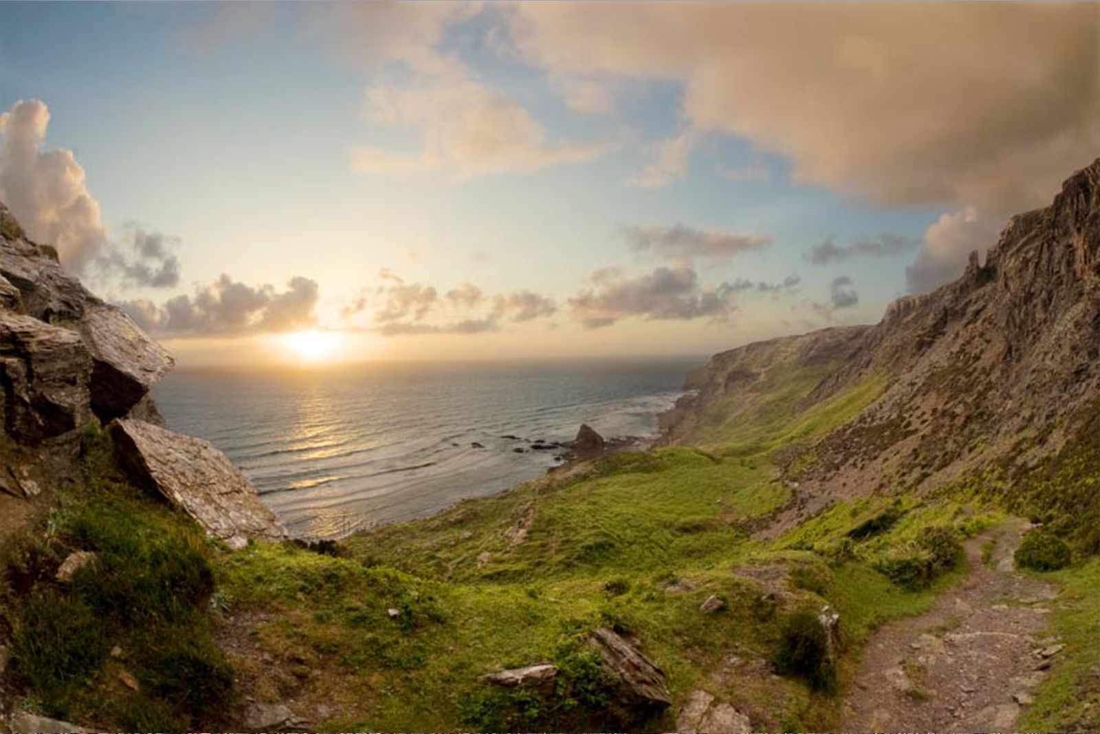
A remote beach beneath some of the highest cliffs in Cornwall – reached by a steep path.
St Gennys church
A small, ancient church in a hamlet overlooking the sea.
Nearby
Places to visit
Towns & villages
Photos

Route map and waypoints
Latitude and longitude (WGS84, as used by phones and sat-navs) with OS grid references. The markers show key points only – follow the waymarked paths between them.
| Point | Place | Lat, long | Grid ref |
|---|---|---|---|
| 1 | Car park by the bridge, Crackington Haven (EX23 0JG) | 50.74151, -4.63261 map | SX 143 968 approx. |
| 2 | Coast path above Tremoutha Haven | 50.73844, -4.63903 map | SX 1388 9652 |
| 3 | Fork below Cambeak (steep path or easier path to the left) | 50.73864, -4.64585 map | SX 1340 9656 |
| 4 | Cambeak headland | 50.73844, -4.65094 map | SX 1304 9655 |
| 5 | Northern Door rock arch (below the path) | 50.73428, -4.65159 map | SX 12982 96095 |
| 6 | Trevigue signpost – path inland above The Strangles | 50.72681, -4.64596 map | SX 133 952 approx. |
| 7 | Trevigue farmhouse (National Trust farm) | 50.72625, -4.64207 map | SX 13622 95178 |
| 8 | Stile and path junction in the Ludon Valley | 50.72614, -4.63600 map | SX 140 951 approx. |
| A1 | The Coombe Barton Inn | 50.74138, -4.63284 map | SX 14333 96837 |
| A2 | Pencannow Point | 50.74453, -4.63769 map | SX 14004 97199 |
| A3 | St Gennys Church (St Genesius) | 50.74458, -4.62504 map | SX 14896 97173 |
| A4 | Lane junction on the main road above the Haven | 50.74086, -4.62124 map | SX 151 967 approx. |
| A5 | Lovers Lane footpath (signed Crackington Haven) | 50.73907, -4.61837 map | SX 15345 96543 |
Before you set out
Carry the OS map – paths and signs can change and mobile signal is patchy.
Check the weather and tide times before you set out.
Keep to the path and well back from cliff edges.
Keep dogs under close control near livestock and cliffs.