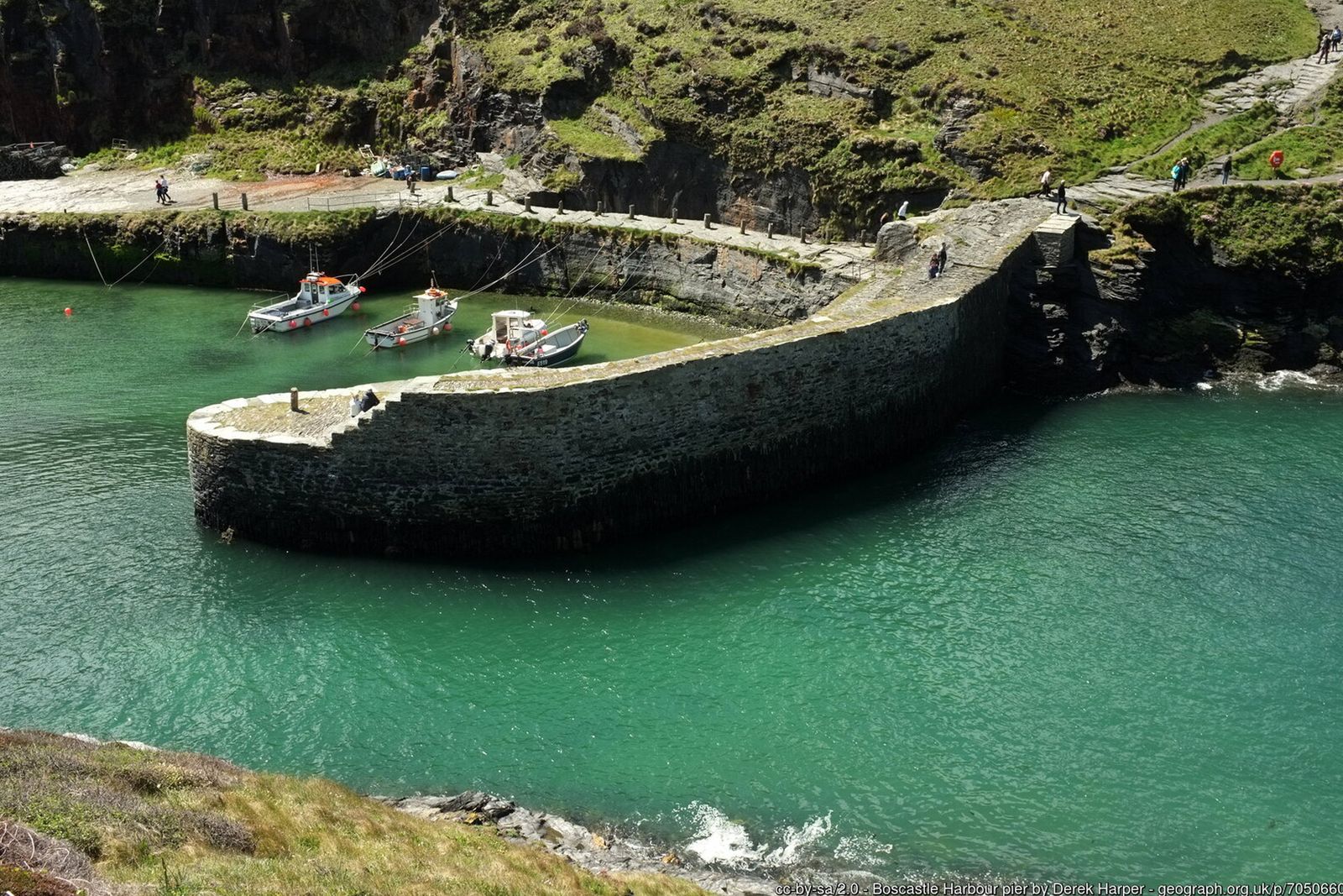
A charming harbour village, medieval churches, rugged cliffs and leafy valleys – one of the finest short circuits on the North Cornwall coast.
Boscastle is one of the prettiest harbours in Cornwall – a narrow natural inlet guarded by high cliffs, with the little island of Meachard at its mouth. This circular walk climbs out of the harbour onto the South West Coast Path, heads south along the cliffs towards Trevalga, then returns inland past ancient churches and through the village.
For a longer day, continue along the coast to the wooded ravine of Rocky Valley, or add the loop to Minster Church and back through the Valency Valley – the river that caused the devastating Boscastle flood of August 2004.
Walk at a glance
- Distance
- Main walk about 4 miles (about 2 hrs)
Via Rocky Valley about 6¼ miles (about 3 hrs)
With Minster Church and Valency Valley about 5½ miles - Grade
- Moderate – some steep climbs and unfenced cliff edges
- Map
- OS Explorer 111 – Bude, Boscastle & Tintagel
- Start
- Main village car park, Boscastle PL35 0HD
- Terrain
- Coast path, fields, quiet lanes, woodland paths and a short stretch of road
Parking
Pay and display car park in Lower Boscastle, about 100 yards from the harbour (postcode PL35 0HD). It is not a National Trust car park, so charges apply to everyone. Blue Badge spaces are available.
Facilities
Public toilets, including accessible toilets, next to the main car park. National Trust café and shop by the harbour. Pubs, cafés and shops in Lower and Higher Boscastle, including the Cobweb Inn and the Wellington Hotel.
Disabled access
The full circuit is not suitable for wheelchairs or limited mobility – the coast path has steep climbs, steps, uneven ground and unfenced cliff edges. The National Trust’s short harbour walk (about 1 mile) is mostly on flat, smooth surfaces with level pavements and paths, though there are some steps and uneven ground towards the harbour entrance. The main car park has Blue Badge spaces, and there is an accessible toilet next to it.
The route
Numbers in circles match the points on the route map and the waypoint table below. Distances are approximate and measured between points.
Main walk – Boscastle, Willapark and Trevalga (about 4 miles)
Car park to the harbour
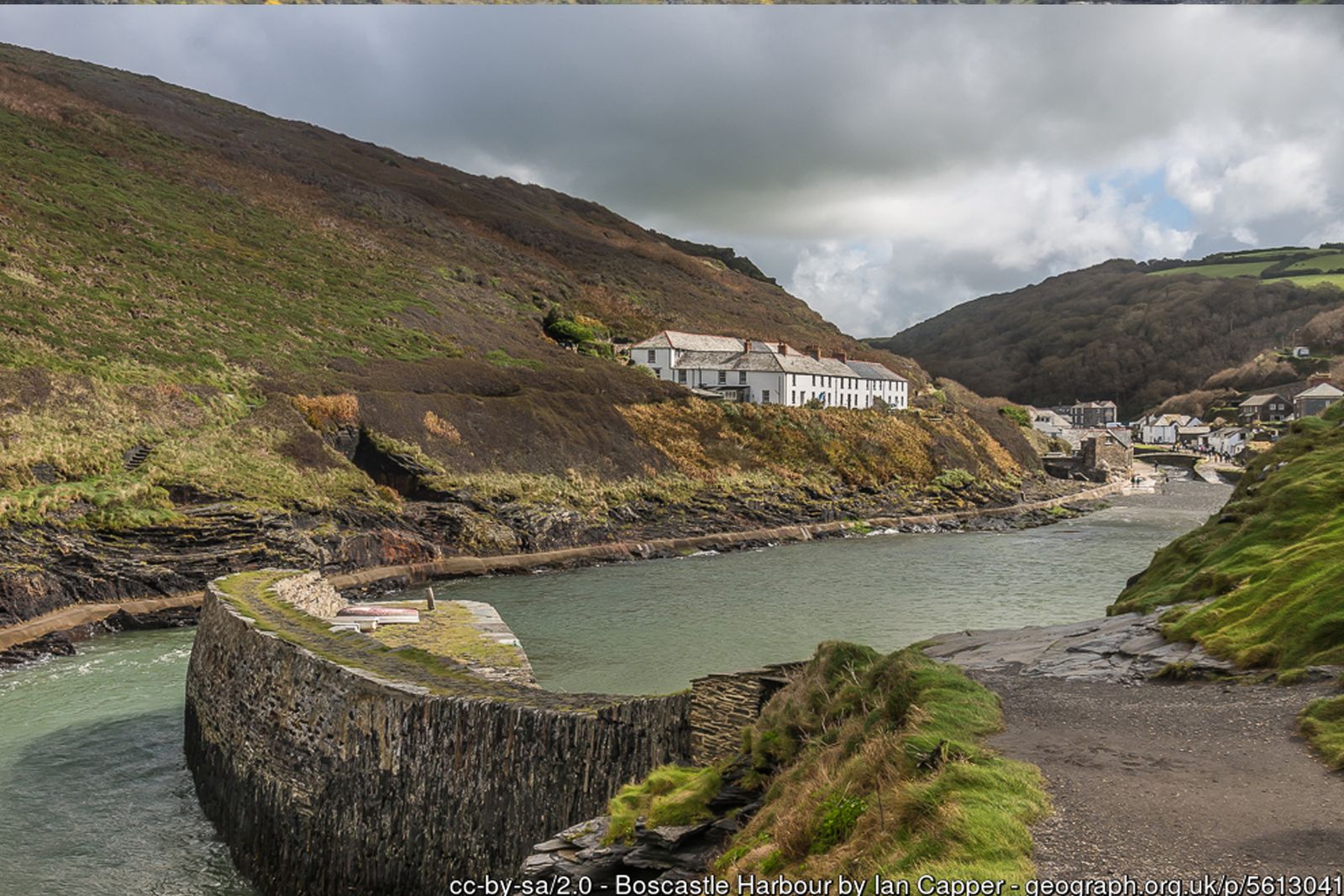
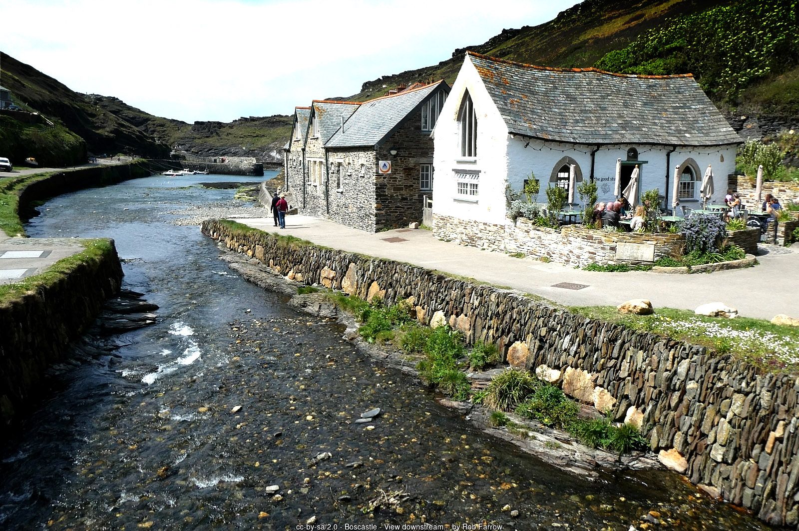
Leave the main car park in Lower Boscastle turning left and walk downhill towards the harbour. Follow the tarmac riverside track along the south side of the River Valency (on your left as you face the sea) all the way to the quay. Across the river you can see the old lime kiln and the National Trust visitor centre. The stone harbour wall at the end of the quay dates from 1584.
Point 2: Harbour quay and Elizabethan harbour wall – 50.69185, -4.69832 (SX 09513 91496)
Up onto the coast path and Willapark
At the end of the quay climb the steps beside the harbour wall and bear left onto the South West Coast Path, with views back over the harbour and out to Meachard island at the harbour mouth. Where the path forks, take the right-hand branch and climb steeply to the white coastwatch lookout on Willapark headland – a good place to look for dolphins and seals. From the lookout, drop back down to the right to rejoin the coast path.
Point 3: Willapark coastwatch lookout – 50.68849, -4.70209 (SX 090 913)
Past the Forrabury Stitches
Continue south-west along the coast path with the sea on your right. Inland on your left is Forrabury Common, where the Stitches – long, narrow strip fields – are still farmed in the medieval way under the care of the National Trust.
Point 4: Forrabury Stitches (strip fields) – 50.68803, -4.69772 (SX 0954 9107)
Blackapits, old quarries and Grower Gut
Keep to the cliff-top path past the deep, narrow inlets of Eastern and Western Blackapit and the old slate workings of California Quarry and Welltown Quarry. The path then drops steeply to cross the stream at Grower Gut, with Grower Rock just offshore, and climbs across an open meadow above more quarried rock. Take care: the cliff edges here are unfenced.
Point 5: Grower Gut – fork for Trevalga – 50.68164, -4.71734 (SX 08128 90411)
Inland to Trevalga church
Near the top of the meadow the path divides. The coast path carries on to the right towards Firebeacon Hill (see the Rocky Valley option below). For the main walk, take the left-hand path signed inland to Trevalga Church, crossing the fields to St Petroc’s Church – look for the early wheel-headed cross in the churchyard.
Point 6: St Petroc’s Church, Trevalga – 50.67822, -4.71736 (SX 08113 90030)
Trevalga to Welltown
Follow the footpath around the back of the church, cross a lane, go through a gate and continue east-north-east over the fields to Welltown Manor, a Grade II* listed manor house.
Point 7: Welltown Manor – 50.68133, -4.70740 (SX 08829 90350)
Welltown to Forrabury church
On reaching the main road (B3263) turn left towards Boscastle – there is no pavement, so take care of traffic – then turn left again at a bench. Take the next turning on the left; after a sharp right-hand bend St Symphorian’s Church at Forrabury comes into view.
Point 8: St Symphorian’s Church, Forrabury – 50.68645, -4.69713 (SX 09575 90893)
Back to the harbour
Continue down past the church towards the village. For refreshments, take the third turning on the right, a narrow lane signposted up to the old village (Higher Boscastle). Otherwise walk downhill back to the harbour and the car park.
Point 1: Main car park, Lower Boscastle (PL35 0HD) – 50.68991, -4.68989 (SX 101 912)
Option Longer walk via Rocky Valley (about 6¼ miles)
Follow the main walk to the fork at Grower Gut (step 5), then:
Firebeacon Hill and Ladies Window
At the fork near the top of the meadow, stay on the coast path to the right. It swings round the headland at Firebeacon Hill, where the sea has cut a channel between Short Island and the mainland. Look out for Ladies Window, a natural rock arch just below the path at the tip of the headland – it is easy to miss.
Point R1: Ladies Window natural arch – 50.68385, -4.72254 (SX 0777 9067)
Along Trevalga Cliff to Rocky Valley
From Ladies Window the path turns sharply left and heads south past Long Island and a string of small islets, then along Trevalga Cliff above a caravan park, before dropping steeply into Rocky Valley.
Point R2: Rocky Valley – coast path footbridge – 50.67360, -4.72950 (approx.)
Up Rocky Valley to the mill and carvings
Leave the coast path and walk inland up the valley. The signed, well-trodden track follows the right-hand bank of the stream, crossing over to the ruins of Trewethet Mill, where two small labyrinth carvings are cut into the rock face behind the mill. Their age is uncertain.
Point R3: Trewethet Mill ruins and labyrinth carvings – 50.67185, -4.72880 (SX 07279 89352)
St Piran’s Well and Trethevy
Continue up the valley and through the grounds at its head to the road. Turn left and follow the road for a short distance past St Piran’s Well and the hamlet of Trethevy. This is the B3263 – walk in single file and face oncoming traffic.
Point R4: St Piran’s Well, Trethevy – 50.67060, -4.72323 (SX 07667 89199)
Across the fields to Trevalga
Just after the entrance to a campsite, take the signed public footpath on your left, head diagonally across to the far corner of the field and join a track to Trevalga church. Continue from step 6 of the main route.
Point 6: St Petroc’s Church, Trevalga – 50.67822, -4.71736 (SX 08113 90030)
Option Minster Church and the Valency Valley (adds about 1½ miles)
Higher Boscastle to Minster Church
From step 8, continue up through the old village (a good time for refreshments) to the main road, the B3266. Turn left and after a few hundred yards turn left down a quiet, leafy lane signed to Minster Church, tucked away in Minster Wood.
Point M1: Minster Church (St Merteriana) – 50.68315, -4.67577 (SX 11071 90472)
Peter’s Wood and the Valency Valley
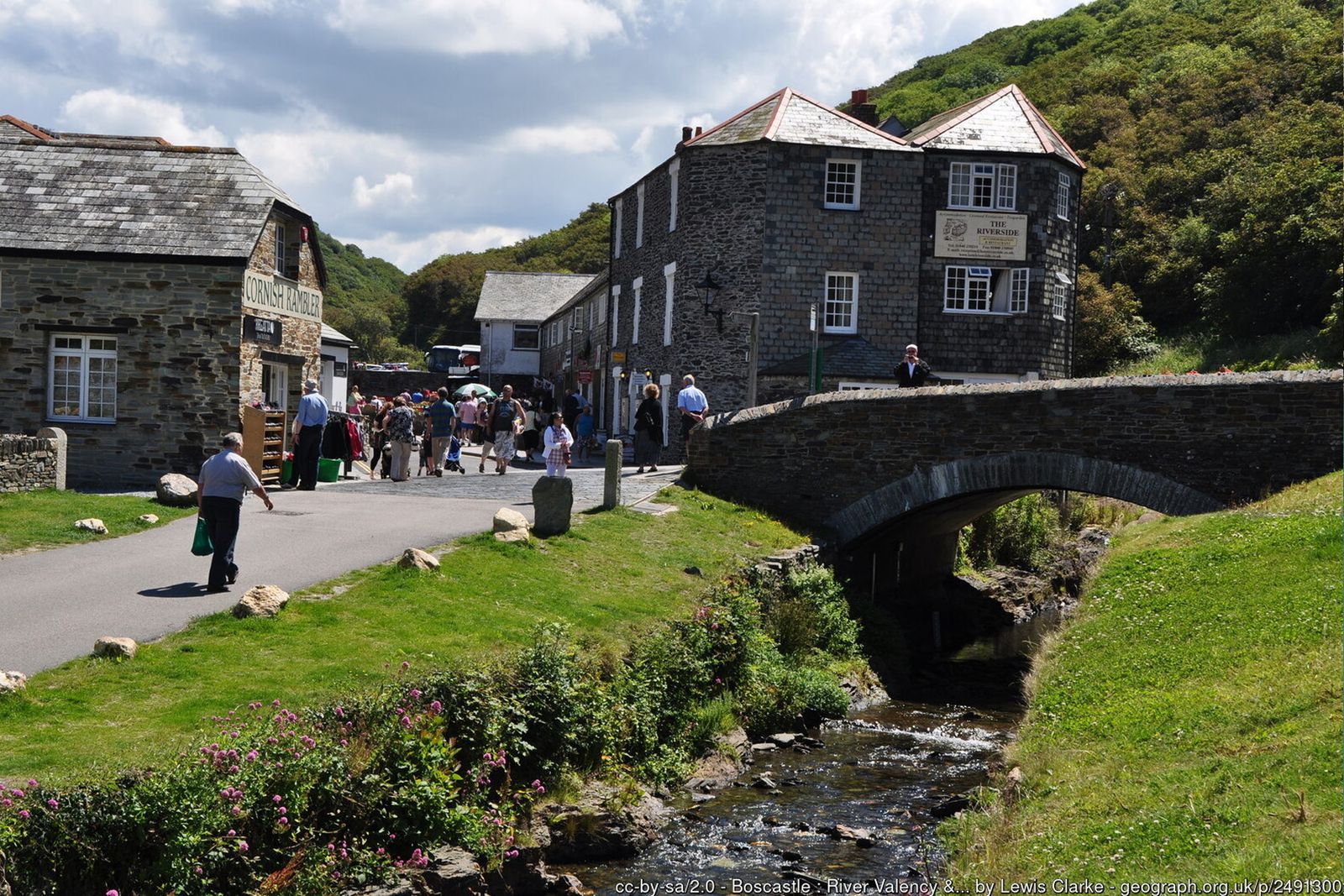
Go through the kissing gate just below the church and follow the signs to Valency Woods. The path descends through Peter’s Wood to a footbridge over the river. Cross it, turn left and follow the Valency Valley path downstream back to the car park. (For a shortcut, stepping stones below the church lead straight to the valley path.)
Point 1: Main car park, Lower Boscastle (PL35 0HD) – 50.68991, -4.68989 (SX 101 912)
All information is given in good faith and for guidance only. Always carry the OS map and check the South West Coast Path website for diversions.
Highlights along the way
Boscastle Harbour
A rare natural harbour protected by twin stone walls, much of it now cared for by the National Trust.
Forrabury Stitches
Medieval strip fields on the headland above the harbour, still farmed in the traditional way.
Rocky Valley
A steep wooded ravine with ruined mill buildings and two small labyrinth carvings in the rock, of uncertain age.
Minster Church & Valency Valley
A secluded church in Minster Wood and a riverside path through the Valency Valley back to the harbour.
Nearby
Photos


Route map and waypoints
Latitude and longitude (WGS84, as used by phones and sat-navs) with OS grid references. The markers show key points only – follow the waymarked paths between them.
| Point | Place | Lat, long | Grid ref |
|---|---|---|---|
| 1 | Main car park, Lower Boscastle (PL35 0HD) | 50.68991, -4.68989 map | SX 101 912 |
| 2 | Harbour quay and Elizabethan harbour wall | 50.69185, -4.69832 map | SX 09513 91496 |
| 3 | Willapark coastwatch lookout | 50.68849, -4.70209 map | SX 090 913 |
| 4 | Forrabury Stitches (strip fields) | 50.68803, -4.69772 map | SX 0954 9107 |
| 5 | Grower Gut – fork for Trevalga | 50.68164, -4.71734 map | SX 08128 90411 |
| 6 | St Petroc’s Church, Trevalga | 50.67822, -4.71736 map | SX 08113 90030 |
| 7 | Welltown Manor | 50.68133, -4.70740 map | SX 08829 90350 |
| 8 | St Symphorian’s Church, Forrabury | 50.68645, -4.69713 map | SX 09575 90893 |
| R1 | Ladies Window natural arch | 50.68385, -4.72254 map | SX 0777 9067 |
| R2 | Rocky Valley – coast path footbridge | 50.67360, -4.72950 map | approx. |
| R3 | Trewethet Mill ruins and labyrinth carvings | 50.67185, -4.72880 map | SX 07279 89352 |
| R4 | St Piran’s Well, Trethevy | 50.67060, -4.72323 map | SX 07667 89199 |
| M1 | Minster Church (St Merteriana) | 50.68315, -4.67577 map | SX 11071 90472 |
Before you set out
Carry the OS map – paths and signs can change and mobile signal is patchy.
Check the weather and tide times before you set out.
Keep to the path and well back from cliff edges.
Keep dogs under close control near livestock and cliffs.