Back to East Cornwall & Bodmin Moor walks
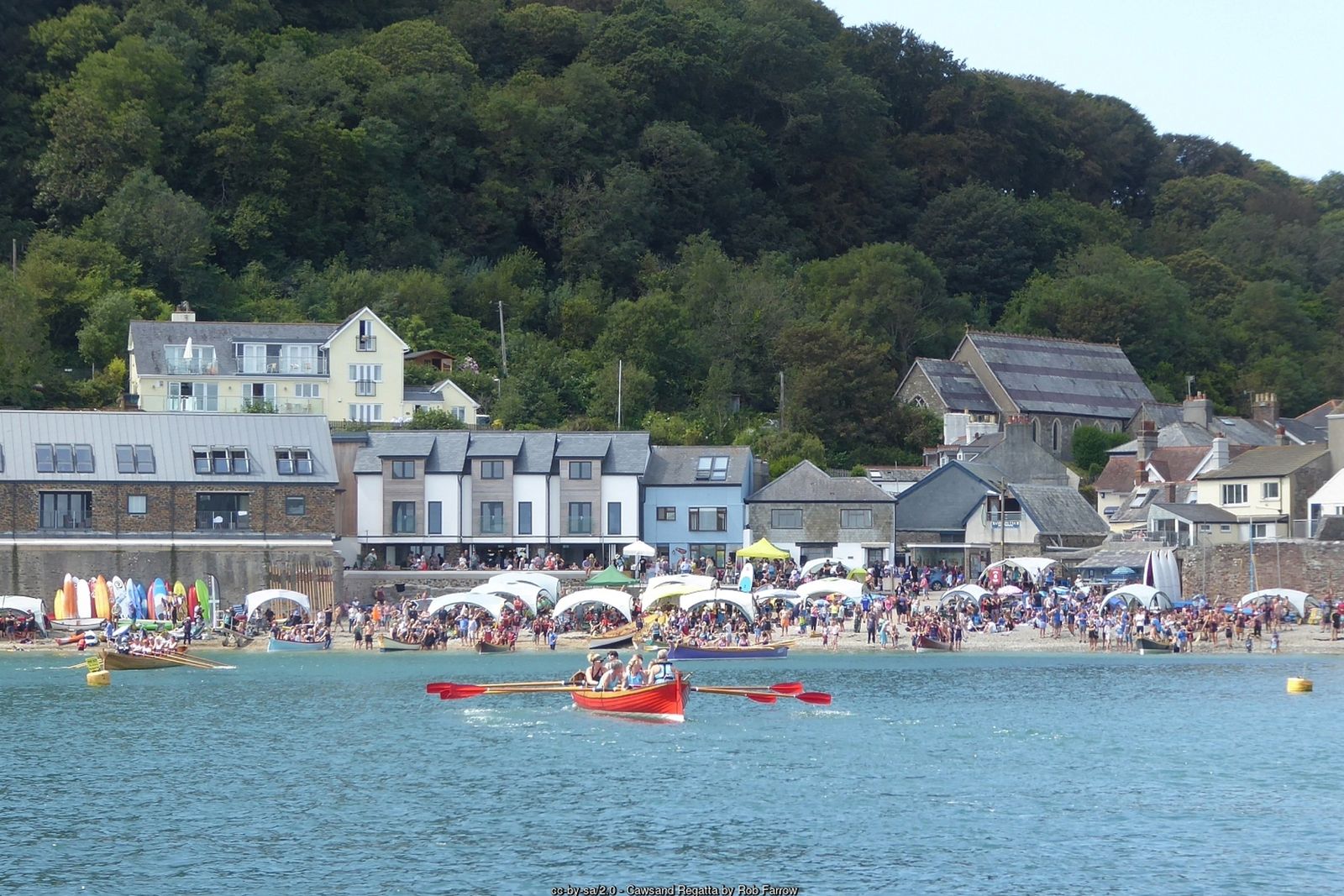
A medieval chapel on a lonely headland, Queen Adelaide’s Grotto and views from Plymouth Sound across Whitsand Bay to Looe – starting from Cornwall’s old smuggling villages.
Rame Head is the south-eastern tip of Cornwall – a steep, grassy cone of a headland crowned by a tiny medieval chapel, with Plymouth Sound on one side and the long sweep of Whitsand Bay on the other. On a clear day you can see the Eddystone Lighthouse out to sea.
This circular walk starts in Cawsand, one of the twin villages of Kingsand and Cawsand whose narrow lanes were once a busy smuggling haunt. It follows the South West Coast Path through the woods to Penlee Point and around the cliffs to Rame Head, then returns inland past the ancient church of St Germanus at Rame and down the peaceful Forder valley.
Walk at a glance
- Distance
- About 5½ miles (about 2¾ hrs)
- Grade
- Moderate – some steady climbs and a steep scramble up Rame Head
- Map
- OS Explorer 108 – Lower Tamar Valley & Plymouth
- Start
- The Square, Cawsand, by the Cross Keys Inn (PL10 1PF)
- Terrain
- Coast path through woodland and over cliff-top grassland, old military roads, field paths and quiet lanes
Parking
Cawsand car park (Cornwall Council, pay and display, 139 spaces, postcode PL10 1PA), a short walk from the square. There is also a car park in the centre of Kingsand. Rame Head car park (PL10 1LH), next to the coastwatch lookout, makes an alternative start. The villages’ streets are very narrow – do not try to park in them.
Facilities
Public toilets in Cawsand by the slipway and on the Kingsand sea front, and at the Rame Head car park. Pubs, cafés and shops in Kingsand and Cawsand, including the Cross Keys Inn and The Bay in Cawsand.
Disabled access
This walk is not suitable for wheelchairs or limited mobility: the coast path climbs steadily with uneven, rocky sections, and the final path up to the chapel on Rame Head is steep and rough. Easier alternatives: from the Rame Head car park there are wide views over Whitsand Bay and towards the headland without walking far, and there are accessible toilets there. In Cawsand the short slipway gives wheelchair and pushchair access to the beach, whereas the Kingsand beach has steps.
Places to stay
The route
Numbers in circles match the points on the route map and the waypoint table below. Distances are approximate and measured between points.
Main walk – Cawsand, Penlee Point, Rame Head, Rame church and Forder (about 5½ miles)
Cawsand Square to Pier Cove
With your back to the Cross Keys Inn in The Square, turn left into Pier Lane, following the fingerpost for the Coast Path. The lane climbs out of the southern end of the village between cottages and becomes a path above the shore, with Cawsand Bay and Plymouth Sound on your left. Above Pier Cove – where a Brennan torpedo station was built in the late 1880s – a path joins from the left: fork right here to stay on the South West Coast Path.
Through the Penlee woods to the grotto
Follow the broad path south through the woods above the sea, ignoring side paths up to the right, with glimpses over the water towards Plymouth Breakwater. The trees thin out as you reach Penlee Point, the western entrance to Plymouth Sound. Just below the path on the left is Queen Adelaide’s Grotto, an old watch-house cave faced with stone after Princess Adelaide’s visit in 1827. The rocks around the grotto fall straight into the sea – keep children and dogs close.
Point 3: Queen Adelaide’s Grotto, Penlee Point – 50.31849, -4.19024 (SX 4417 4880)
Round Penlee Point to the stile
From the grotto turn sharply right and follow the coast path west, now above Whitsand Bay rather than Plymouth Sound. After a short climb you pass a stile on the right, where a path climbs to the car park at the old Penlee Battery (now a nature reserve) – ignore it and keep straight on along the coast path, with the sea on your left.
Point 4: Stile below Penlee Battery car park (path junction) – 50.31970, -4.19760 (SX 436 489 approx.)
Along the cliffs to Rame Head
The path runs along the grassy cliff tops with Rame Head and its chapel ahead. After about a mile you pass a junction signed right to Rame Church – keep straight on for the headland (turning right here is a short cut that misses Rame Head). Where the path reaches the neck of the headland, cross the line of the Iron Age rampart by its central causeway and take the path on the left up the steep, rocky mound, finishing with steps, to St Michael’s Chapel on the summit. The chapel was licensed for Mass in 1397 and a beacon was kept here for centuries; on a clear day you can see the Eddystone Lighthouse out to sea. The final climb is steep and rough, and the headland has unfenced drops on every side – take great care, especially in wind or wet weather.
Point 6: St Michael’s Chapel, Rame Head – 50.31362, -4.22311 (SX 41814 48328)
Up to the Rame Head car park
Go back down the steps from the chapel and take the left-hand fork, then follow the coast path as it climbs the far hillside. Where the coast path swings left towards Polhawn and Whitsand Bay, bear right uphill instead to reach the Rame Head car park beside the white National Coastwatch lookout, the old coastguard station. There are toilets here.
Point 7: Rame Head car park and National Coastwatch lookout (PL10 1LH) – 50.31750, -4.21948 (SX 42085 48752)
Across the fields to Rame church
Take the public footpath opposite the car park entrance. Follow the right-hand hedge round the corner of the field, then cross the next field diagonally to the right to reach the road. Turn left along the road to the church of St Germanus, with its slate broach spire, consecrated in 1259 on an earlier Norman site. The road has no pavement – walk in single file and watch for traffic.
Point 8: Church of St Germanus, Rame – 50.32122, -4.21206 (SX 42626 49150)
Through Rame and down Rame Lane
From the church continue north along the lane into the small village of Rame. At the road junction just after the village, fork right onto Rame Lane, a quiet lane that drops into the wooded Forder valley. Quiet lane with no pavement – keep to the edge.
Point 9: Rame Lane, Forder valley – 50.32457, -4.21325 (SX 425 496 approx.)
Forder and the climb up Forder Hill
Follow Rame Lane down the valley to the hamlet of Forder. Here fork left onto Forder Hill and climb steeply until you reach a public footpath signed off the lane on the right. (For a shorter, easier finish you can instead stay on the lower lane, Forder Lane, which runs down into the top of Cawsand.)
Point 10: Forder – fork onto Forder Hill – 50.32996, -4.21108 (SX 426 502 approx.)
Over the fields past Cawsand Fort
Turn right onto the footpath and head downhill through the field towards the sea, bearing slightly right to a gap in the far hedge. Ignore the green lane on the right and take the path just to its left through the next field to another green lane ahead. Carry straight on along the path past the walls of Cawsand Fort, built in the 1860s on the site of a 1779 battery and now converted to homes, to reach a road. Take care on the fields if cattle are grazing.
Point 11: Cawsand Fort – 50.33251, -4.20276 (SX 43325 50385)
Down the steps to The Square
Cross the road with care and go down the steps to New Road below. Cross New Road, turn right and then take the long flight of stone steps on the left, in front of the fort, down to Garrett Street by the beach. Turn right along Garrett Street and follow it to The Square in Cawsand, where you started.
Point 1: The Square, Cawsand, by the Cross Keys Inn (PL10 1PF) – 50.33117, -4.20205 (SX 43371 50235)
All information is given in good faith and for guidance only. Always carry the OS map and check the South West Coast Path website for diversions.
Highlights along the way
St Michael’s Chapel
A tiny medieval chapel on the summit of Rame Head, licensed for Mass in 1397.
Penlee Point
Queen Adelaide’s Grotto and the old Penlee Battery nature reserve at the entrance to Plymouth Sound.
St Germanus, Rame
A remote church consecrated in 1259 on an earlier Norman site.
Kingsand & Cawsand
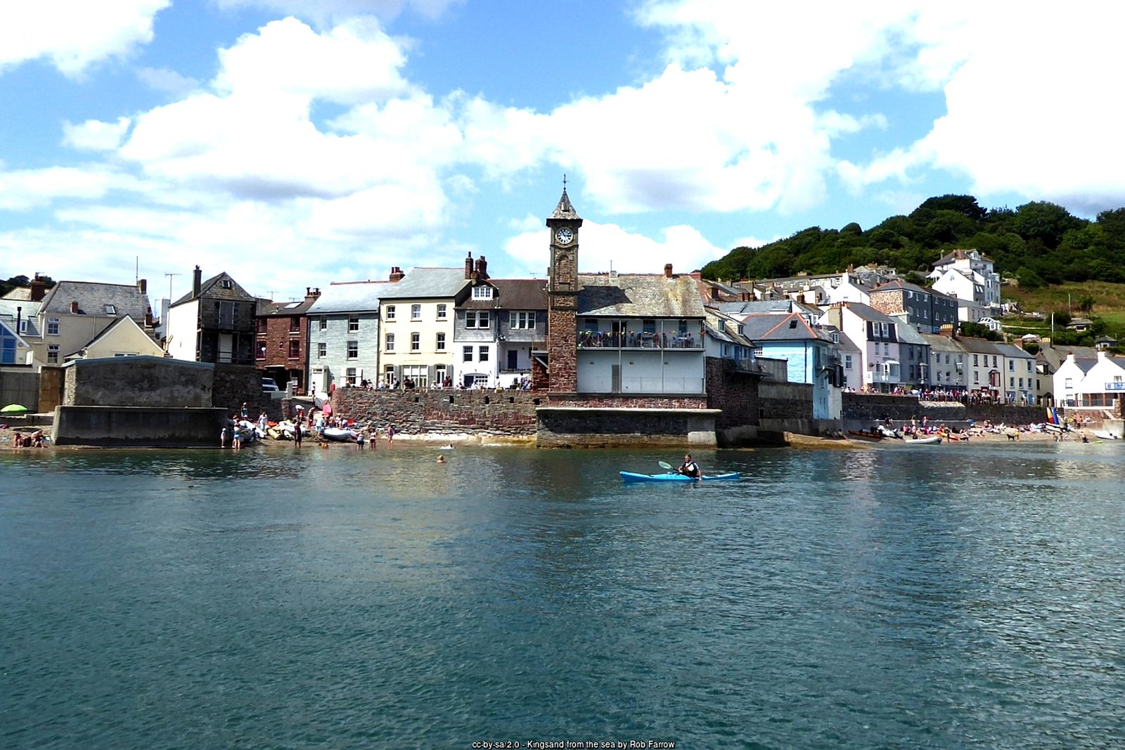
Twin fishing and smuggling villages; Kingsand was once on the Devon side of the old county border.
Nearby
Towns & villages
Photos
Route map and waypoints
Latitude and longitude (WGS84, as used by phones and sat-navs) with OS grid references. The markers show key points only – follow the waymarked paths between them.
| Point | Place | Lat, long | Grid ref |
|---|---|---|---|
| 1 | The Square, Cawsand, by the Cross Keys Inn (PL10 1PF) | 50.33117, -4.20205 map | SX 43371 50235 |
| 2 | Pier Lane and Pier Cove (fork above the cove) | to be confirmed | – |
| 3 | Queen Adelaide’s Grotto, Penlee Point | 50.31849, -4.19024 map | SX 4417 4880 |
| 4 | Stile below Penlee Battery car park (path junction) | 50.31970, -4.19760 map | SX 436 489 approx. |
| 5 | Junction signed to Rame Church (keep ahead on coast path) | to be confirmed | – |
| 6 | St Michael’s Chapel, Rame Head | 50.31362, -4.22311 map | SX 41814 48328 |
| 7 | Rame Head car park and National Coastwatch lookout (PL10 1LH) | 50.31750, -4.21948 map | SX 42085 48752 |
| 8 | Church of St Germanus, Rame | 50.32122, -4.21206 map | SX 42626 49150 |
| 9 | Rame Lane, Forder valley | 50.32457, -4.21325 map | SX 425 496 approx. |
| 10 | Forder – fork onto Forder Hill | 50.32996, -4.21108 map | SX 426 502 approx. |
| 11 | Cawsand Fort | 50.33251, -4.20276 map | SX 43325 50385 |
Before you set out
Carry the OS map – paths and signs can change and mobile signal is patchy.
Check the weather and tide times before you set out.
Keep to the path and well back from cliff edges.
Keep dogs under close control near livestock and cliffs.