Back to East Cornwall & Bodmin Moor walks
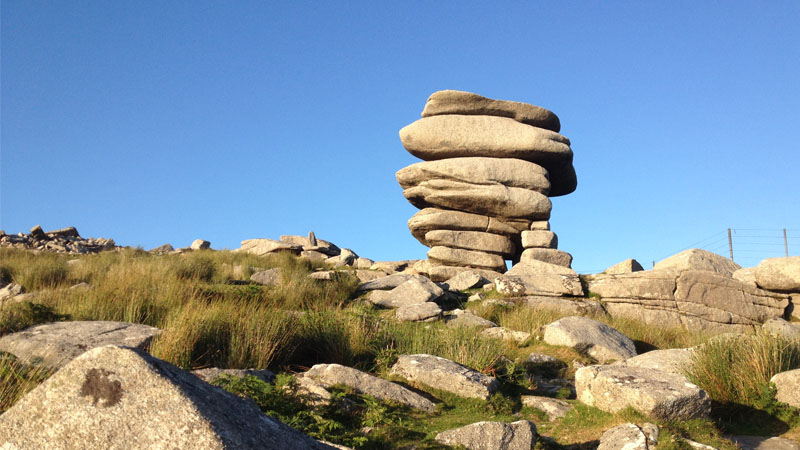
A fascinating circular walk across one of the richest prehistoric and industrial landscapes on Bodmin Moor, linking The Hurlers, ancient mining workings, the Cheesewring Quarry, Daniel Gumb's Cave, Stowe's Pound and Rillaton Barrow.
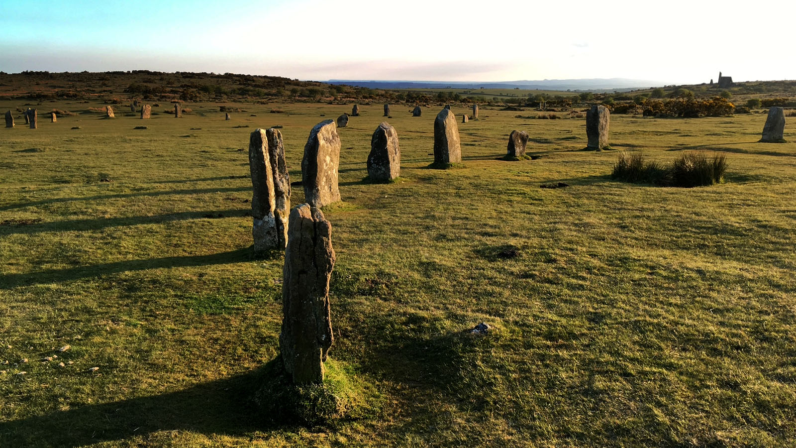
Starting at the Hurlers car park at Minions, the route crosses the open moorland through the remarkable landscape surrounding the three Hurlers stone circles. Along the way are old bell pits, prehistoric ceremonial remains and traces of the mining industry which transformed this part of Bodmin Moor during the nineteenth century.
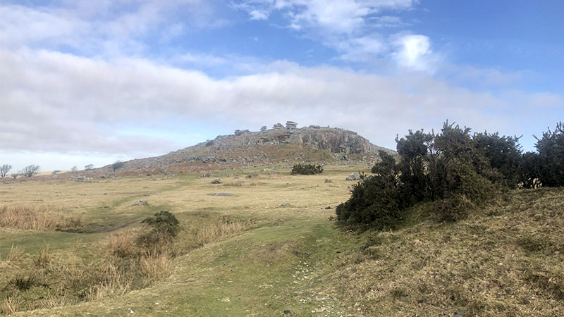
The route then approaches the western edge of Cheesewring Quarry, following the line of the old mining and railway landscape before climbing past Daniel Gumb's Cave to the dramatic granite stacks of the Cheesewring. From Stowe's Pound there are extensive views across the Tamar Valley and towards Caradon Hill, while on a clear day the higher ground of Bodmin Moor, including the direction of Brown Willy, can be seen across the landscape.
The return crosses the ridge before reaching Rillaton Barrow, the Bronze Age burial monument famous for the discovery of the Rillaton Gold Cup, before turning south-west across the moor to return to The Hurlers and the car park.
Walk at a glance
- Distance
- Approximately 4 miles (6.4 km)
- Time
-
About 2 to 2½ hours walking time
Allow longer for the archaeological sites and viewpoints - Grade
- Moderate – open moorland, uneven ground and a rocky climb around Stowe's Hill
- Map
- OS Explorer 109 – Bodmin Moor
- Start
- Hurlers Car Park, Minions
- Highest point
- Around 360 m on Stowe's Hill
- Terrain
- Open moorland, grassy tracks, old mining and railway formations, rocky ground and uneven paths
Parking
Free parking is available at the Hurlers car park at Minions. The Hurlers are reached from the car park across uneven open moorland. Parking is also available elsewhere in Minions, but spaces can become busy during good weather and holiday periods.
Facilities
There are no facilities on the open moorland around The Hurlers, Cheesewring or Stowe's Pound. Minions has refreshments, a shop and places to eat. Check opening times before setting out.
Disabled access
This full walk is not suitable for wheelchairs or most people with limited mobility. The route crosses rough, uneven and sometimes wet open moorland, with rocky ground around Cheesewring and Stowe's Hill.
Places to stay
The route
Numbers in circles match the points on the route map and the waypoint table below. Distances are approximate and measured between points.
Distances between waypoints are approximate. The route crosses open access moorland and some sections do not follow a single defined footpath. GPS positions are supplied as navigation aids and should be used together with OS Explorer 109.
Main walk – The Hurlers, the Cheesewring, Stowe’s Pound and Rillaton Barrow (about 4 miles)
Hurlers car park to The Hurlers
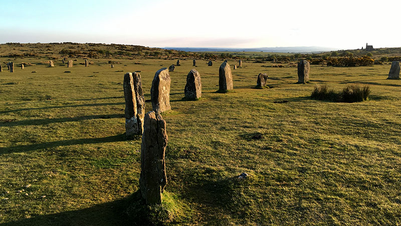
Leave the Hurlers car park and cross the open ground towards The Hurlers. The three stone circles stand in a remarkable line across this part of Bodmin Moor. Take time to walk between the circles and appreciate their relationship with the surrounding prehistoric landscape. The Hurlers are a group of three Late Neolithic or Early Bronze Age stone circles. English Heritage describes the grouping as unique in England.
Point 2: The Hurlers northern stone circle – 50.51813, -4.45763 (SX 25870 71590)
Across the bell pits and prehistoric ceremonial landscape
Continue north-west across the uneven moorland, passing numerous shallow hollows and mounds created by historic mining. These bell pits and shallow workings are a reminder that the prehistoric ceremonial landscape was later surrounded by centuries of mineral exploitation. The route approaches the line of the prehistoric avenue associated with The Hurlers. The avenue is another part of the wider ceremonial landscape and helps demonstrate that the stone circles were not isolated monuments.
Point 3: Hurlers Avenue / ceremonial way – 50.52056, -4.45927 (SX 25763 71864)
Across the old mining ground towards Cheesewring Quarry
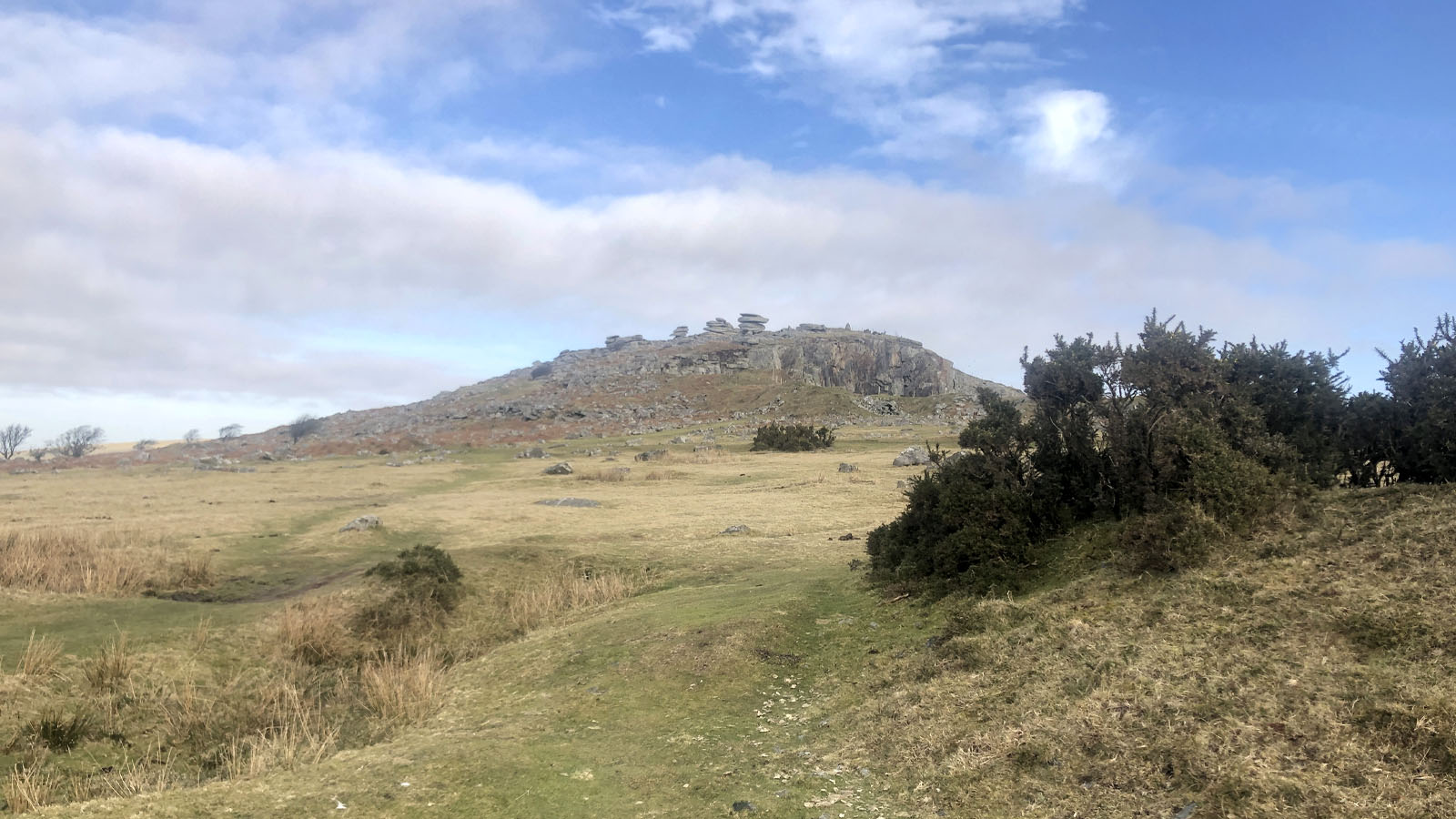
Continue across the moor towards Stowe's Hill. The ground becomes increasingly dominated by the remains of nineteenth-century mining and quarrying. Look for lines of shallow pits, spoil heaps and the remains of old tracks. As you approach the western side of Cheesewring Quarry, the ground rises gently. Follow the western edge of the quarry, where the old mining incline and railway formation become increasingly obvious. The Cheesewring Quarry was connected with the Liskeard and Caradon Railway, which served the mines and quarries around Minions.
Point 4: Western edge of Cheesewring Quarry / old mining incline – 50.52407, -4.45945 (SX 25763 72254)
Climb to the Cheesewring
From the quarry edge climb the rocky ground towards the Cheesewring. The character of the landscape changes rapidly here, with the enormous granite faces of the quarry below and the weathered granite tor above. The Cheesewring is a natural granite formation created by weathering. The stacked appearance of the granite slabs gives the tor its distinctive name.
Point 5: The Cheesewring – 50.52543, -4.45944 (SX 25769 72406)
From the Cheesewring to Stowe's Pound
From the Cheesewring continue up onto Stowe's Hill. The summit is surrounded by the substantial prehistoric enclosure known as Stowe's Pound. The enclosure contains numerous hut platforms and surviving stretches of granite walling. Rather than thinking of it simply as an isolated hillfort, it is best understood as part of the wider prehistoric settlement and ceremonial landscape around Minions.
Point 6: Stowe’s Pound / Stowe’s Hill – 50.52601, -4.45931 (SX 25780 72470)
Views from Stowe's Hill
After exploring Stowe's Pound, begin the return descent towards the quarry. Retrace the route towards the quarry edge, passing via 50.525012, -4.459564, before continuing down towards the southern edge of the large quarry. On a clear day the elevated position gives wide views across the surrounding landscape. Looking east and south-east, Caradon Hill is conspicuous with its transmitter mast. Beyond the Tamar Valley are the hills of Devon. Looking north and north-west, the broad uplands of Bodmin Moor stretch towards the higher ground around Brown Willy. Take care on the rocky descent and remain clear of quarry faces, unstable ground and abandoned mine workings.
Point 7: Quarry descent – 50.52378, -4.45953 (SX 25756 72222)
Follow the southern edge of the quarry and cross towards the ridge
From the quarry edge, continue down to Point 7 at the southern edge of the large quarry, at 50.523775, -4.459530. Follow the southern edge of the quarry to 50.523587, -4.457888 before turning south to cross towards the ridge line. On the way, pass the old fenced-off mine shaft at 50.522963, -4.456857. Keep outside the fencing and well clear of the shaft and any other mine workings. The route then continues south-east towards the old mining track and ridge at Point 8.
Point 8: Old fenced-off mine shaft – 50.52296, -4.45686 (SX 25943 72126)
Pass the old fenced-off mine shaft and continue to the ridge
Continue south along the ridge across the open moor. The ground here contains numerous traces of prehistoric activity as well as later prospecting and mining. Rillaton Barrow eventually becomes the dominant feature ahead. This large Bronze Age burial monument is one of the most important prehistoric sites in the Minions landscape.
Point 9: Rillaton Barrow – 50.52116, -4.45542 (SX 26038 71922)
Rillaton Barrow back towards The Hurlers
From Rillaton Barrow head south-west across the open moor towards The Hurlers. The barrow is particularly significant because of the discovery in 1837 of a Bronze Age burial containing the famous Rillaton Gold Cup. The original cup is now held by the British Museum. The alignment between the Hurlers and Rillaton Barrow is one of the most interesting features of the prehistoric landscape. The barrow stands on the skyline beyond the northern circle and forms part of a much wider pattern of prehistoric monuments.
Point 10: The Hurlers – 50.51813, -4.45763 (SX 25870 71590)
The Hurlers to the car park
Return through the Hurlers landscape, giving yourself another opportunity to look at the stone circles from different angles. From the stones continue across the moorland to the Hurlers car park, where the walk ends.
Point 1: Hurlers Car Park, Minions – 50.51386, -4.45577 (SX 25987 71111)
Option Daniel Gumb’s Cave (short detour)
From point 4 at the end of step 3:
Daniel Gumb's Cave
Before climbing further towards the Cheesewring, make the short detour to Daniel Gumb's Cave. The cave and the remains of Daniel Gumb's unusual stone-built home lie close to the quarry edge. Daniel Gumb was an eighteenth-century stonemason and mathematician who made his home among the granite rocks of Stowe's Hill. The surviving remains are a fascinating reminder that people once lived and worked directly within this rugged landscape. Take particular care around the quarry edge and do not enter unstable workings or climb into unsafe areas.
Point A1: Daniel Gumb’s Cave / House – 50.52443, -4.45902 (SX 25795 72294)
All information is given in good faith and for guidance only. Always carry the OS map and check the South West Coast Path website for diversions.
Highlights along the way
The Hurlers
Three prehistoric stone circles forming one of the most remarkable ceremonial landscapes on Bodmin Moor.
Ancient Mining Ground
Bell pits, shafts, spoil heaps and old industrial tracks reveal the centuries of mineral exploitation around Minions.
Cheesewring Quarry
A dramatic abandoned granite quarry beside the natural granite tor, linked historically with the Liskeard and Caradon Railway.
Daniel Gumb's Cave
The remains of the unusual eighteenth-century stone home associated with Daniel Gumb, the local stonemason and mathematician.
The Cheesewring
One of Cornwall's best-known granite tors, formed by natural weathering and standing dramatically above the quarry.
Stowe's Pound
A substantial prehistoric enclosure on Stowe's Hill, with surviving granite walls and hut platforms.
Rillaton Barrow
A large Bronze Age burial monument associated with the discovery of the famous Rillaton Gold Cup.
Bodmin Moor Views
Wide views across Caradon Hill, the Tamar Valley and the northern Bodmin Moor landscape towards the higher moors.
Photos
Route map and waypoints
Latitude and longitude (WGS84, as used by phones, GPS devices and mapping apps) with OS grid references. The route line is indicative; follow the paths and open-access routes on the ground.
| Point | Place | Lat, long | Grid ref |
|---|---|---|---|
| 1 | Hurlers Car Park, Minions | 50.51386, -4.45577 map | SX 25987 71111 |
| 2 | The Hurlers northern stone circle | 50.51813, -4.45763 map | SX 25870 71590 |
| 3 | Hurlers Avenue / ceremonial way | 50.52056, -4.45927 map | SX 25763 71864 |
| 4 | Western edge of Cheesewring Quarry / old mining incline | 50.52407, -4.45945 map | SX 25763 72254 |
| A1 | Daniel Gumb’s Cave / House | 50.52443, -4.45902 map | SX 25795 72294 |
| 5 | The Cheesewring | 50.52543, -4.45944 map | SX 25769 72406 |
| 6 | Stowe’s Pound / Stowe’s Hill | 50.52601, -4.45931 map | SX 25780 72470 |
| 7 | Quarry descent | 50.52378, -4.45953 map | SX 25756 72222 |
| 8 | Old fenced-off mine shaft | 50.52296, -4.45686 map | SX 25943 72126 |
| 9 | Rillaton Barrow | 50.52116, -4.45542 map | SX 26038 71922 |
| 10 | The Hurlers | 50.51813, -4.45763 map | SX 25870 71590 |
Before you set out
Carry OS Explorer 109. Some paths across the open moorland are indistinct and can become difficult to follow in poor weather.
Bodmin Moor is exposed and weather can change rapidly. Take waterproof clothing even when conditions look settled in Minions.
Keep well away from mine shafts, quarry faces and unstable ground. Never enter abandoned mine workings.
Stowe's Pound is a Scheduled Monument. Do not remove, rearrange or use stones from the prehistoric enclosure walls to build stone cairns or “fairy cairns”. Leave the archaeological remains exactly as you find them.
Sheep and ponies graze freely across the moor. Keep dogs under close control and follow current local requirements for dogs near livestock and ground-nesting birds.