Back to East Cornwall & Bodmin Moor walks
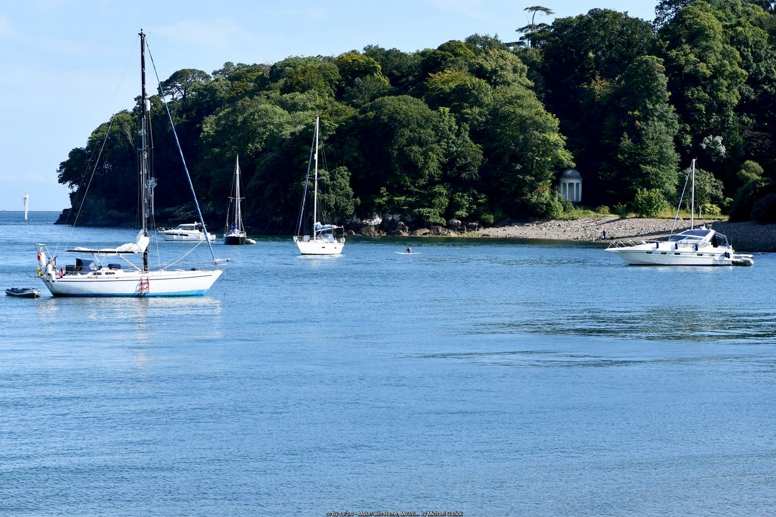
Historic gardens, woodland follies and a coast path with grandstand views over Plymouth Sound – all a short ferry ride from Plymouth.
Mount Edgcumbe Country Park covers some 865 acres of the Rame Peninsula facing Plymouth across the mouth of the Tamar. Its gardens and parkland – among the earliest landscaped grounds in Cornwall – are rated Grade I, and the Tudor-style house, gutted by bombs in 1941, was rebuilt after the war. The park has been owned jointly by Plymouth and Cornwall councils since 1971 and is free to explore.
This circuit starts at Cremyll, where a ferry has crossed from Plymouth since medieval times. It passes the formal gardens, follows the South West Coast Path along the wooded shore past Lady Emma’s Cottage and Fort Picklecombe, climbs through the deer park to Maker Church, and returns along the quiet waterside to Cremyll. A longer option continues along the coast to the twin villages of Kingsand and Cawsand.
Walk at a glance
- Distance
- Main walk about 4.3 miles (about 2½ hrs)
With Kingsand extension about 6½ miles (about 3½ hrs) - Grade
- Moderate – some steep climbs and steps on the coast path
- Map
- OS Explorer 108 – Lower Tamar Valley & Plymouth
- Start
- Cremyll ferry landing, opposite the Edgcumbe Arms, Cremyll PL10 1HX
- Terrain
- Surfaced garden paths, woodland and cliff paths, parkland and a waterside footpath – muddy in places
Parking
Cremyll pay and display car park (Mount Edgcumbe, RingGo location 16851) beside the ferry landing. Maker car park by Maker Church (honesty box) is an alternative start on the circuit. Better still, arrive on foot: the Cremyll Ferry carries foot passengers and cycles across the Tamar from Admiral’s Hard, Stonehouse, in Plymouth – check the timetable before you travel.
Facilities
Public toilets at Cremyll and at the Orangery in the formal gardens, with the Orangery café and the Edgcumbe Arms pub at Cremyll. The country park is open free every day; Mount Edgcumbe House is open seasonally for guided tours (check opening times before you visit). Pubs, cafés and toilets in Kingsand and Cawsand on the extension.
Disabled access
The full walk is not suitable for wheelchairs: the coast path has steep climbs, uneven ground and steps, including the ZigZags above Lady Emma’s Cottage. The area around Cremyll is the most accessible part – the lower formal gardens have surfaced paths with easy and moderate ramps (the few steps can be avoided by slopes) and there is an accessible toilet by the Orangery. Blue Badge parking is on the drive next to the house, and rugged all-terrain mobility scooters can be hired through the Countryside Mobility scheme (book ahead).
The route
Numbers in circles match the points on the route map and the waypoint table below. Distances are approximate and measured between points.
Main walk – Cremyll, the coast path, Picklecombe, Maker Church and Empacombe (about 4.3 miles)
Cremyll to the Orangery
From the ferry landing, with the Edgcumbe Arms behind you, walk a few steps to the right and go through the large iron gates into Mount Edgcumbe House and Country Park. Just inside, bear left towards the Orangery and the formal gardens, which lie on your left between the drive and the water. The gardens are free and well worth a short detour; there are toilets and a café at the Orangery. The park gates are closed from dusk until 8am.
Point 2: Orangery in the Italian Garden – 50.35904, -4.17381 (SX 45471 53274)
Barn Pool and the Blockhouse
Pick up the South West Coast Path (acorn waymarks) beyond the gardens and follow it along the shore with the water on your left. You soon pass the small Tudor Blockhouse, built around 1540 to guard the Tamar, above the sheltered anchorage of Barn Pool. Look across to Drake’s Island and Plymouth Hoe.
Point 3: Tudor Blockhouse above Barn Pool – 50.35817, -4.17180 (SX 45611 53173)
Along the shore to Milton’s Temple
Keep to the coast path along the edge of the park, ignoring paths up to the right. The path passes the little round Ionic temple of 1755, known as Milton’s Temple, set in a grassy amphitheatre among big trees. Look out too for the mock-ruined Folly on the slope above Barn Pool.
Point 4: Milton’s Temple – 50.35322, -4.17033 (SX 4570 5262)
Into the woods to Lady Emma’s Cottage
The path now enters woodland and begins to climb steeply through the trees. Continue to follow the acorn waymarks, still with the sea on your left and ignoring any paths heading inland, until you reach Lady Emma’s Cottage, a black-and-white timbered house (now a holiday let – please respect its privacy).
Point 5: Lady Emma’s Cottage (foot of the ZigZags) – 50.34876, -4.16830 (SX 4583 5212)
Up the ZigZags and round Redding Point
Beyond the cottage the path climbs steeply up the ZigZags, a series of hairpin bends and steps cut into the wooded cliff in the 18th century. At the top there is a fine viewpoint over Plymouth Sound and the Breakwater. Carry on along the path around Redding Point, with the sea still on your left. The cliff edge is steep and largely unfenced here – keep children and dogs close. Fort Picklecombe soon comes into view on the rocks below.
Point 6: Fort Picklecombe – 50.34388, -4.17221 (SX 45536 51586)
Behind Fort Picklecombe to Picklecombe Seat
Near Picklecombe Point the coast path turns right, away from the sea, to skirt around the landward side of Fort Picklecombe, a Victorian battery now converted into flats (private). Follow the waymarks past the fort’s tennis courts to Picklecombe Seat, a Gothick stone alcove built in the late 18th century from the stonework of an old chapel. The path then swings back towards the coast and starts to go downhill.
Point 7: Picklecombe Seat – 50.34602, -4.17330 (SX 45465 51826)
Leave the coast path above Hooe Lake
A short way after Picklecombe the path reaches a junction above the head of the Hooe Lake valley. Here the main walk leaves the coast path: take the right-hand fork, heading uphill. (For the Kingsand extension, stay on the coast path instead – see below.)
Up through the deer park to Maker Church
Bear uphill around the head of the valley and climb steeply through the deer park, carrying straight on at the top to Maker Church, whose tall tower is a good guide. Keep dogs on a lead in the deer park. The church car park is just beside it, and the views back over the Sound are superb.
Point 9: Maker Church (St Mary & St Julian) and car park (PL10 1JB) – 50.34730, -4.18506 (SX 44633 51992)
Maker Church to St Julian’s Well
Leave the car park on the signed footpath heading north past a gate. St Julian’s Well, a tiny medieval well chapel, lies just to the north of the church near the road – a short detour if it is not directly beside your path. Cross the B3247 with care: traffic is fast and there is no pavement.
Point 10: St Julian’s Well – 50.34885, -4.18496 (SX 44645 52165)
Down through the woods to the waterside
Across the road go down the steps on a narrow path through the woods. Keep straight on at the first junction, then bear right onto a track (yellow waymark) to a wooden kissing gate. Go through into an open field with views over the Hamoaze to Torpoint. Turn left on the gravel track, cross the lane at Lower Anderton with care, and follow the footpath signed for the Cremyll ferry and Empacombe along the field edge above the water (Millbrook Lake on your left), around Palmer Point. You pass a roofless round stone tower – the so-called Empacombe windmill.
Point 11: Empacombe “windmill” tower – 50.35490, -4.18754 (SX 44481 52843)
Empacombe Quay
Continue down to the little harbour at Empacombe, where the old quay wall encloses a small tidal basin. Follow the footpath signs around the edge of the harbour and past Empacombe House – the buildings are private, so keep to the signed path.
Point 12: Empacombe Quay – 50.35568, -4.18682 (SX 44535 52928)
Back to Cremyll
Carry on along the path above the shore with the water on your left, passing the Cremyll car park, to emerge in Cremyll beside the Edgcumbe Arms and the ferry landing where you started.
Point 1: Cremyll ferry landing, opposite the Edgcumbe Arms (PL10 1HX) – 50.36058, -4.17506 (SX 45387 53448)
Option Longer walk via Kingsand (about 6½ miles)
Follow the main walk to the junction above the Hooe Lake valley (step 7), then:
Along the coast to Kingsand
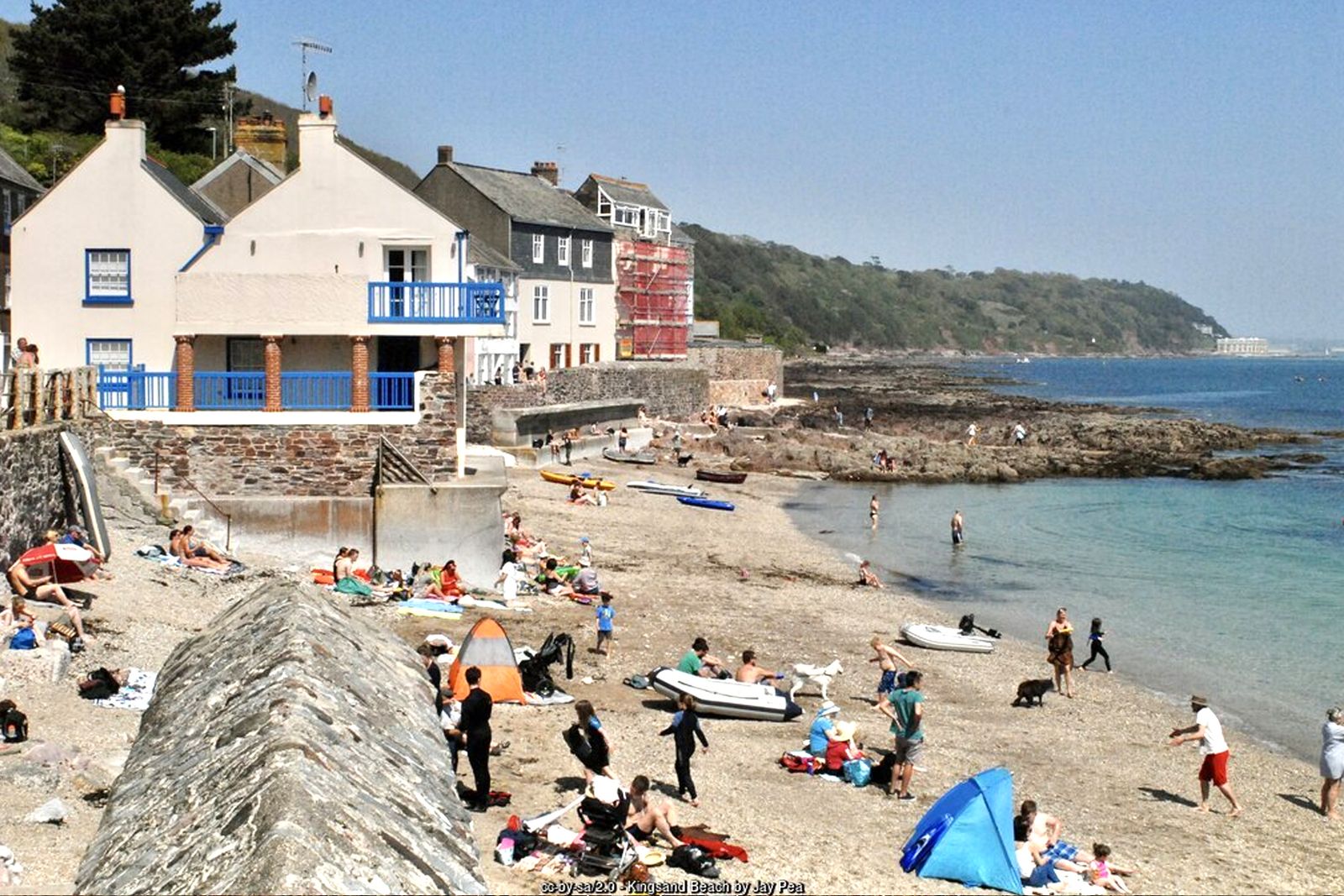
Stay on the coast path, keeping the sea on your left, through the scrubby woodland of Minadew Brakes above the rocky shore. Where the path divides into upper and lower branches, take either – they join again further on. Drop into Kingsand along Devonport Hill, then follow The Green or the lane signed “Unsuitable for Motors” into the village. The clock tower of the Institute stands on the seafront; Cawsand, with more pubs and cafés, is just beyond.
Point A1: Kingsand – the Institute clock tower – 50.33340, -4.20070 (SX 434 504 (approx.))
Climb to Grenville Battery
To return, head back towards the north end of Kingsand and climb the steep hill out of the village. Near the top follow the footpath along the ridge past the remains of Grenville Battery, an 18th-century redoubt on Maker Heights, with wide views back over Cawsand Bay.
Point A2: Grenville Battery, Maker Heights – 50.33946, -4.19557 (SX 43859 51143)
Maker Heights to Maker Church
Join the lane towards Maker Farm, then cross the fields on the signed footpath (there is a stile), passing Friary Manor. Use the tower of Maker Church as your guide and rejoin the main walk at the church car park (step 9) to return to Cremyll by Empacombe.
Point 9: Maker Church (St Mary & St Julian) and car park (PL10 1JB) – 50.34730, -4.18506 (SX 44633 51992)
All information is given in good faith and for guidance only. Always carry the OS map and check the South West Coast Path website for diversions.
Highlights along the way
The formal gardens
Italian, French and English gardens around the Orangery, plus the National Camellia Collection.
Barn Pool
A sheltered deep-water anchorage below the park, used by ships since at least Viking times.
Picklecombe and Redding Point
Cliff-top follies, Victorian Fort Picklecombe and superb views over Plymouth Sound and the Breakwater.
Maker Church
A medieval church high on the peninsula beside the deer park, home to the Edgcumbe family vault.
Nearby
Beaches
Towns & villages
Photos
Route map and waypoints
Latitude and longitude (WGS84, as used by phones and sat-navs) with OS grid references. The markers show key points only – follow the waymarked paths between them.
| Point | Place | Lat, long | Grid ref |
|---|---|---|---|
| 1 | Cremyll ferry landing, opposite the Edgcumbe Arms (PL10 1HX) | 50.36058, -4.17506 map | SX 45387 53448 |
| 2 | Orangery in the Italian Garden | 50.35904, -4.17381 map | SX 45471 53274 |
| 3 | Tudor Blockhouse above Barn Pool | 50.35817, -4.17180 map | SX 45611 53173 |
| 4 | Milton’s Temple | 50.35322, -4.17033 map | SX 4570 5262 |
| 5 | Lady Emma’s Cottage (foot of the ZigZags) | 50.34876, -4.16830 map | SX 4583 5212 |
| 6 | Fort Picklecombe | 50.34388, -4.17221 map | SX 45536 51586 |
| 7 | Picklecombe Seat | 50.34602, -4.17330 map | SX 45465 51826 |
| 8 | Path junction above the Hooe Lake valley (leave the coast path) | to be confirmed | – |
| 9 | Maker Church (St Mary & St Julian) and car park (PL10 1JB) | 50.34730, -4.18506 map | SX 44633 51992 |
| 10 | St Julian’s Well | 50.34885, -4.18496 map | SX 44645 52165 |
| 11 | Empacombe “windmill” tower | 50.35490, -4.18754 map | SX 44481 52843 |
| 12 | Empacombe Quay | 50.35568, -4.18682 map | SX 44535 52928 |
| 13 | Cremyll House, back at Cremyll | 50.36078, -4.17683 map | SX 45262 53474 |
| A1 | Kingsand – the Institute clock tower | 50.33340, -4.20070 map | SX 434 504 (approx.) |
| A2 | Grenville Battery, Maker Heights | 50.33946, -4.19557 map | SX 43859 51143 |
Before you set out
Carry the OS map – paths and signs can change and mobile signal is patchy.
Check the weather and tide times before you set out.
Keep to the path and well back from cliff edges.
Keep dogs under close control near livestock and cliffs.