Back to East Cornwall & Bodmin Moor walks

Ancient riverside woodland, a medieval granite bridge and the grassy ramparts of an Iron Age hillfort with sweeping views over the Lynher valley.
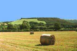
Cadson Bury is an Iron Age hillfort crowning a steep, rounded hill above the River Lynher, a couple of miles south-west of Callington. Its single bank and ditch enclose around 6 acres, and from the ramparts there are wide views over the Lynher valley and the surrounding countryside.
This short circular walk from the National Trust car park at Newbridge follows the river through ancient woodland – part of a Site of Special Scientific Interest where dippers, otters and dormice live – before climbing to the fort and dropping back down through the woods. It is short, but the climb and the steps make it feel more.
Walk at a glance
- Distance
- About 1½ miles (about 1 hr)
- Grade
- Moderate – short but with a steep climb to the fort and many steps on the descent
- Map
- OS Explorer 108 – Lower Tamar Valley & Plymouth
- Start
- National Trust Cadsonbury car park, Newbridge, near Callington PL17 7HL
- Terrain
- Riverside woodland paths, a steep grassy field, narrow worn tracks and woodland steps – muddy after rain
Parking
One small National Trust car park beside the River Lynher, reached by a narrow lane on the Liskeard side of Newbridge, off the A390 about 2 miles south-west of Callington (postcode PL17 7HL). Spaces are limited: if it is full, please come back later rather than parking on the lanes. No overnight parking.
Facilities
There are no facilities at Cadson Bury. The nearest public toilets, cafés and pubs are in Callington.
Disabled access
This walk is not suitable for wheelchairs or pushchairs: the National Trust notes steps and uneven ground throughout, the climb to the hillfort is steep, and there are kissing gates, a stile and a long flight of woodland steps on the way down. People with limited mobility can still enjoy the level stretch of path beside the River Lynher from the car park, though it can be muddy and may flood after heavy rain. There is no Blue Badge parking or accessible toilet on site.
The route
Numbers in circles match the points on the route map and the waypoint table below. Distances are approximate and measured between points.
Main walk – Lynher woods and Cadson Bury hillfort (about 1½ miles)
Into the Lynher woods
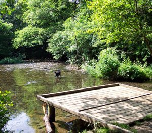
From the small National Trust car park go through the kissing gate at the far end and into the woods. Follow the path downstream with the River Lynher on your left. This is ancient semi-natural woodland, part of a Site of Special Scientific Interest – watch for dippers on the stones and, if you are lucky, an otter. Beside the path you will see pits, spoil heaps and low walls: the remains of early tin streaming in the valley gravels. After heavy rain the river rises quickly and runs very fast – keep children and dogs back from the banks.
Point 2: Riverside path, Cadsonbury Wood – 50.48215, -4.33320 (SX 3456 6730 approx.)
Lane and the fishermen’s path
The riverside path brings you out onto a tarmac lane. Turn left along it for a short way, then take the next path on the left, back down towards the river (look for the private fishing signs – the path is open to walkers, the fishing is not). Follow this second riverside stretch until it bends right, away from the water, and climbs back up to the lane. Turn right along the lane and look for a kissing gate with a National Trust sign warning of the steep climb. The lane is narrow with no pavement – walk in single file and listen for traffic. If the riverside path is flooded, simply stay on the lane to the kissing gate.
Point 3: Kissing gate onto Cadson Bury Down – 50.47945, -4.33567 (SX 3438 6701)
Through the gate onto Cadson Bury Down
Go through the kissing gate onto Cadson Bury Down. This is a permissive path across a grazed field: the signs ask you to keep dogs on a lead and to stay close to the fence. Keep the fence close by as the path begins to climb through the gorse.
Point 4: Permissive path beside the fence, Cadson Bury Down – 50.48008, -4.33528 (SX 3441 6708)
Climb to the ramparts
Climb steadily beside the fence – this is the steepest part of the walk, so take your time and turn round to enjoy the widening views over the Lynher valley. As you near the top, the ditch and bank of the hillfort appear on your left; follow them round to the entrance on the south-west side and step inside the ramparts.
Point 5: South-west entrance to the hillfort – 50.48136, -4.33597 (SX 34366 67224)
Around Cadson Bury
The single bank and ditch enclose an oval area roughly 275 m long and 170 m wide – around 6 acres. The interior is almost level, with gorse and scrub in places. It is well worth walking round the top of the rampart for the views over the Lynher valley and the surrounding countryside. Look for the two entrances at either end of the fort: the south-west one you came in by and the north-east one, with its inturned banks, which is much the clearer. Cattle often graze here, so keep dogs under close control.
Point 6: Cadson Bury Iron Age hillfort (centre) – 50.48279, -4.33654 (SX 34330 67384)
Leave by the north-east entrance
Cross the interior of the fort to the north-east entrance, where the ends of the rampart turn inwards to form a narrow gateway. Go out through it.
Point 7: North-east entrance of the hillfort – 50.48383, -4.33579 (SX 34387 67498)
Down through the woods
Beyond the entrance follow the narrow, well-worn track that runs along the embankment, keeping the hillfort on your left, to reach a stile (it has a lifting bar for dogs; larger dogs may need a helping hand). Cross it and descend through the woodland on a long flight of steps. The steps and track are uneven and very slippery when wet – take your time.
Point 8: Foot of the woodland steps on the lane – 50.48601, -4.33574 (SX 34398 67740)
Back along the lane
At the bottom of the steps you come out on the tarmac lane. Turn right and follow it back beside the woods to the car park. Walk facing oncoming traffic – the lane is narrow with no pavement.
Point 1: National Trust Cadsonbury car park, Newbridge (PL17 7HL) – 50.48754, -4.33175 (SX 346 679)
Option Add-on: look at Newbridge (about ¼ mile there and back)
From the car park (point 1), before or after the walk:
To the medieval bridge
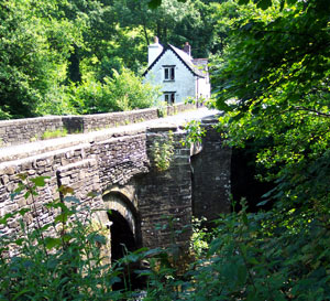
Walk back up the lane to the A390 at Newbridge to see the granite bridge over the Lynher. First recorded in 1478, it has four arches with pointed cutwaters, was repaired in 1698 and widened on its south side in 1875; Charles I crossed it in August 1644 after his victory at Lostwithiel. The A390 is a busy main road with no pavement over the bridge and priority signs for oncoming traffic – view the bridge from the lane end and do not walk onto the carriageway. Return the same way to the car park.
Point A1: Newbridge (Grade II* medieval bridge over the Lynher) – 50.48840, -4.33110 (SX 347 679)
All information is given in good faith and for guidance only. Always carry the OS map and check the South West Coast Path website for diversions.
Highlights along the way
Cadson Bury hillfort
A scheduled Iron Age hillfort cared for by the National Trust, with a single bank and ditch around the hilltop.
Newbridge
A granite bridge over the Lynher first recorded in 1478, widened in the 1870s; Charles I crossed it in 1644.
The Lynher valley woods
Semi-natural riverside woodland, part of a Site of Special Scientific Interest, with dippers and otters on the river.
Tin streaming remains
Pits, dumps and walls beside the river left by the ancient industry of streaming tin from the valley gravels.
Nearby
Towns & villages
Photos
Route map and waypoints
Latitude and longitude (WGS84, as used by phones and sat-navs) with OS grid references. The dotted line shows the route and the markers show key points – always follow the paths on the ground.
| Point | Place | Lat, long | Grid ref |
|---|---|---|---|
| 1 | National Trust Cadsonbury car park, Newbridge (PL17 7HL) | 50.48754, -4.33175 map | SX 346 679 |
| 2 | Riverside path, Cadsonbury Wood | 50.48215, -4.33320 map | SX 3456 6730 approx. |
| 3 | Kissing gate onto Cadson Bury Down | 50.47945, -4.33567 map | SX 3438 6701 |
| 4 | Permissive path beside the fence, Cadson Bury Down | 50.48008, -4.33528 map | SX 3441 6708 |
| 5 | South-west entrance to the hillfort | 50.48136, -4.33597 map | SX 34366 67224 |
| 6 | Cadson Bury Iron Age hillfort (centre) | 50.48279, -4.33654 map | SX 34330 67384 |
| 7 | North-east entrance of the hillfort | 50.48383, -4.33579 map | SX 34387 67498 |
| 8 | Foot of the woodland steps on the lane | 50.48601, -4.33574 map | SX 34398 67740 |
| A1 | Newbridge (Grade II* medieval bridge over the Lynher) | 50.48840, -4.33110 map | SX 347 679 |
Before you set out
Carry the OS map – paths and signs can change and mobile signal is patchy.
Check the weather and tide times before you set out.
Keep to the path and well back from cliff edges.
Keep dogs under close control near livestock and cliffs.