Back to East Cornwall & Bodmin Moor walks
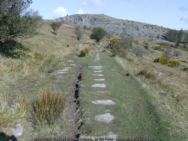
A varied circular walk through the extraordinary industrial landscape around Minions, beginning on the old track bed of the Liskeard and Caradon Railway before climbing a short but steep mining incline and crossing open Bodmin Moor to Gold Diggings Quarry.
The route is particularly interesting because the character of the walking changes as you go. The first section follows a comparatively level old railway formation, where granite sleeper blocks can still be seen in places. The railway was built to connect the mines and granite workings around Caradon Hill and Minions with Moorswater and the port of Looe.
From the railway track bed the route climbs a short, steep old mining gradient to the Cheesewring Quarry spur. An optional out-and-back diversion follows the old quarry railway into the cutting and the heart of the Cheesewring Quarry, where the scale of the nineteenth-century granite industry becomes clear. Granite from the quarry was used for major engineering and architectural work, including Tower Bridge and the Albert Memorial.
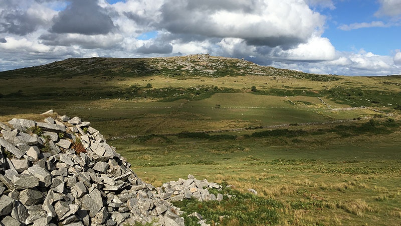
Beyond the quarry the route becomes much more open and moorland in character. It follows old mining drainage and embankment features, crosses Withey Brook and climbs diagonally towards the old Gold Diggings Quarry. The return follows a broad farm and quarry track around the contours of the hillside, passing close to The Pipers, before crossing to The Hurlers and continuing past the South Phoenix Mine engine house and back to Minions.
This is a walk for anyone interested in the way archaeology, mining, quarrying, railway engineering and the natural landscape overlap on Bodmin Moor. The old railway formations are themselves part of the story: the Liskeard and Caradon Railway opened in the nineteenth century to carry mineral traffic, and later extensions served an expanding network of mines and quarries around the hill.
Walk at a glance
- Distance
- Approximately 3½–4 miles (5.6–6.4 km), depending on the exact line taken and whether the quarry diversion is included
- Time
- About 2 to 2½ hours walking time; allow longer for the quarry and mining remains
- Grade
- Moderate – an easier railway track bed section followed by a short steep mining incline, rough quarry ground and open moorland
- Map
- OS Explorer 109 – Bodmin Moor
- Start
- Eastern Minions Car Park, Duchy Terrace, Minions, PL14 5LJ
- Character
- Railway track bed, mining incline, quarry workings, open moorland and broad farm tracks
Parking
The walk starts at the eastern Minions car park on Duchy Terrace, close to the Henwood turn-off. Cornwall's Minions car parks are free, but surfaces can be uneven and spaces can be busy in good weather.
Facilities
Minions has refreshments and visitor facilities. There are no facilities once the route crosses the open moorland, so carry water and food appropriate to the length of your walk.
Disabled access
The complete circular route is not suitable for wheelchairs. Although the old railway formation is comparatively level, the route includes a steep incline, rough quarry ground, open moorland and uneven tracks.
Places to stay
The route
Numbers in circles match the points on the route map and the waypoint table below. Distances are approximate and measured between points.
The route descriptions use the GPS positions supplied for this walk together with additional historical and landscape research. Distances between waypoints are approximate. The route crosses open access moorland and old industrial formations, so some sections may be indistinct or wet. GPS positions should be used with OS Explorer 109 rather than as a substitute for map reading.
Main walk – railway track bed, Withey Brook, Gold Diggings Quarry and The Hurlers (about 3½ miles)
Eastern Minions car park to the old railway track bed
Leave the eastern Minions car park on Duchy Terrace, near the Henwood turn-off, and walk north towards the old Liskeard and Caradon Railway track bed. The railway is one of the defining features of Minions' industrial landscape. The line was begun in 1844 and was extended to Minions and Cheesewring Quarry in 1846, forming part of the network that carried minerals and granite towards Moorswater and Looe.
Point 2: Liskeard and Caradon Railway track bed – 50.51693, -4.45239 (SX 26238 71444)
Follow the Liskeard and Caradon Railway track bed
Join the old railway formation at Point 2 and follow the track bed as it curves around the lower slopes towards the old mining incline. This is one of the easier parts of the walk: the old formation provides a relatively steady gradient compared with the rougher moorland later in the route. Look carefully at the surface for surviving granite sleeper blocks, reminders of the railway and the local quarrying industry.
The railway's purpose was to carry the output of the Caradon mining district, including copper and tin ores and granite, towards the canal and later railway connections at Moorswater. The wider Liskeard and Caradon Railway network developed branches and inclines as mines and quarries expanded.
Point 3: Old mining incline – 50.52436, -4.45438 (SX 26123 72275)
Climb the old mining incline to the Cheesewring Quarry spur
At the old mining incline, turn left and follow the old enclosure wall with the wall on your right, climbing the steep mining gradient. Take this section steadily; it is considerably steeper and rougher than the railway track bed. The incline is a visible reminder of the engineering required to connect the higher quarry and mining workings with the railway system below.
At the top, reach the old Cheesewring Quarry spur track bed. This branch and the wider railway system were closely tied to the expansion of granite quarrying around Stowe's Hill.
Point 4: Cheesewring Quarry spur track bed – 50.52385, -4.45606 (SX 26002 72222)
Leave the quarry spur and follow the old mining ditch and embankment
From Point 4, walk west up the slight slope to the edge of the old mining ditch and embankment at Point 5. Follow the ditch along its southern edge to the old mining incline at Point 6. This section reveals another layer of the industrial landscape: not all the surviving features are railway tracks or buildings; drainage ditches, banks and embankments also record how the mines and quarries were worked.
Point 6: Old mining incline – 50.52377, -4.45958 (SX 25753 72222)
Down the valley to Withey Brook
From Point 6 follow the path westward down the valley. The open character of Bodmin Moor becomes increasingly apparent as the industrial features of Stowe's Hill fall behind. The route descends to Withey Brook at Point 7. Ground can be wet after rain, and the stream crossing should be approached with care.
Point 7: Withey Brook – 50.52304, -4.46352 (SX 25471 72149)
Across the moor to Gold Diggings Quarry
From Withey Brook, walk diagonally north-west across the open moor, climbing the side of the valley towards the old Gold Diggings Quarry workings. This is one of the more open and less clearly defined sections of the walk, so keep the GPS waypoints and OS map to hand.
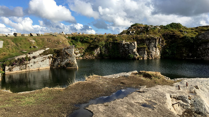
Gold Diggings Quarry, also known as Caradon Quarry in historic records, is recorded by the Cornwall and Scilly Historic Environment Record as a nineteenth-century granite extraction quarry. The old workings make a good place to pause and enjoy the scenery. Do not approach quarry edges or enter flooded workings.
Point 8: Gold Diggings Quarry – 50.52450, -4.47089 (SX 24954 72330)
Return on the contour track to the Bodmin Moor rescue point
From Gold Diggings Quarry take the farm track leading away from the workings. Follow it south-east as it broadly follows the contour of the hillside. The track eventually reaches the Bodmin Moor rescue point at Point 9. This broad track section provides a marked contrast with the rougher open moorland crossed earlier.
Point 9: Bodmin Moor rescue point – 50.52057, -4.46380 (SX 25442 71876)
Past The Pipers standing stones
Continue south along the track. The Pipers standing stones lie just to the east of the track at Point 10. They are two prehistoric standing stones associated with the wider ceremonial landscape around The Hurlers. Historic England notes that The Pipers are part of the remarkable prehistoric setting around the three stone circles.
Keep to the existing route and avoid disturbing stones or archaeological features.
Point 10: The Pipers standing stones – 50.51594, -4.46020 (SX 25680 71353)
Cross the moor to The Hurlers
Cross the moor eastwards from The Pipers towards The Hurlers. The three Late Neolithic or Early Bronze Age stone circles form one of the most important prehistoric ceremonial landscapes in this part of Cornwall. The circles are aligned along a north-east to south-west axis and sit within a wider landscape of prehistoric monuments.
Point 11: The Hurlers – 50.51657, -4.45812 (SX 25830 71418)
South Phoenix Mine and return to Minions
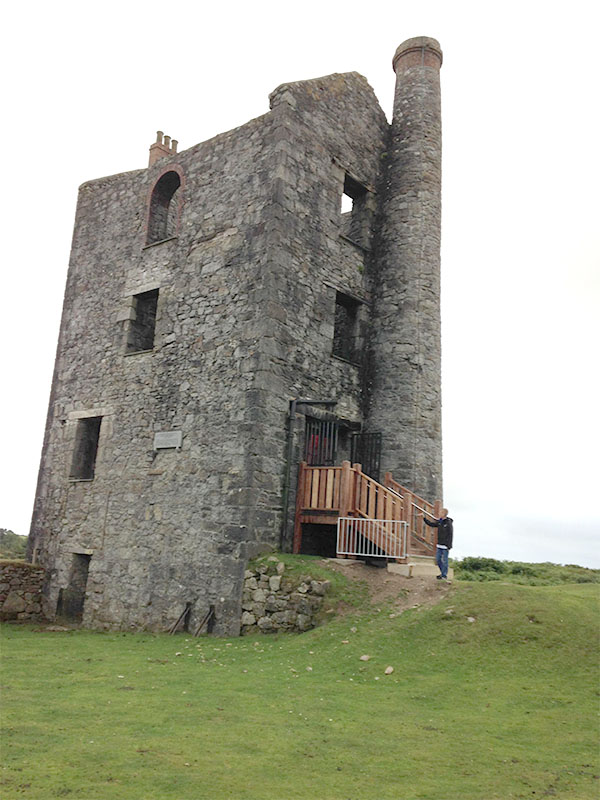
From The Hurlers continue eastwards towards the South Phoenix Mine engine house. South Phoenix was one of the mines in the wider Caradon mining district, and its surviving industrial remains help explain why the railway network was built across this otherwise remote moorland.
From the engine house turn south-east, following the track back to the eastern Minions car park.
Point 1: Eastern Minions Car Park – 50.51605, -4.45237 (SX 26235 71347)
Option Cheesewring Quarry diversion (out and back)
From point 4 at the end of step 3:
Optional diversion into Cheesewring Quarry
Optional quarry diversion: From Point 4 turn right and follow the old quarry track bed towards the cutting at the entrance to Cheesewring Quarry. Enter the cutting at Point A1 and continue into the centre of the quarry at Point A2. Then retrace the same route to Point 4.The Cheesewring Quarry is one of the most important industrial landscapes around Minions. The quarry produced high-quality granite for major engineering and architectural projects. Research records its granite being used for Tower Bridge and the Albert Memorial, as well as for other bridges, docks, breakwaters and public works. Granite sleeper blocks for the Liskeard and Caradon Railway were also produced here.
The old cutting gives a strong impression of how the railway entered the quarry workings. Remain on established tracks and keep well away from quarry faces, unstable ground and any water-filled workings.
Point 4: Cheesewring Quarry spur track bed – 50.52385, -4.45606 (SX 26002 72222)
Option Stowe’s Pound diversion (out and back)
From point 6 at the end of step 4:
Optional Stowe's Pound diversion
At Point 6 there is an optional diversion north to Stowe's Pound, the prehistoric enclosure on Stowe's Hill. The enclosure and Cheesewring form part of a remarkable prehistoric landscape that also includes The Hurlers and other ceremonial and funerary monuments. If taking the diversion, allow additional time and take care around uneven granite walls and rocks.
Point 6: Old mining incline – 50.52377, -4.45958 (SX 25753 72222)
All information is given in good faith and for guidance only. Always carry the OS map and check the South West Coast Path website for diversions.
Highlights along the way
Liskeard and Caradon Railway
Follow a surviving railway formation with granite sleeper blocks still visible in places, linking the walk directly with Minions' industrial history.
Cheesewring Quarry
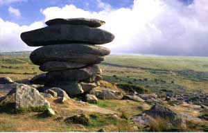
An optional diversion explores the old quarry railway cutting and the dramatic granite workings beside the Cheesewring.
Historic granite
Cheesewring granite was exported widely and was used for major projects including Tower Bridge and the Albert Memorial.
Gold Diggings Quarry
A nineteenth-century granite quarry recorded in the Cornwall and Scilly Historic Environment Record, set in open moorland.
The Pipers and The Hurlers
Prehistoric standing stones and three stone circles form a remarkable ceremonial landscape near Minions.
South Phoenix Mine
The surviving engine house and surrounding mining remains illustrate the scale of nineteenth-century mineral extraction around Caradon Hill.
Photos
Route map and waypoints
Latitude and longitude (WGS84, as used by phones, GPS devices and mapping apps) with OS grid references. The solid line shows the main walk; the dashed orange branches are the optional Cheesewring Quarry and Stowe’s Pound diversions.
| Point | Place | Lat, long | Grid ref |
|---|---|---|---|
| 1 | Eastern Minions Car Park | 50.51605, -4.45237 map | SX 26235 71347 |
| 2 | Liskeard and Caradon Railway track bed | 50.51693, -4.45239 map | SX 26238 71444 |
| 3 | Old mining incline | 50.52436, -4.45438 map | SX 26123 72275 |
| 4 | Cheesewring Quarry spur track bed | 50.52385, -4.45606 map | SX 26002 72222 |
| A1 | Cheesewring Quarry cutting entrance | 50.52462, -4.45704 map | SX 25936 72311 |
| A2 | Centre of Cheesewring Quarry | 50.52534, -4.45825 map | SX 25853 72393 |
| 5 | Old mining ditch / embankment | 50.52348, -4.45674 map | SX 25953 72183 |
| 6 | Old mining incline | 50.52377, -4.45958 map | SX 25753 72222 |
| B1 | Stowe’s Pound – optional diversion | 50.52601, -4.45931 map | SX 25780 72470 |
| 7 | Withey Brook | 50.52304, -4.46352 map | SX 25471 72149 |
| 8 | Gold Diggings Quarry | 50.52450, -4.47089 map | SX 24954 72330 |
| 9 | Bodmin Moor rescue point | 50.52057, -4.46380 map | SX 25442 71876 |
| 10 | The Pipers standing stones | 50.51594, -4.46020 map | SX 25680 71353 |
| 11 | The Hurlers | 50.51657, -4.45812 map | SX 25830 71418 |
| 12 | South Phoenix Mine engine house | 50.51692, -4.45385 map | SX 26134 71446 |
Before you set out
Carry OS Explorer 109. The old railway sections are generally easier to follow, but open-moorland sections can become indistinct in mist, rain or poor visibility.
Bodmin Moor is exposed and the weather can change quickly. Wear suitable footwear and carry waterproof clothing.
Keep well away from mine shafts, quarry faces, unstable spoil and flooded workings. Do not enter abandoned mine workings.
The short mining incline is steep. Take care on loose or wet ground, particularly after rain.
The route passes important prehistoric monuments. Do not climb, move or rearrange stones, and do not build new stone cairns from archaeological walls or rubble.
Sheep and ponies graze freely across the moor. Keep dogs under close control and follow current local requirements around livestock and ground-nesting birds.