Portreath, Cornwall – Village Guide to the Beach, the Old Mining Harbour, the Pepperpot & the Coast to Coast Trail
Portreath
Cornwall Online | West Cornwall Towns and Villages | Camborne | Redruth | Gwennap | Portreath | Godrevy | Gwithian | Hayle | St Ives | St Agnes
On This Page
- Holidays in Portreath
- Best Time to Visit
- Portreath Beach & Tidal Pool
- Surfing & the Vortex
- Portreath Harbour
- The Pepperpot Daymark
- Tramroad, Incline & Coast to Coast
- The Wreck of the Escurial
- Walks, Tehidy & Nance Wood
- History of Portreath
- Key Buildings
- Notable People
- Things to Do
- Events
- Places near Portreath
- Visitor Information
- Stay & Explore
- Family Holidays & Short Breaks
- Frequently Asked Questions
Portreath at a Glance
Village and harbour on the north coast of west Cornwall, about four miles from Redruth and Camborne. Name from the Cornish Porthtreth, ‘sandy cove’. Sandy surf beach with RNLI lifeguards in season, a tidal pool by the harbour wall and the Vortex reef break. Grade II listed harbour of 1760, the Pepperpot daymark, and the start of the Coast to Coast and Portreath Branchline trails. Part of the Cornish Mining World Heritage Site and the Cornwall National Landscape. Population 1,336 (parish, 2011 census).
Portreath through the year
Spring – boats craned back into the harbour
Mid-May to late September – RNLI lifeguards on the beach
Autumn – boats craned out for the winter
Boxing Day – the festive swim
HOLIDAYS IN PORTREATH
Portreath is a friendly village on the north coast of west Cornwall, tucked into a steep valley where a stream runs down between high cliffs to a sandy cove. It is only four miles from Redruth and Camborne, yet it feels a world away: a sweep of fine sand, rock pools, a long narrow harbour, a handful of pubs and cafés, and miles of clifftop path in both directions.
It was not always so peaceful. Two hundred years ago Portreath was one of the busiest ports in Cornwall. Ships sailed out of the harbour loaded with copper ore for the smelting works of South Wales and came back with coal for the steam engines of the mines; horse-drawn wagons rumbled down Cornwall’s first tramroad, and trucks were lowered down a steep incline to the quays. Look closely and you can still see the history everywhere – in the harbour basins, the old incline, the white Pepperpot on the cliff and the rock-cut pools on the beach.
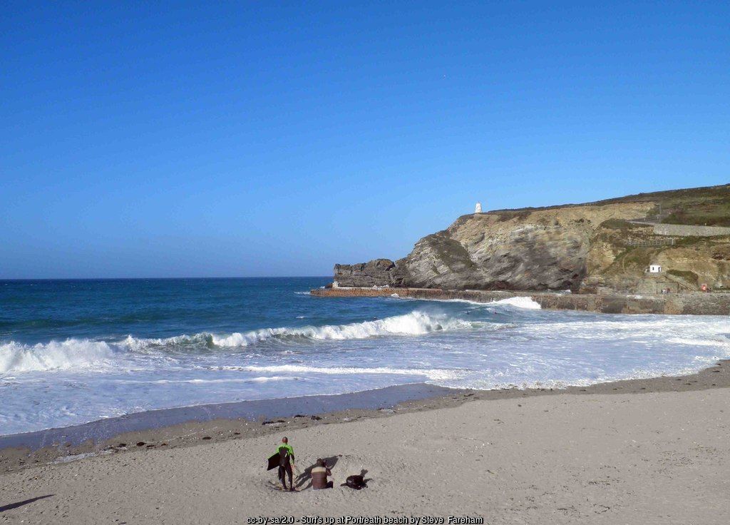
Today Portreath beach is a favourite with families and surfers. RNLI lifeguards patrol through the summer, Portreath Surf Life Saving Club has looked after the beach since 1958, and at low tide there are rock pools, the sheltered tidal pool beside the harbour wall and the pools cut into the rocks for the Basset ladies in the 18th century. When a big swell runs, experienced bodyboarders ride the famous Vortex off the harbour wall.
Portreath is a wonderful base for walkers and cyclists. The Coast to Coast trail starts at the harbour and follows the old tramroad right across Cornwall to Devoran; the South West Coast Path climbs west along the National Trust’s North Cliffs towards Basset’s Cove and Hell’s Mouth and east towards Porthtowan; and the woods and lakes of Tehidy Country Park are just inland.
The village has everything you need for a relaxed holiday – a seafront car park, a bakery, a village shop, surf hire, beach cafés and three pubs – while Redruth, Camborne, St Agnes and the beaches of St Ives Bay are all within a short drive.
For somewhere to stay, see Portreath holiday cottages and holidays and short breaks in Portreath.
Best Time to Visit Portreath
Summer is the classic time for a beach holiday, with lifeguards on duty, the cafés busy and long evenings for sunsets over Gull Rock – but the seafront car park fills early, so arrive in good time. Late spring and early autumn are ideal for walking and cycling, with quieter trails, wild flowers or heather on the cliffs and the sea at its warmest in September. In winter Portreath is at its most dramatic: big Atlantic swells crash over the harbour wall, the beach is open to dogs, and a bracing Boxing Day swim is a village tradition.
↑ Back to topPORTREATH BEACH, THE TIDAL POOL & LADY BASSET’S BATHS
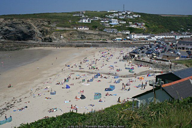
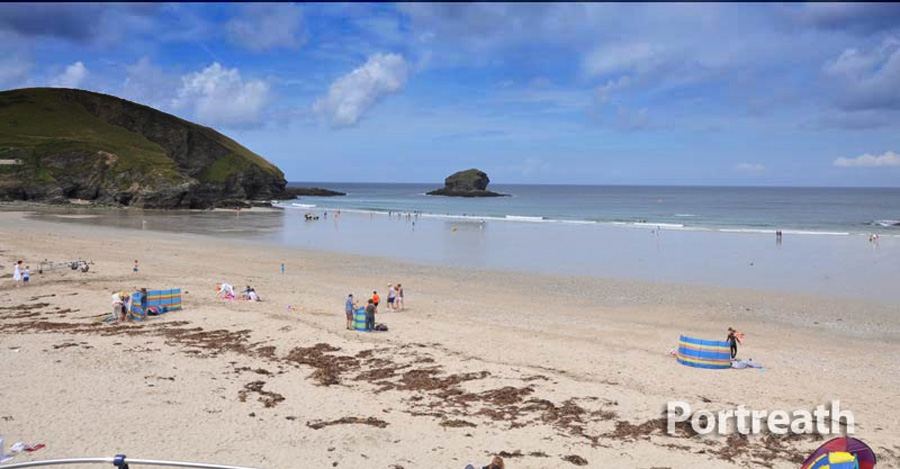
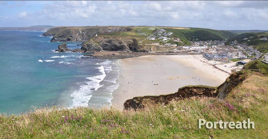
Portreath beach fills the mouth of the valley between Western Hill and Lighthouse Hill, a wide cove of soft sand with a stream running across it and rocky reefs at either side. At low tide there is plenty of firm sand for games and long walks, with rock pools to explore below the cliffs; at high tide the sea comes well up the beach, so check the tide times before you settle down. Gull Rock stands just offshore, and the evening sun sets right across the bay.
It is a proper family beach, with the village on the doorstep. The car park, toilets, beach cafés and surf hire are all on the seafront, and RNLI lifeguards patrol every day from mid-May to late September. They work alongside Portreath Surf Life Saving Club, founded in 1958 by a dozen volunteers, which trains young lifesavers in its clubhouse on the seafront. Always swim between the red and yellow flags – the surf here can be powerful, and rip currents form near the rocks and the harbour wall.
On the north side of the beach the harbour wall shelters a tidal pool, a favourite with younger children and swimmers who want to stay out of the swell. On the south-western side, below the cliffs, are the little pools cut into the rocks in the late 18th century on the orders of Francis Basset of Tehidy, traditionally for his daughter Frances to bathe in. They are still known as Lady Basset’s baths, and children love hunting for them at low tide.
The south side of the cove is where the very first quay was built in 1713. It was soon wrecked by the sea, but storms occasionally strip away the sand to reveal its foundations, as they did in 1983 – and the same storms sometimes uncover the stumps of a prehistoric submerged forest beneath the beach.
- Portreath Beach guide – tides, lifeguards, dogs and access
- Basset’s Cove – a quieter cove along the coast to the west
Beach safety
Lifeguards: RNLI, daily mid-May to late September, 10am–6pm
Swim: between the red and yellow flags
Dogs: not allowed 1 July–31 August, 10am–6pm
Tides: the sea reaches the top of the beach at high water
Surfing at Portreath & the Vortex
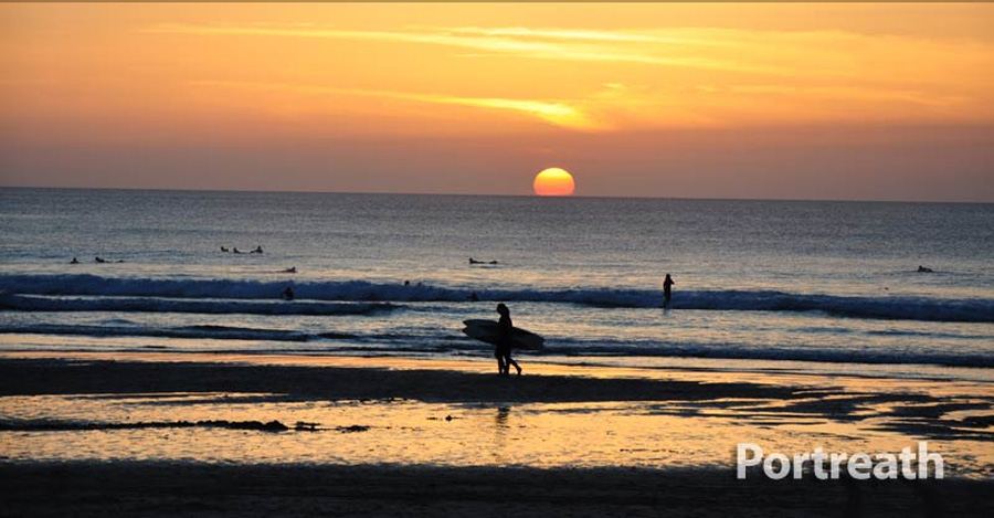
Portreath faces north-north-west into the Atlantic, so it picks up plenty of swell, while Western Hill gives some shelter from the prevailing south-westerly winds. The beach break suits improvers and bodyboarders on smaller days, and surf hire and lessons are available in the village in summer.
The beach is best known, though, for the Vortex – a powerful, hollow wave that breaks along the harbour wall on a big swell at the right state of tide. It is strictly for experienced bodyboarders and surfers, but it makes a thrilling spectacle to watch from the harbour, where waves explode over the wall on stormy days. Stay well back from the edge.
↑ Back to topPORTREATH HARBOUR – CORNWALL’S GREAT COPPER PORT
The Basset family of Tehidy owned most of the coast north of Camborne and Redruth, and in 1760 they began building the pier that turned this little cove into a port. For years the place was known simply as Basset’s Cove. Copper ore from the rich mines of Camborne, Redruth and Gwennap could not be smelted in Cornwall, for lack of coal, so it was shipped across the Bristol Channel to the furnaces of Swansea; the same ships came back loaded with Welsh coal for the boilers of the mine engines.
The harbour grew in stages: it was improved in 1778–81, the outer basin was added in 1801, the pier was lengthened in 1824 and the inner basin was built in 1846, with room for some 40 ships. By 1827 Portreath was described as perhaps Cornwall’s most important port, and around 1840 up to 700 ships a year passed through its narrow entrance, carrying about 100,000 tons of copper ore. Coal and ore were stockpiled on the quays for the winter months, when the crossing to Wales was too dangerous.
When Cornish copper mining collapsed in the late 1860s the trade dwindled, and in 1886 the Bassets made Portreath a free port. It was managed by the Bain family, who ran a fleet of coastal colliers, and coal, cement, slate and potatoes kept the quays busy until commercial shipping ended around 1960. The coal and ore yards were later built over, and in 1980 the owners, the Beynon Shipping Company, gave the harbour to Kerrier District Council. It now belongs to Cornwall Council and is run by the Portreath Harbour Association.
Today the Grade II listed harbour, built of killas, slate and granite between 1760 and the 1860s, is home to a fleet of small fishing, diving and pleasure boats. Walk out along the quays to see the two basins, the gated slipway and the long wall that guards the entrance, and look across to the Pepperpot on the cliff above.
↑ Back to top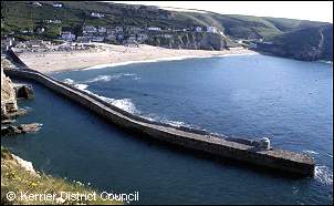
Portreath Harbour
Begun: 1760, by the Bassets of Tehidy
Basins: outer 1801, inner 1846
Peak: c.1840, up to 700 ships a year
Trade: copper ore out to Swansea, Welsh coal in
Commercial shipping ended: c.1960
Today: Grade II listed; small fishing and pleasure boats
THE PEPPERPOT – PORTREATH DAYMARK & LIGHTHOUSE HILL
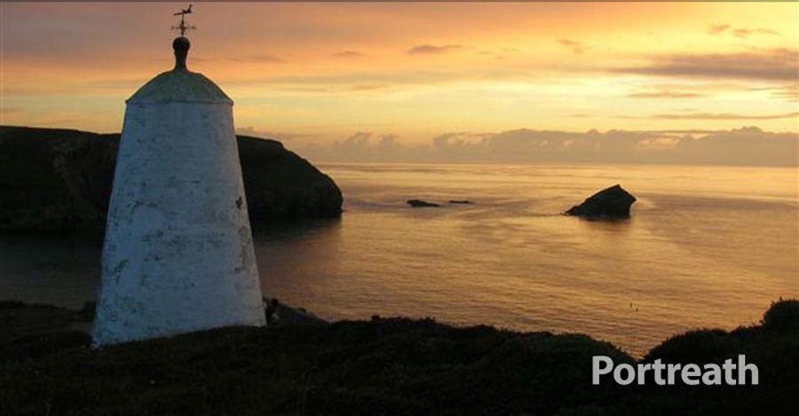
The white, round tower on the cliff above the harbour entrance is Portreath’s best-loved landmark. Known locally as the Pepperpot – and also as the Landmark or the Lighthouse, which is why the headland is called Lighthouse Hill – it is a daymark, built in the late 18th or early 19th century so that the masters of ore ships could pick out the narrow harbour entrance from the sea. It was never a true lighthouse. By 1830 it was being used as a coastguard watch house, and a sign over its blocked doorway still reads ‘HM Coastguard Board of Trade’.
The Pepperpot is a scheduled monument, and the coast path passes right beside it. From here there are wonderful views back over the harbour and beach to Western Hill, and along the coast to St Agnes Head. Nearby stood the pilots’ lookout, which signalled with flags by day and lights by night whether it was safe for ships to enter.
The heights on both sides of the cove were also fortified. In 1782, with a French and Spanish invasion feared during the American War of Independence, Francis Basset placed four 12-pounder cannon on the cliff above the beach – where Battery House stands today – and two more above the harbour, manned by local miners.
↑ Back to top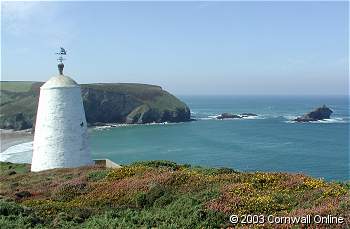
CORNWALL’S FIRST RAILWAY, THE PORTREATH INCLINE & THE COAST TO COAST TRAIL
Before the railways, copper ore came down to Portreath on the backs of mules – around 1800 some 15,000 mules were at work in west Cornwall’s copper trade, and it took a thousand mule loads to fill a single schooner. The answer was the Portreath Tramroad, begun in 1809 by the Williams family of Scorrier with the Bassets and the Foxes of Falmouth. It reached Scorrier by 1812 and the great mines of Poldice near St Day by 1819. It was a horse-drawn plateway, with L-shaped cast-iron plates laid on granite blocks, and it was the first railway in Cornwall. It closed in 1865.
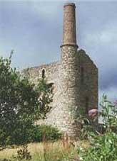
The second line arrived in 1837–38, when the Hayle Railway built a branch from the mines around Carn Brea down to the harbour. The last stretch was the Portreath Incline, a cable-worked slope about 1,700 feet long that dropped some 240 feet to the quays, with a stationary steam engine at the top to haul the wagons up and lower them down. The branch closed in 1936; the line of the incline can still be seen on the hillside above the village.
Both routes now carry walkers, cyclists and horse riders. The Coast to Coast trail follows the old tramroad for about 11 miles from Portreath harbour, through the wooded valley and the Poldice mining landscape, to Devoran on Restronguet Creek on the south coast – mostly traffic-free and gently graded, and easily done in a day. The Portreath Branchline Trail, about 5½ miles, follows the Hayle Railway branch inland past Illogan towards Pool and links with the Tehidy and Great Flat Lode trails. Bikes can be hired in Portreath, at Elm Farm near Cambrose and at Bissoe.
- Mineral Tramways – the Coast to Coast and Portreath Branchline trails
- Devoran – the south-coast end of the Coast to Coast trail
Trails from Portreath
Coast to Coast – Portreath to Devoran, about 11 miles, mostly traffic-free
Portreath Branchline Trail – about 5½ miles, Portreath to Pool
Tehidy Trail – through Tehidy Country Park
South West Coast Path – east to Porthtowan, west to Godrevy
THE WRECK OF THE ESCURIAL & THE PORTREATH ANCHOR
This is a dangerous coast, and Portreath has many stories of shipwreck. The best remembered is the loss of the steamer Escurial on 25 January 1895. Built in Glasgow in 1879, she was carrying coal from Cardiff to Fiume (now Rijeka in Croatia) when she began to take in water in a severe winter storm and her engine failed. Watched from the cliffs by the Portreath coastguards, she drifted in towards the shore, and with one anchor dragging she was driven aground near Gull Rock.
The St Ives lifeboat was beaten back by the heavy seas, and the Hayle lifeboat was brought overland to Portreath by horses, but it was almost impossible to launch into the surf. Coastguards and villagers waded into the breakers to pull men ashore. Of her crew of nineteen, eleven were lost.
Divers have explored the wreck ever since. The great anchor that stands on the Square outside the Portreath Arms is said locally to be one of the Escurial’s, raised by divers in the 1970s; another anchor from the ship now stands at Mount Charles in St Austell. Both are reminders of the dangers that the sailors of the ore ships faced on this coast.
↑ Back to top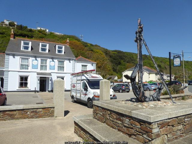
WALKS FROM PORTREATH – NORTH CLIFFS, TEHIDY & NANCE WOOD
The wild cliffs either side of Portreath are some of the finest walking country on the north coast. Buzzards and ravens ride the updraughts, fulmars and kittiwakes nest on the ledges, and grey seals haul out in the coves below. In late summer the clifftops are purple with heather and yellow with gorse.
Heading west, the South West Coast Path climbs Western Hill and runs along the North Cliffs, much of them cared for by the National Trust, past the steps down to Basset’s Cove and on to the dizzy chasm of Hell’s Mouth, with views ahead to Godrevy Lighthouse and St Ives. The cliffs here were once Basset land, and wreckage washed up from storm-wrecked ships gave the family a useful income. Heading east, the path climbs Lighthouse Hill past the Pepperpot and skirts the radar station at Nancekuke on the way to Porthtowan.
Inland, Tehidy Country Park – once the estate of the Basset family – has around 250 acres of woodland and lakes with more than nine miles of paths, a café and free parking; it can be reached on foot from Portreath or along the North Cliffs. Just south-east of the village, Nance Wood is a Site of Special Scientific Interest, a strip of wind-pruned sessile oak on a steep valley side. Further up the valley, the medieval tower of the old Illogan church stands on its own in the churchyard – kept because it was a landmark for ships at sea.
↑ Back to top
HISTORY OF PORTREATH
The name Portreath comes from the Cornish Porthtreth, ‘sandy cove’, and was first recorded in 1485. For centuries it was a tiny settlement of fishermen, farmers and tin streamers, who worked the tin washed down the valley and into the beach sand; tin streaming here is first recorded in 1602. A ship wrecked on this coast as early as 1307 left Gascon wine washed up at ‘Porth Treyth’.
The Bassets of Tehidy, who had held the estate since Norman times, transformed the cove. A Devon contractor, Samuel Nott, built the first quay in 1713 on the western side of the beach, but the sea destroyed it before 1749. The present harbour followed in 1760, and the village grew up around it, with a pilchard seine fishery from 1800, shipbuilding, lime burning and rope making. St Mary’s Church was built in 1827, and the Methodist chapel, the Basset Arms and the school followed later in the century; Cornish wrestling tournaments were held at the Basset Arms in the 1800s.
The copper boom made Portreath one of the most important ports in Cornwall in the first half of the 19th century, served by Cornwall’s first tramroad and by the Hayle Railway. The collapse of copper mining in the late 1860s ended the great days, though coal kept the harbour working until about 1960.
In the Second World War RAF Portreath opened on the clifftops at Nancekuke in March 1941, first as a fighter station and then as a staging post for aircraft flying out to North Africa. From 1950 the site became a secret outstation of the Chemical Defence Establishment at Porton Down; it returned to the RAF in 1980 and is now Remote Radar Head Portreath, with its distinctive white radar dome. Since 2006 Portreath has been one of the areas of the Cornwall and West Devon Mining Landscape World Heritage Site.
↑ Back to top
Portreath timeline
1485 – first record of the name
1602 – tin streaming recorded in the valley
1713 – first quay built (destroyed before 1749)
1760 – present harbour begun by the Bassets
1782 – batteries built above the beach and harbour
1801 – outer basin added
1809 – Portreath Tramroad begun
1824 – pier extended
1827 – St Mary’s Church built
1837–38 – Hayle Railway branch and incline
1846 – inner basin built
1865 – tramroad closes
1886 – harbour becomes a free port
1895 – wreck of the Escurial
1936 – incline and branch close
1941 – RAF Portreath opens
1958 – Surf Life Saving Club founded
c.1960 – commercial shipping ends
2006 – World Heritage Site status
KEY BUILDINGS & LANDMARKS IN PORTREATH
- Portreath Harbour – Grade II listed harbour of 1760 to the 1860s, with an outer harbour and two basins in line, built of killas, slate and granite.
- The Pepperpot, Lighthouse Hill – late 18th- or early 19th-century daymark and later coastguard lookout; a scheduled monument.
- Portreath Incline – the raised lower section of the incline that carried trucks down to the quays, Grade II listed.
- St Mary’s Church – the village church, built in 1827 as Portreath grew around the harbour.
- Glenfeadon House – home of the Bain family, who managed the harbour from the 1880s; a Grade II listed gazebo stands near the house.
- Battery House – built on the site of the 1782 battery that guarded the beach.
NOTABLE PEOPLE OF PORTREATH
- Francis Basset, Lord de Dunstanville (1757–1835) – head of the Basset family of Tehidy, owners of the harbour, who fortified the cove in 1782 and had the bathing pools cut into the rocks; the Basset Monument on Carn Brea was raised in his memory.
- John Williams of Scorrier (1753–1841) – mine owner and the leading promoter of the Portreath Tramroad, Cornwall’s first railway, which linked his mines at Scorrier and Poldice with the harbour.
- Donald and David Wise Bain – father and son who managed Portreath harbour after it became a free port in 1886, built up a fleet of coastal colliers and lived at Glenfeadon House.
THINGS TO DO IN PORTREATH
Portreath is a place for simple pleasures: a day on the sand, a walk on the cliffs, a bike ride and a pasty or a pint by the harbour. Most of what there is to see is free, and the village is small enough to explore on foot in an hour or two.
For a rainy day or a change of scene, the mining towns of Redruth and Camborne are only four miles away, with Kresen Kernow, King Edward Mine, Heartlands and the Great Flat Lode Trail, and the bigger attractions of St Ives, Truro and the south coast are all within half an hour’s drive.
Here are our favourite things to do in and around the village:
- Spend a day on Portreath beach – rock pools, the tidal pool and RNLI lifeguards in summer.
- Search for Lady Basset’s baths, the pools cut into the rocks, at low tide.
- Watch the surfers and bodyboarders riding the Vortex off the harbour wall.
- Walk out along the harbour and climb Lighthouse Hill to the Pepperpot.
- Cycle the Coast to Coast trail right across Cornwall to Devoran and back.
- Walk the North Cliffs to Basset’s Cove and Hell’s Mouth, or east to Porthtowan.
- Explore the woods and lakes of Tehidy Country Park, with its golf course next door.
- See the old anchor on the Square and toast the sunset over Gull Rock.
EVENTS IN PORTREATH
Portreath is a village rather than a festival town, but there is a strong community life, and plenty going on nearby.
Craning in and craning out (spring and autumn) – the Portreath Harbour Association lifts the village boats back into the harbour for the season and out again for the winter; a busy and sociable day on the quays.
Community events (through the year) – beach cleans, litter picks and the village yard sale organised by local groups, with refreshments at the pubs.
Boxing Day swim (26 December) – brave souls in fancy dress take a festive dip in the Atlantic. It is an informal event, so check locally that it is going ahead.
Nearby festivals – Trevithick Day in Camborne (late April), Murdoch Day in Redruth (June) and Redruth’s International Mining and Pasty Festival (September) are all within a few miles. Dates change each year – check before you travel.
↑ Back to topPLACES NEAR PORTREATH
- Redruth – Kresen Kernow, Murdoch House and Cornish mining heritage, about 4 miles south-east.
- Camborne – Richard Trevithick’s town, Tehidy and the Great Flat Lode, about 4 miles south-west.
- Porthtowan – a lively surf beach about 3 miles east.
- Gwennap – Gwennap Pit, where John Wesley preached, about 6 miles south-east.
- St Agnes – cliffs, engine houses and Trevaunance Cove, about 7 miles north-east.
- Gwithian and Godrevy – dunes, surf and the lighthouse on St Ives Bay, about 8 miles west by road.
Portreath, on the north coast of west Cornwall – the harbour and beach at the foot of the valley, with Redruth and Camborne inland.
VISITOR INFORMATION
Portreath is reached from the A30 at the Avers junction (Redruth and Pool), following the A3047 and then the B3300 down to the coast; the last stretch into the village is narrow and winding. Buses run from Camborne and Redruth, both of which have main-line railway stations.
Parking & EV Charging
The main car park is the pay and display car park on the seafront, right beside the beach – the only large car park in the village. It fills early on summer days and roadside parking is very limited, so arrive early, or come by bus or bike. There are disabled bays in the seafront car park. Charges change – check the signs.
Electric vehicle charging:
There are no public council chargers in Portreath. The nearest are in Redruth (including the West End car park) and at the supermarkets in Pool. Chargers change often – check the live map before you travel.
Bus & Train
Buses 48 and 49 (Go Cornwall Bus) link Portreath with Camborne and Redruth, stopping on the Square and by the beach car park. The nearest railway stations are Redruth and Camborne, both on the main line with trains to Penzance, Truro, Plymouth and London Paddington. Check timetables before you travel.
Facilities & Supermarkets
Portreath has a village shop, a bakery, public toilets near the seafront, surf hire and bike hire. For a big shop, the nearest supermarkets are in Redruth and Pool:
- Tesco – Tolgus Hill, Redruth TR15 1AX
- Tesco Extra – Station Road, Pool TR15 3QJ
- Lidl – Illogan Highway, Pool TR15 3EE
- Morrisons – Agar Road, Illogan Highway, Redruth TR15 3NH
Cafés, Pubs & Restaurants
Three pubs: the Portreath Arms on the Square, the Basset Arms on Tregea Terrace (whose cellar once served as a mortuary for shipwrecked sailors) and the Waterfront Inn by the harbour. There are beach cafés and takeaways beside the seafront car park, and the village bakery for pasties. Opening hours vary out of season.
Health
The nearest Minor Injury Unit is at Camborne Redruth Community Hospital, Barncoose, Redruth TR15 3ER, open every day from 8am to 10pm. The nearest A&E is the Royal Cornwall Hospital at Treliske, Truro. There are GP surgeries and pharmacies in Redruth, Camborne and Illogan. On the beach, ask the lifeguards for first aid. Call NHS 111 for urgent advice and 999 in an emergency.
Disabled Access
The seafront, car park, cafés and harbour quays are close together and fairly level, so the beach can be enjoyed from the promenade. Getting onto the soft sand is harder – check access at the seafront when you arrive. The village streets climb steeply up the valley sides. Much of the Coast to Coast trail is firm and gently graded.
Vets & Dogs
Dogs are banned from Portreath beach from 1 July to 31 August between 10am and 6pm, and welcome the rest of the year. The coast path, Tehidy Country Park and the Coast to Coast trail are good dog walks – keep dogs on leads near livestock and the cliff edges. The nearest vets are in Redruth, including Medivet Redruth (Monument Vets), Drump Road, Redruth TR15 1PS.
National Trust & English Heritage
The National Trust looks after much of the coast between Portreath and Godrevy, including the North Cliffs and Hell’s Mouth, and runs East Pool Mine at Pool, with two great beam engines. Check opening before you go.
Attractions
Tehidy Country Park, the Mineral Tramways trails, Kresen Kernow in Redruth, King Edward Mine and Carn Brea, Gwennap Pit, and the beaches of Porthtowan, Godrevy and St Agnes are all close by.
STAY & EXPLORE IN PORTREATH
Official Information
FAMILY HOLIDAYS & SHORT BREAKS IN PORTREATH
Family holidays in Portreath are all about the beach – rock pools and sandcastles, the sheltered tidal pool, surf lessons with lifeguards on watch, and fish and chips by the harbour as the sun goes down over Gull Rock. Older children love cycling the Coast to Coast trail, hunting for Lady Basset’s baths and climbing up to the Pepperpot.
Browse Portreath holiday cottages for self-catering homes in the village and along the coast, or holidays and short breaks in Portreath for every type of accommodation.
Short breaks in Portreath are a treat in any season – a spring weekend cycling coast to coast, an autumn break for the cliffs and quiet beaches, or a winter escape to watch the storms crash over the harbour wall. Booking direct with the owner means no agency fees.
↑ Back to topFREQUENTLY ASKED QUESTIONS ABOUT PORTREATH
Portreath is a village and small harbour on the north coast of west Cornwall, about four miles north-west of Redruth and four miles north-east of Camborne by road, at the end of the B3300. Porthtowan is about three miles to the east along the coast and Godrevy about six miles to the west.
Yes. Portreath has a sandy beach with rock pools, a tidal pool sheltered by the harbour wall, toilets, cafés and a car park on the seafront. RNLI lifeguards patrol daily from mid-May to late September, and Portreath Surf Life Saving Club has looked after the beach since 1958. The surf can be powerful, so always swim between the red and yellow flags.
The main car park is the pay and display car park on the seafront, right beside the beach. It is the only large car park in the village and fills early on summer days, when roadside parking is very limited. Arrive early, or come by bus or along the Coast to Coast trail.
Dogs are welcome on Portreath beach for most of the year, but a seasonal dog ban applies from 1 July to 31 August between 10am and 6pm. The coast path, Tehidy Country Park and the Coast to Coast trail are good dog walks all year.
The Pepperpot is the white, round daymark on Lighthouse Hill above the harbour entrance. It was built in the late 18th or early 19th century as a landmark for ships making for the harbour and was later used as a coastguard lookout. It is a scheduled monument and can be reached on the coast path.
The Mineral Tramways Coast to Coast trail starts at Portreath harbour and runs for about 11 miles across Cornwall to Devoran on Restronguet Creek, mostly traffic-free along old mineral tramways. Bikes can be hired at Portreath, Cambrose and Bissoe.
Yes. Go Cornwall Bus services 48 and 49 link Portreath with Camborne and Redruth, where there are main-line railway stations with trains to Truro, Penzance and London Paddington. Check the Transport for Cornwall timetable before you travel.
Portreath harbour was begun in 1760 by the Basset family of Tehidy to ship copper ore from the mines around Camborne, Redruth and Gwennap to the smelters of South Wales, with Welsh coal brought back for the mine engines. By 1827 it was described as perhaps Cornwall’s most important port. Commercial shipping ended around 1960.
Portreath comes from the Cornish Porthtreth, meaning ‘sandy cove’. The name was first recorded in 1485. In its busiest years the village was also known as Basset’s Cove, after the family who built the harbour.