Godrevy, Cornwall – Godrevy Lighthouse, the Seals of Mutton Cove, the Beach & National Trust Walks
Godrevy
Cornwall Online | West Cornwall Towns and Villages | St Ives | Carbis Bay | Hayle | Gwithian Towans | Godrevy Head | Portreath | Porthtowan | St Agnes | Isles of Scilly | Sennen Cove & Land’s End | Pendeen | St Just | Porthcurno | Lamorna | Mousehole | Newlyn | Penzance | Marazion – St Michael’s Mount | Praa Sands | Porthleven
On This Page
- Holidays at Godrevy
- Best Time to Visit
- Godrevy Island & Lighthouse
- Virginia Woolf & To the Lighthouse
- Seals at Mutton Cove & Wildlife
- Godrevy Beach & Surfing
- Walks at Godrevy
- Gwithian & the Towans
- History of Godrevy
- Key Landmarks
- Notable People
- Things to Do
- Events
- Places near Godrevy
- Visitor Information
- Stay & Explore
- Family Holidays & Short Breaks
- Frequently Asked Questions
Godrevy at a Glance
National Trust headland at the north-eastern end of St Ives Bay, beyond the village of Gwithian, about four miles from Hayle. Name from the Cornish Godrevi, ‘small farms’. Godrevy Lighthouse (1859) on Godrevy Island, the inspiration for Virginia Woolf’s To the Lighthouse. Grey seals at Mutton Cove, a lifeguarded surf beach at the head of three miles of sand, coastal heath grazed by ponies, and the South West Coast Path all round. Sat-nav postcode TR27 5ED.
Godrevy through the year
Spring – primroses and thrift on the island; wild flowers on the heath
Mid-May to late September – RNLI lifeguards on the beach
June–July – silver-studded blue butterflies
Autumn & winter – the most seals at Mutton Cove
HOLIDAYS AT GODREVY
Godrevy is one of the most loved places in west Cornwall: a wild, grassy headland at the far end of St Ives Bay, with a white lighthouse on a rocky island just offshore. Look one way and three miles of golden sand sweep away past Gwithian towards Hayle and St Ives; look the other and the high cliffs of the North Cliffs run on towards Portreath. It is the view that a young Virginia Woolf looked out on every summer – and the lighthouse that found its way into one of the most famous novels of the 20th century.
The headland and some five miles of coast are cared for by the National Trust. There is no village here, just a car park, a café, a lifeguard hut and the open heath – which is a large part of the appeal. Families come for the beach, the rock pools and the surf; walkers come for the coast path and the views; and almost everyone walks up to the clifftop above Mutton Cove to look down on the grey seals hauled out on the sand below.
The beach at Godrevy is the northern end of the long sweep of St Ives Bay. It faces the full Atlantic swell, making it one of the best surfing beaches in west Cornwall, and at low tide the sands stretch away into the distance. On calmer days there are rock pools to explore beneath the low cliffs, and plenty of room to spread out even in the height of summer.
Godrevy is wonderful in every season. In spring the island is bright with primroses and sea thrift, in summer the heath hums with butterflies and the beach is busy with surfers, and in autumn and winter the seals gather in numbers and storms send spray high over the island. Whatever the weather, the light here is something special – which is why so many artists have painted it.
The village of Gwithian, with its church and pub, is half a mile away across the Red River; Hayle and St Ives are a short drive around the bay, and Portreath is along the coast to the east.
For somewhere to stay, see Gwithian holiday cottages and holidays and short breaks in Gwithian – the nearest to Godrevy.
Best Time to Visit Godrevy
Spring and early summer are ideal for walking, with wild flowers on the heath, nesting birds on the cliffs and the beach still open to dogs until the end of June. High summer is the time for surfing, swimming and picnics, with lifeguards on duty – but the car park fills quickly, so arrive early. Autumn and winter are the best time to see the grey seals, when numbers at Mutton Cove are at their highest, and the big Atlantic swells make for spectacular storm-watching around the island.
↑ Back to topGODREVY ISLAND & GODREVY LIGHTHOUSE
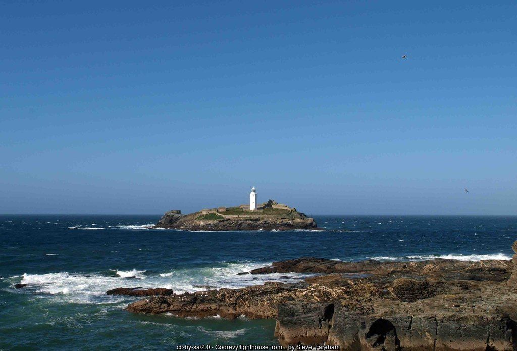
Godrevy Island lies about 300 yards off Godrevy Point, across the narrow and fast-flowing Godrevy Sound. It is a low, grassy rock of about 12 acres, open to the full force of Atlantic gales; gulls, oystercatchers and pipits nest here, and in spring the island is bright with primroses, sea thrift and heather. Beyond it a dangerous reef called the Stones runs out for about a mile towards St Ives, and over the centuries many ships came to grief on it.
The disaster that led to the lighthouse came on 30 November 1854, when the iron screw steamer Nile was wrecked on the Stones with the loss of everyone on board. Under pressure from shipowners and merchants, Trinity House agreed to build a light, and the station designed by the engineer James Walker was first lit on 1 March 1859. The white octagonal tower, 26 metres high and built of rubble stone bedded in mortar, stands near the centre of the island beside the keepers’ buildings; the whole station cost £7,082.
Originally two keepers looked after two lights: a white light flashing every ten seconds and a fixed red light marking the Stones. The lens revolved on rollers, driven by clockwork powered by a heavy weight falling down a shaft inside the tower wall, and a fog bell was struck every five seconds in poor visibility. Landing keepers on the island was always difficult, and in 1939 the light was converted to acetylene, the fog bell removed and the keepers withdrawn. It was converted to solar power in 1995, and in 2012 the light itself was moved from the tower to a small steel structure on the rock beside it. The old tower is kept by Trinity House as a daymark, and the light is monitored from its centre at Harwich in Essex.
The island is not open to visitors – landing needs the permission of Trinity House – but the views from Godrevy Point are superb, and in summer boat trips from St Ives harbour sail out around the island and along the coast.
↑ Back to topGodrevy Lighthouse
Built by: Trinity House; engineer James Walker
First lit: 1 March 1859
Tower: white, octagonal, 26 m high
Why: the loss of the steamer Nile on the Stones, 1854
Automated: 1939; solar powered from 1995
Light today: on a steel structure beside the tower (since 2012), flashing white and red every 10 seconds
Listed: Grade II
VIRGINIA WOOLF & TO THE LIGHTHOUSE
Every summer from 1882 to 1894 the Stephen family – the writer Leslie Stephen, his wife Julia and their children, among them the young Virginia and her sister Vanessa, later the painter Vanessa Bell – stayed at Talland House in St Ives, high above Porthminster Beach. From the house and garden they looked straight across the bay to Godrevy Lighthouse, and a trip out to the lighthouse was a childhood adventure.
Thirty years later, as Virginia Woolf, she turned those memories into To the Lighthouse (1927). The Ramsay family of the novel spend their summers in a house in the Hebrides, and the long-postponed journey to the lighthouse lies at its heart – but the house, the family and the lighthouse are widely recognised as Talland House, the Stephens and Godrevy. St Ives also coloured Jacob’s Room and The Waves.
Talland House is now private, but you can still see the view that inspired the book from the coast path above Porthminster, and from Godrevy Point you can look back across the bay towards St Ives.
↑ Back to topGREY SEALS AT MUTTON COVE & GODREVY WILDLIFE
On the north side of the headland, a short walk from the car park, the cliffs drop to Mutton Cove – one of the best places in Cornwall to see Atlantic grey seals. Seals are here all year, resting on the sand or bobbing in the water, but numbers build up through the autumn, and in winter a hundred or more may haul out on the beach. The National Trust has fenced the clifftop path, so you can look straight down into the cove.
There is no way down to the cove, and the seals must not be disturbed: keep quiet, stay behind the fence, keep dogs on a short lead and never fly drones over the beach. A startled seal stampeding into the sea can injure itself or abandon a pup. Bring binoculars – and look out to sea too, as dolphins, porpoises and, in summer, basking sharks are sometimes seen off the point.
The headland itself has some of the finest coastal heathland in Cornwall, and part of it has been a Site of Special Scientific Interest since 1951. The National Trust manages the heath at the Knavocks with a herd of grazing ponies, which keep the gorse in check and help wild flowers, stonechats and butterflies – including the rare silver-studded blue in early summer. Fulmars, cormorants, guillemots and razorbills nest on the cliffs and offshore rocks.
↑ Back to topSeal watching code
Watch from the clifftop path only
Keep noise down and stay out of sight
Keep dogs on a short lead
No drones over the cove
Most seals: autumn and winter
GODREVY BEACH & SURFING
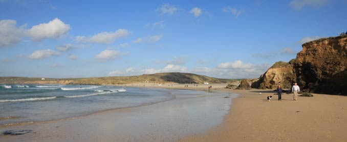
Godrevy beach lies on the western side of the headland, at the northern end of the three miles of sand that run round St Ives Bay to Hayle. Rocky reefs run out at the Godrevy end, with rock pools to explore at low tide, while to the south the sand opens out past the Red River towards Gwithian, backed by low cliffs and dunes – the towans.
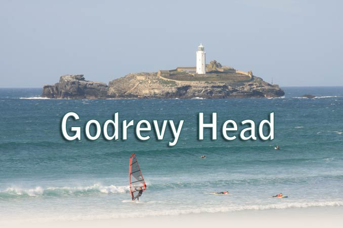
The beach faces west-north-west into the open Atlantic, so it catches plenty of swell and is one of the most popular surfing beaches in west Cornwall, from beginners on small days to experienced surfers when a big swell runs. Kite surfers and windsurfers love it too. RNLI lifeguards patrol daily from mid-May to late September, from the hut beside the boardwalk down from the car park.
At high tide the sea covers almost all of the sand at the Godrevy end and reaches the foot of the cliffs, so keep an eye on the tide when you explore the rocks and coves, and stay away from the cliff edges, which are crumbling in places. The water between the headland and the island is dangerous – never try to swim or paddle out to it.
- Godrevy Beach guide – tides, lifeguards, dogs and access
- Surfing in Cornwall – Cornwall Online surf guide
Beach safety
Lifeguards: RNLI, daily mid-May to late September
Swim: between the red and yellow flags
Dogs: not allowed 1 July–31 August, 10am–6pm
Tides: high water reaches the cliffs at the Godrevy end
WALKS AT GODREVY – THE HEADLAND, THE KNAVOCKS & HELL’S MOUTH
Around Godrevy Head – an easy circular walk of a mile or so. From the car park on the headland, follow the coast path out towards Godrevy Point with the sea on your left, for wonderful views of the lighthouse and across the bay to St Ives and the hills of West Penwith. Follow the path round the north side of the headland to the viewpoint above Mutton Cove, then take the path that branches off to the right, back across the headland to the car park.
Navax Point and the Knavocks – carry on along the coast path past Mutton Cove to Navax Point, the next headland, and the heath of the Knavocks, grazed by the National Trust’s ponies. The cliffs here stand more than 200 feet above the sea.
Godrevy to Hell’s Mouth – the National Trust’s 5-mile circular walk follows the coast path east along the high North Cliffs to the dramatic chasm of Hell’s Mouth, then returns inland and through the dunes. Allow two and a half to three hours; there are some steep climbs. From Hell’s Mouth the coast path continues on past Basset’s Cove to Portreath.
Godrevy to Gwithian sands – from the car park, follow the boardwalk down through the towans to the beach and walk south-west along the sands towards Gwithian and Hayle. Return along the clifftop path or through the dunes.
↑ Back to top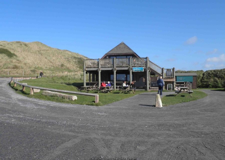
GWITHIAN, THE TOWANS & THE RED RIVER
Half a mile south of Godrevy, across the bridge over the Red River, is the village of Gwithian, with its church, thatched cottages and the Red River Inn. The river once ran red with waste from the tin mines upstream around Camborne, and tin was recovered from its sands until the last century; today it is much cleaner and joins the sea at the beach below Godrevy.
Between Gwithian and Hayle lie the towans – Cornish for sand dunes – one of the largest dune systems in Cornwall, rich in wild flowers and butterflies. Behind Gwithian beach, the old sand pit where sand was dug for many years is now the St Gothian Sands Local Nature Reserve, a haven for wading birds. The sands of Gwithian, Upton Towans, Mexico Towans and Hayle Towans run on for three miles to the mouth of the Hayle estuary, with beach cafés and car parks along the way.
↑ Back to top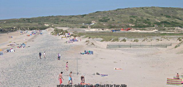
HISTORY OF GODREVY
People have lived and farmed at Godrevy for thousands of years. The headland and the dunes around Gwithian are among the most important archaeological landscapes in Cornwall: from 1949 the archaeologist Charles Thomas, whose family owned land here, led excavations that uncovered Mesolithic flint-working floors, a Bronze Age barrow on Godrevy headland, prehistoric fields with the marks of early ploughs, and an Iron Age and Romano-British farmstead at Crane Godrevy, which went on to become a medieval farm. The name itself, from the Cornish Godrevi, is usually explained as ‘small farms’.
The waters off the headland were feared by sailors. Many ships were lost on the Stones reef before the wreck of the Nile in 1854 finally led to the building of the lighthouse in 1859.
In 1939 D. W. Thomas of Gwithian gave 320 acres and five miles of coastline at Godrevy to the National Trust, and in 1962 Nicholas and Charles Thomas gave a further 19 acres next to Godrevy Farm. Today the Trust manages the headland for wildlife and visitors, and is adapting to the coastal erosion that is steadily eating into the soft cliffs.
↑ Back to topGodrevy timeline
Mesolithic – flint-working on the headland
Bronze Age – barrow on Godrevy headland
Iron Age–Roman – farmstead at Crane Godrevy
30 Nov 1854 – steamer Nile lost on the Stones
1 Mar 1859 – Godrevy Lighthouse first lit
1882–94 – the Stephen family’s summers at Talland House
1927 – To the Lighthouse published
1939 – headland given to the National Trust; lighthouse automated
1949 – Charles Thomas’s excavations begin
1951 – designated a Site of Special Scientific Interest
1995 – lighthouse solar powered
2012 – light moved to a steel structure beside the tower
KEY LANDMARKS AT GODREVY
- Godrevy Lighthouse – white octagonal tower of 1859 by James Walker for Trinity House; Grade II listed with its keepers’ buildings and walls.
- Godrevy Island – the 12-acre rock at the inner end of the Stones reef, home to nesting seabirds.
- Mutton Cove – the cove on the north side of the headland where grey seals haul out.
- Crane Godrevy – scheduled site of an Iron Age and Romano-British round, later a medieval farm.
- Godrevy Barrow – Bronze Age burial mound on the headland, excavated by Charles Thomas in the 1950s and again in 2012–13.
- The Knavocks – National Trust coastal heath south of Navax Point, grazed by ponies.
NOTABLE PEOPLE & GODREVY
- Virginia Woolf (1882–1941) – novelist who spent her childhood summers at Talland House in St Ives looking out at Godrevy Lighthouse, the inspiration for To the Lighthouse (1927).
- James Walker (1781–1862) – civil engineer and consultant to Trinity House who designed Godrevy Lighthouse, first lit in 1859.
- Charles Thomas (1928–2016) – Camborne-born archaeologist and historian, Professor of Cornish Studies, whose first excavation was the Bronze Age barrow on Godrevy headland in 1950; he directed the Gwithian excavations and co-wrote Godrevy Light (2009) about the lighthouse.
THINGS TO DO AT GODREVY
Godrevy is a place for the simple pleasures of the Cornish coast – fresh air, big skies, wildlife and the sea. You could spend a whole day here without getting back in the car, with the café on hand for lunch.
For a change of scene, Hayle, St Ives and its galleries, and the mining towns of Camborne and Redruth are all within a short drive.
Our favourite things to do at Godrevy:
- Watch the grey seals from the clifftop above Mutton Cove.
- Walk round Godrevy Head for the best views of the lighthouse.
- Learn to surf or bodyboard on the lifeguarded beach.
- Explore the rock pools beneath the cliffs at low tide.
- Walk the North Cliffs to Hell’s Mouth.
- Stroll three miles of sand to Gwithian and the towans.
- Look out for dolphins, ponies and butterflies on the Knavocks.
- Take a boat trip from St Ives around Godrevy Island.
EVENTS AT GODREVY & NEARBY
Godrevy is a quiet countryside site rather than an events venue, but there is often something going on.
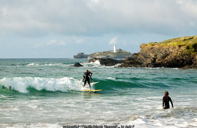
Surf competitions (through the year) – junior and club surfing contests are held on the beach, such as the schools’ ‘Shoresurf’ competition pictured above.
National Trust events (spring to autumn) – guided walks, wildlife watches, beach cleans and volunteering days with the Godrevy rangers.
Nearby festivals – the St Ives September Festival of music and arts (September) and the town’s other events are just across the bay. Dates change each year – check before you travel.
↑ Back to topPLACES NEAR GODREVY
- Gwithian – village, church and pub, half a mile south across the Red River.
- Hayle – harbour town, estuary and the start of the three miles of sand, about 4 miles by road.
- Camborne – Richard Trevithick’s town, about 5 miles south-east.
- Portreath – harbour, beach and the Pepperpot, about 7 miles east by road.
- St Ives – harbour, beaches and galleries across the bay, about 9 miles by road.
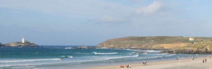
Godrevy, at the north-eastern end of St Ives Bay – the headland, the lighthouse on Godrevy Island and the beach running south to Gwithian and Hayle.
VISITOR INFORMATION
Godrevy is reached from the A30 at the Loggans Moor roundabout near Hayle, then along the B3301 through Gwithian; the National Trust entrance is just past Godrevy Bridge, and a single-track road leads on to the car parks. The sat-nav postcode is TR27 5ED.
Parking & EV Charging
The National Trust car park beside Godrevy Café is open all year (about 100 spaces, including disabled bays), with a small second car park further along the road and extra field parking on the headland in the warmer months, depending on the weather. Pay at the machines or with the JustPark app; National Trust members park free. On busy days, if the car park is full, come back later – don’t park on the verges of the B3301.
Electric vehicle charging:
There are no public chargers at Godrevy. The nearest are in Hayle and Camborne – check the live map before you travel.
Bus & Train
Buses from Hayle stop in Gwithian village opposite the Red River Inn, and in summer an open-top bus runs around the bay from St Ives. From Gwithian it is a walk of about a mile to the headland. The nearest railway station is Hayle, on the main line, with the St Ives branch line from St Erth. Check timetables before you travel.
Facilities & Supermarkets
Godrevy has a café, toilets (including an accessible toilet) in the field car park on the headland, and a lifeguard station in season; there are no shops. The nearest supermarkets are in Hayle and Carbis Bay:
- Asda – South Quay, Hayle TR27 4EP
- Co-op and Lidl – Hayle
- Tesco – St Ives Road, Carbis Bay TR26 2PN
Cafés & Pubs
Godrevy Café, the wooden building beside the first car park, serves breakfasts, lunches, cakes and drinks, with a balcony over the dunes; it is open most days through the year. The Red River Inn in Gwithian is half a mile away, and there are beach cafés along the towans towards Hayle.
Health
On the beach, ask the lifeguards for first aid. The nearest Minor Injury Unit is at Camborne Redruth Community Hospital, Barncoose, and there is an urgent treatment centre at West Cornwall Hospital in Penzance. The nearest A&E is the Royal Cornwall Hospital at Treliske, Truro. GP surgeries and pharmacies are in Hayle. Call NHS 111 for urgent advice and 999 in an emergency – ask for the Coastguard if someone is in trouble in the sea or on the cliffs.
Disabled Access
There are disabled parking spaces in the first car park and in the small car park on the way up to the headland, and fairly level access to the café. A wide, fairly level gravel path leads from the field parking to the viewpoint above Mutton Cove, and boardwalks run through the dunes in places. Access down to the beach involves steps, ramps and soft sand.
Vets & Dogs
Dogs are welcome at Godrevy all year, but not on the beach from Harvey’s Towans to Godrevy Point between 1 July and 31 August, 10am to 6pm. Keep dogs on a short lead on the headland – especially near the seals and the grazing ponies – and well away from the cliff edges. There are vets in Hayle and Camborne.
National Trust & English Heritage
Godrevy is a National Trust site: the headland, the beach car parks and the North Cliffs towards Hell’s Mouth are all in its care. The Trust also runs East Pool Mine near Camborne. Check opening before you go.
Attractions
Godrevy Lighthouse and the seals, the beaches and towans of St Ives Bay, the RSPB Hayle Estuary reserve, the galleries of St Ives, and the mining heritage of Camborne and Redruth are all close by.
STAY & EXPLORE NEAR GODREVY
Heritage & Wildlife
Official Information
FAMILY HOLIDAYS & SHORT BREAKS NEAR GODREVY
Family holidays near Godrevy mean days on one of Cornwall’s great beaches – surf lessons with lifeguards on watch, rock pools under the cliffs, sandcastles on three miles of sand – and the thrill of spotting seals from the clifftop and the lighthouse on its island. Children love the ponies on the headland, the boardwalks through the dunes and an ice cream from the café.
Browse Gwithian holiday cottages for self-catering homes in the village closest to Godrevy, or holidays and short breaks in Gwithian for every type of accommodation, from cottages to campsites in the towans.
Short breaks near Godrevy are a treat in any season – a spring weekend for wild flowers and walking, an autumn or winter break to watch the seals and the Atlantic storms, or a few summer days surfing. Booking direct with the owner means no agency fees.
↑ Back to topFREQUENTLY ASKED QUESTIONS ABOUT GODREVY
Godrevy is the National Trust headland at the north-eastern end of St Ives Bay in west Cornwall, just beyond the village of Gwithian and about four miles north-east of Hayle by road. The sat-nav postcode is TR27 5ED.
No. The lighthouse stands on Godrevy Island, about 300 yards off Godrevy Point, and landing needs the permission of Trinity House. The best views are from the coast path on Godrevy Point, and boat trips from St Ives sail out around the island in summer.
Yes. As a child Virginia Woolf spent her summers at Talland House in St Ives, which looks across the bay to Godrevy. The lighthouse is widely seen as the inspiration for her 1927 novel To the Lighthouse, although she moved the story to the Isle of Skye.
Grey seals haul out on the beach at Mutton Cove, on the north side of the headland, a short walk from the National Trust car park. Watch from the clifftop path behind the fence, keep quiet and keep dogs on a lead. There is no access down to the cove. Numbers are highest in autumn and winter.
The National Trust car park beside Godrevy Café is open all year, with extra field parking on the headland in the warmer months. Pay by machine or the JustPark app; National Trust members park free. Arrive early in summer – if the car park is full, come back later rather than parking on the verges.
Dogs are welcome at Godrevy all year, but they are not allowed on the beach between Harvey’s Towans and Godrevy Point from 1 July to 31 August between 10am and 6pm. They can still walk on the headland paths, on a short lead.
Yes. RNLI lifeguards patrol Godrevy beach daily from mid-May to late September. The beach is open to the full Atlantic swell, with strong currents, so always swim between the red and yellow flags and beware of the incoming tide below the cliffs.
Yes. Godrevy Café is a wooden building beside the first car park, with a balcony looking over the dunes. It is open most days through the year. There are toilets in the field car park on the headland.
Godrevy comes from the Cornish Godrevi, usually explained as ‘small farms’. The headland has been farmed since prehistoric times, and the remains of an Iron Age and Romano-British farmstead have been excavated at Crane Godrevy nearby.
Cornwall Online | West Cornwall Towns and Villages | St Ives | Carbis Bay | Hayle | Gwithian Towans | Godrevy Head | Portreath | Porthtowan | St Agnes | Isles of Scilly | Sennen Cove & Land’s End | Pendeen | St Just | Porthcurno | Lamorna | Mousehole | Newlyn | Penzance | Marazion – St Michael’s Mount | Praa Sands | Porthleven