Cornwall Beach Guide | Beaches in Cornwall
Cornish Beaches - Cornwall Beaches and Cove Guide
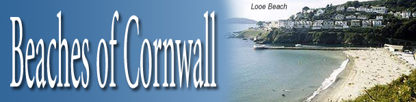
Cornwall Beaches - Looe, Millendreath, Rame, Seaton & Whitsand Bay
Back to Cornwall Online's Beach Guide
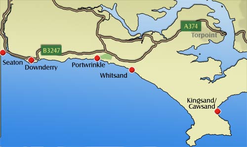
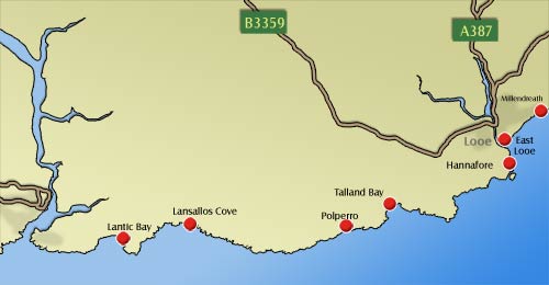
SOUTH EAST CORNWALL BEACHES
Looe, Millendreath, Seaton & Whitsand Bay
This south eastern section of Cornish coastline is home to the bustling harbour towns of Polperro and Looe, popular with tourists for their numerous shops, cafes and restaurant.
There are numerous well facilitated family beaches such as East Looe beach, Seaton and Downderry, as well as a number of small hidden coves offering tranquility and spectacular scenery.
- Roadside parking adjacent to the beach
- Toilets
- Refreshments
- Dogs allowed
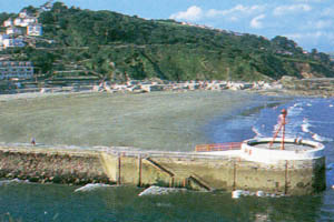
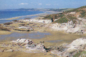
A long strip of shingle and patches of sand with large area of rocks revealed at lower tides. Grassy banks above the beach are ideal for picnics. Easily accessible from adjacent parking along the seafront. South east facing.
Sat Nav Co-ordinates:
N50º 20' 41.28"
W4º 27' 13.92"
- Car park in the town
- Toilets
- Refreshments
- No dogs Easter to October
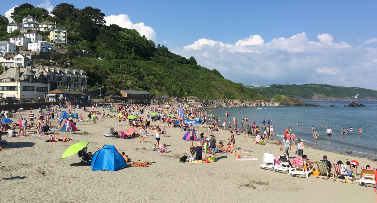
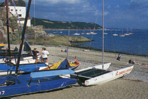
A sandy beach, popular with families and often crowded. The town offers excellent facilities including shops, restaurants, cafes etc. To avoid congestion in the town, parking is a 10 minute flat and accessible walk to the beach through the town.
Sat Nav Co-ordinates:
N50º 21' 21.78"
W4º 27' 18.51"
- Car park adjacent to the beach
- Toilets
- No dogs all year
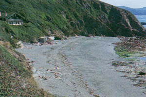
Small south facing cove of sand and rock pools. The surrounding area is largely occupied by Millendreath Holiday Park which is currently closed to the general public. Level, easy access from parking located close to the beach.
Sat Nav Co-ordinates:
N50º 21' 46.08"
W4º 26' 06.89"
- Car park
- Toilets
- Refreshments
- Dogs allowed
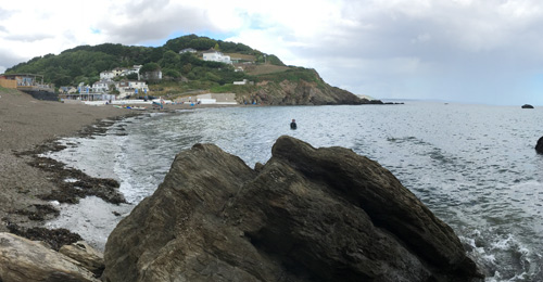
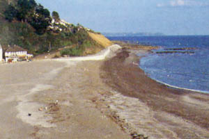
A large, south facing beach of gray sand and small pebbles, popular with families. Located at the bottom of the river Seaton valley. Easy level access from parking and all facilities are nearby.
Sat Nav Co-ordinates:
N50º 21' 57.08"
W4º 23' 14.85"
- Car parking in the village
- Toilets
- Refreshments
- Dogs allowed
A wide south facing beach of sand and shingle with rocks at low tide. Easy access from parking.
Sat Nav Co-ordinates:
N50º 21' 44.93"
W4º 22' 14.66"
- Car park
- Toilets
- Refreshments
- No dogs Easter to October
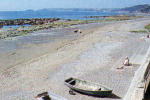
Small south west facing beach of rocks and sand, fairly well covered at high tide. Popular with families. Easy access from parking.
Sat Nav Co-ordinates:
N50º 21' 42.94"
W4º 18' 30.51"

CLICK
HERE
Self Catering - Cottages
in Whitsand Bay
CLICK
HERE
Bed & Breakfast - Hotels in Whitsand Bay
- Car park
- Toilets at Tregonhawke
- Dogs allowed
A four mile, south west facing, stretch of sand and rocks, much of which is covered at high tide. Access from parking areas along the coast road is difficult and involves negotiating fairly uneven paths and flights of steps. Particular care should be taken to prevent being cut off by the incoming tide on this stretch of the coast.
Sat Nav Co-ordinates:
N50º 20' 54.85"
W4º 15' 27.74"
- Car park
- Toilets
- Refreshments
- Dogs allowed (Kingsand)
- No dogs Easter to October (Cawsand)
Fairly sheltered small, east facing coves of sand and shingle accessed after a short walk from either the large car park at Cawsand or the parking at Kingsand.
Sat Nav Co-ordinates:
N50º 20' 01.08"
W4º 12' 07.13"
- National Trust car park
- Toilets
- Dogs allowed
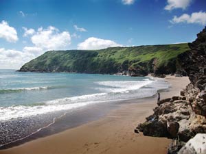
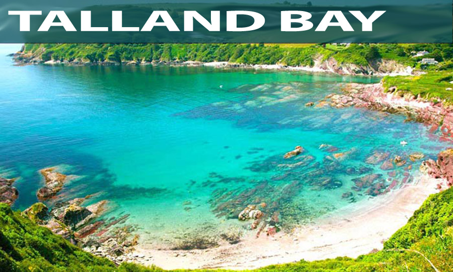
A secluded and attractive cove of white sand with some shingle. An beautiful beach byt bathing can be hazardous.
Views towards Pencarrow Head. Access from car park is difficult and not suitable for wheelchairs/pushchairs. South facing.
Sat Nav Co-ordinates:
N50º 19' 58.87"
W4º 36' 04.59"
- A family favourite
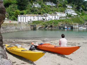
At low tide the harbour dries revealing a small sand and shingle beach. At the end of a deep and sheltered valley, the west side is better known as Chapel Pool. There is tourist traffic to invade your peacful day out as the car park is at the top of the valley. From the car park is an easy 10 minute walk through the streets, or have a ride on the horse drawn bus service in high season.
Sat Nav Co-ordinates:
N50º 19' 51.96"
W4º 31' 11"
- National Trust car park
- Dogs allowed
An attractive, rarely busy south facing cove of sand and shingle. Reached by a 20 minute walk down an unmade track, possible, but not easy for pushchairs and involves the crossing of a stile.
Sat Nav Co-ordinates:
N50º 20' 12.66"
W4º 34' 08.00"
- Car park adjacent to the beach
- Toilets
- Refreshments
- Dogs allowed
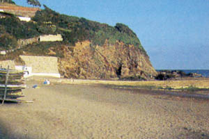
Limited south facing beach of shingle and rocks with some sand at low tide. Plenty of rock pools. Easily accessed from parking area.
Sat Nav Co-ordinates:
N50º 20' 15.90"
W4º 29' 51.12"