
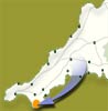
 The
Lizard
The
Lizard
A
fascinating stretch of the coastal footpath offering coves and beaches
all well worth exploring.
| Distance: | 14 miles. 8+ hours | Recommended
maps: Ordnance Survey Explorer Map 103 The Lizard |
|
| Grade: | Grade -
Moderate Type - Gravel paths |
||
| Facilities: | Toilets, Cafes at The Lizard Village and The Lizard | ||
| Parking: |
Car parks in Village
|
||
 |
|
 |
|
All information given in good faith and for use as guidance only. |
![]()
Take the T1 bus service, buy yourself a Day rover ticket and set off on a fascinating stretch of the coastal footpath. The 7:44 was empty save for me, a young girl torn between her mobile phone and her "Walkman", a young man looking out of the window and wishing he were somewhere else and an older man in shirt, tie and white sneakers with a suitcase. Oh, and the driver.
Lizard Head at 8:45 even on a sunny late summer Saturday is very quiet and peaceful. Hardly a ripple disturbs the Ocean except where the currents meet offshore and there is always turbulence. Ten ships of varying size ply the trade goods of the World both East and West offshore from this famous landfall. The most Southerly this and that are dotted around, and a man taking money out of the telescope slot machine. He had a key by the way and I think he was genuinely meant to be taking the money!
Over to the East is the Lloyd's building, silhouetted against the morning sun like a giant Lego block, with its short turrets and knobbly bits on top. This is reached via a straightforward, well-trodden section of coast path, quite close to the edge in places. Also along here is a huge hole in the cliff top, made when a sea cave roof fell in during a February gale in 1847. The Lion's Den as it is known is well marked with warning signs of its precipitous drop so take great care. No extra points for getting too close to the edge.
Bass Point is the next headland with its MCI volunteer Coastguard lookout. A quick chat with the duty officer about the weather, bird spotting... (has he really seen a Chough here in the last few days?)... and the passing shipping and on again. Twenty vessels in the last hour and a half, I am told. A busy day but "set fair". Busy too on the pink flowers growing on the hedge of the nearby cottage. Tortoiseshell, Red Admiral, Gatekeeper and White butterflies abound and further along little blue and brown cousins flit along the path in front of me, stopping to take in the sweetness of the flowers or bask in the early morning sun.
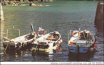
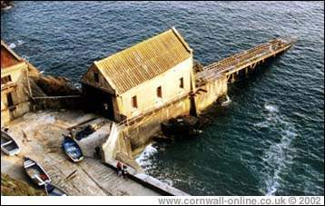
Soon the path comes up to the Lizard Lifeboat Station. A Tyne Class boat is based here, slipway launched down to an often boiling sea. Today however, the sea is glassy smooth and clear. It's one of my ambitions to take the plunge with the Lifeboat down this or a similar slipway. Past a pleasant little hideaway cliff chalet and up and down a few gentle slopes, nothing too serious yet. Past another collapsed sea cave, the Devil's Frying Pan, looking today for all the world as if someone turned off the heat. No boiling sea in the bottom, just the odd gull floating around, turning the seaweed and flotsam looking for breakfast. Cadgwith is just around the next corner and down the hill. A working fishing cove with its boats drawn up on a winch from the tideline. A host of gulls are feasting on the discarded guts thrown overboard by two stocky Cornishmen, silently gutting the night's catch.
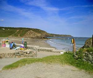
The National Trust owned Poltesco Cove is soon reached via Enys Head. Soon though the pleasantness of the surroundings becomes as touristified as it can possibly get. A large caravan site, complete with its own pitch and putt course. This is the approach to Kennack Sands.
At the far end of this stretch of beach is a small pond, crossed by a wooden bridge, freshwater fed by the trickle which comes from the boggy land around and supporting a shoal of small fish and a host of dancing, fairy-like, multicoloured dragon flies. Quite a change from the approach to the beach via the caravan park.
Further on and a reminder of the dangers of this coast, an old rusting boiler from a shipwreck can be seen on the beach at Spernic Cove. Carrick Luz a little further on boasts an Iron Age Fort. Evidence of old mine workings in the cliffs around Downas Cove are further testament to another bygone age.
A pleasant place to stop for lunch but the climb up from here to Beagles Point is the stiffest of the day by far and not to be entertained on a full stomach!
Near here too, ample evidence of the dangers of the coastline. A simple wooden cross with the inscription "B.J. Sharpe, 21/3/74, aged 30". A small tribute to a well loved friend or relative. An obvious tragedy remembered with respectful memories. "Somebody loves and remembers you still B.J.. Rest in peace".
Rounding Black Head the path turns North, the geology is changing from the serpentine which has made the Lizard peninsula famous and which has been carved and polished into tourist souvenirs by successive generations of Lizard families.
Used too for hedging and stiles, it can be green, red, brown and a host of colours in between but is, without fail, damned slippery when wet. Cautionary note here when climbing serpentine stiles. Ever onward then and past Chynalls Point, an almost mini version of Cape Cornwall, except for its lack of mine chimneys. A detour slightly inland to avoid the grounds of a large hotel and you are in Coverack. The Paris Hotel, named after a famous wreck in 1899 serves a passable pint of bitter shandy to the weary walker. The village, like a lot, one time thriving Cornish fishing ports, now boasts but a small resident fleet of boats, but caters well for the tourist industry and has its own school for windsurfing. Lowland Point is a little further on.
The Manacles Rocks now come into view. These jagged points have been the graveyard of a host of ships and countless sailors ever since man first took to the waters around our coastline. The large "hole" in the cliff is Dean Quarry, and the coastpath wends its way right through the middle. Dean Quarry was untill 2010 a working quarry, but it is now closed..
After the quarry and Shag Rock, Godrevy Cove is reached. The path goes inland from here, avoiding the quarries and cliffs of Manacle Point.
It rejoins the coast again briefly at Porthoustock and properly at Porthallow (Proustock and Pralla' to the locals) but our route is inland. A good day's walking of around 13 or 14 miles is behind you and another well earned pint at the Three Tuns in St. Keverne while we wait for the T2 to Helston and thence, the T1 back home and a hot bath.
LOCAL GUIDES MAPS AND BOOKS