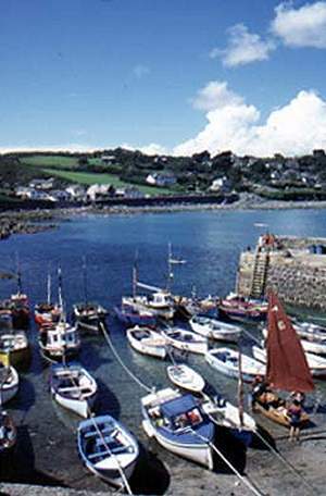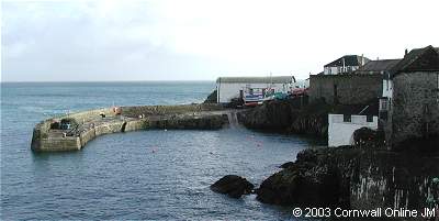
 Coverack
Attractive walk taking in beautiful views
of Coverack. You will also get the best view of the Manacles rocks, where
many a ship has been wrecked.
| Distance: | 5 miles. 3 hours | Recommended
maps: Ordnance Survey Explorer Map 103 - The Lizard |
|
| Grade: | Grade -
Moderate Type - Coastal path gravel |
||
| Facilities: | Toilets, Pub, shops and cafes in Coverack | ||
| Parking: |
Car Parks in the Village
|
||
 |

|
|
All information given in good faith and for use as guidance only. |
![]()
This very attractive walk takes in beautiful views of Coverack. You will also get the best view of the Manacles rocks, where many a ship has been wrecked. The walk covers varied terrain, and stout shoes are advisable, or wellingtons after rainfall.
Coverack to St Keverne, via Godrevy Cove (5 miles)
The walk begins at the main car park, at the north end of the village.
Leave the main road and continue along the lane past the bus shelter. At the top of the lane follow the sign to Lowland Point down to a path along the cliff edge. Look out for the plant life along this path, especially the Pale Bitterwort and Ladies' Tresses. For the first 1/4 mile the path undulates and to avoid slippery rocks and mud, alternative routes have been cut above the path. Occasional openings lead on to the cliff edge.
Beyond The Grove there is a stretch of path bounded by bracken which grows to shoulder height. A number of stone steps then lead up to a raised beach where the ground opens out to give a clear view out to sea.
The path continues along the raised beach to Lowland Point (pictured above). From here you climb up to Dean Quarry, where the path divides.. (For a shorter walk, follow the grassy track up to the left, behind the quarry, and join the road to St Keverne). The coast path goes through the workings and to the seaward side of the tips, leading you to Godrevy Cove.
Godrevy is quite a large beach made from quarry waste. You get the best view of the Manacles from here, especially at low tide. The footpath away from Godrevy Cove leads through Chenhale Farm to Rosenithon. Turn left, and follow the road to St Keverne. In the village, take the lane past the garage heading south out of the square. Climb over the stile in front of you at the first sharp right turn. Keeping the hedge on your left, go through two fields then head diagonally right across the third field and over a stile into the road. If you're a bit peckish at this point, Tregellast Barton's Croust House and ice creams are just down the road on your left.
Cross the stile on the right-hand side of the lane to Trebarveth. Take the path diagonally right across the field, and then over several more fields and stone stiles to Trevalsoe. Follow the road to a sharp right turn. Take the track straight ahead over the little bridge and up to Boscarnon (dogs here - so keep yours on a lead). The path goes in front of the house and farm buildings and bears left onto the concrete drive, with the remains of an old Cornish hedge on your left. Keep on this until it turns sharp right.
Climb over the stile to the left of the gate in front of you and follow the track across three fields. After the slipway by the gate out of the third field, follow the track which turns down to the left and goes between hedges either side to a copse with a ruined building on your right. The path now crosses two ancient meadows with large outcrops of rock. After the gapway out of the first meadow, turn to the right through an archway of bushes, over two stiles and into another meadow. From here on the path down to Coverack is easy to follow down through boulder-strewn heathland and copses, with views over the bay.
LOCAL GUIDES MAPS AND BOOKS
