Cornwall's Mineral Tramways
Walking and Cycling Trails Through a Fascinating Mining Heritage
Walking and Cycling Trails Through a Fascinating Mining Heritage
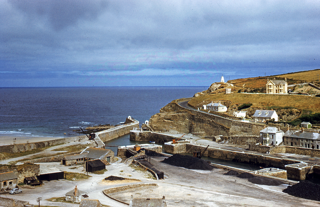
Mineral Tramways is one of the largest trail networks of its kind in Britain, offering free access to walkers, cyclists and horse riders across a network that now spans six connected trails - the Coast to Coast Trail, the Great Flat Lode Trail, the Tresavean Trail, the Tehidy Trail, the Portreath Branchline Trail and the Redruth & Chacewater Railway Trail - totalling over 60km (37 miles). Most routes largely follow the lines of early horse-drawn tramroads that once carried ore, coal and timber between the mines and the coast.
The trails connect the harbours of Hayle, Portreath and Devoran with inland mining towns and historic estates such as Tehidy, once home to the Basset mining family and now a country park in its own right. Along the way you'll pass towering granite engine houses, waymarkers and interpretation boards that tell the story of Cornwall's role at the forefront of the Industrial Revolution - the Great Flat Lode area is recognised as one of the world's best-preserved mining landscapes, and forms part of the Cornwall and West Devon Mining Landscape World Heritage Site.
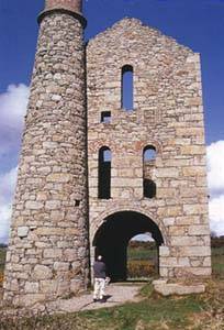
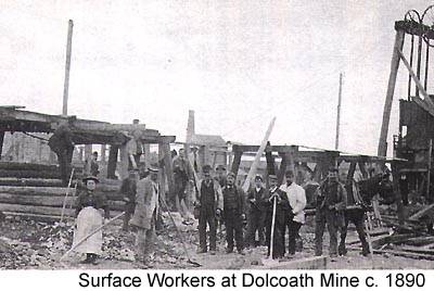
This was Cornwall's industrial heyday, roughly 1750 to 1850, when the mines employed huge numbers of men, women and children under often brutal conditions. Women worked the surface as balmaidens, breaking ore, while children laboured on the dressing floors and underground. When the copper and tin industry collapsed in the later 19th century, an estimated two-thirds of Cornish miners emigrated to find work abroad - a loss that reshaped the county's communities for generations, and whose legacy is still visible in the trails, engine houses and mining villages you can walk through today.
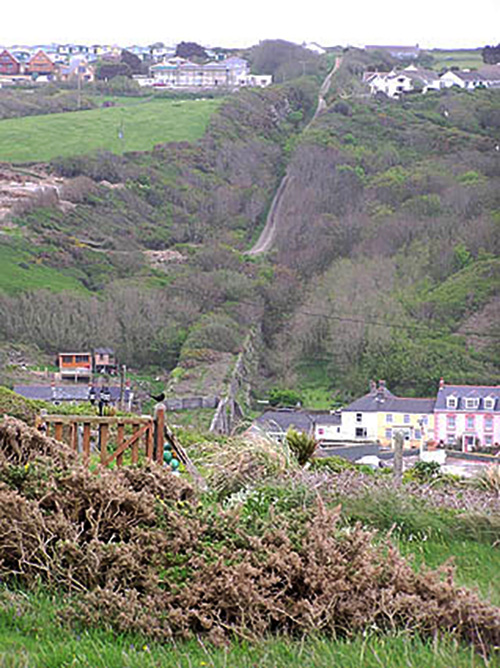
Cornwall's tramways and railways fell largely silent once the mining industry collapsed, and many lines lay disused for most of the 20th century. The Mineral Tramways Heritage Project, set up by Cornwall County Council in 1989, set about converting these old routes into a network of surfaced, multi-use trails for walkers, cyclists and horse riders - opening around 20 miles of paths in its first phase, later expanded to the roughly 37 miles (60km) that make up today's network.
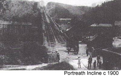
The Coast to Coast Trail is the best-known result of this work and is now designated National Cycle Network Route 3. Its first section, the old Portreath to Scorrier tramroad, was originally laid in 1812 as Cornwall's first surfaced tramway - making it one of the oldest pieces of transport infrastructure in the county to find a genuinely new use, nearly two centuries on from its construction.
The wider network also connects into The Cornish Way, a much larger regional cycling and walking route developed by Cornwall Council's Countryside Service in partnership with Sustrans, linking several heritage trails across roughly 180 miles of the county.
The project's success in reopening this landscape for public use is widely credited with helping draw attention to the area's mining heritage, which went on to be recognised as part of the Cornwall and West Devon Mining Landscape UNESCO World Heritage Site in 2006.
Converting the routes was only part of the work. The Heritage Project was a £6 million regeneration scheme, funded through Objective One, the South West Regional Development Agency, the Heritage Lottery Fund and local parish and town councils, and it also carried out the careful conservation of twelve significant mining sites along the way - making old shafts and engine houses safe so that they could be enjoyed by visitors rather than fenced off and forgotten.
Today the majority of the network is traffic-free, flat and surfaced, making most of the trails wheelchair and buggy friendly as well as suitable for walkers, cyclists and horse riders. Bike hire is available at Bissoe, Redruth and Portreath, so you don't need your own to explore - a practical legacy of a project that turned Cornwall's industrial past into one of its most accessible outdoor attractions.
| Trail | Distance | Start / end points | Parking | Facilities | Difficulty |
|---|---|---|---|---|---|
| Coast to Coast Trail | 11 miles (17.5km) | Portreath (north coast) – Devoran (south coast), via Bissoe | Portreath (near the beach), Devoran (near the quay), Unity Woods and Bissoe | Cafes and pubs along the route, incl. the Old Quay Inn (Devoran) and Saint Piran Cafe (Bissoe); bike hire at Bissoe | Easy – mostly level, largely off-road |
| Great Flat Lode Trail | 7.5 miles (12km), circular | Circular route around Carn Brea – join at South Wheal Frances car park or King Edward Mine | South Wheal Frances (free), King Edward Mine | Cafe at King Edward Mine Museum; The Countryman Inn, Carnkie | Moderate – mostly off-road with some short climbs |
| Tresavean Trail | 1.1 miles (1.8km) | Lanner village – joins the Redruth & Chacewater Railway Trail | Lanner village, or by the reservoir at Buller Hill | Pubs in Lanner village, incl. The Coppice Inn | Easy – level and entirely off-road |
| Tehidy Trail | 2.5 miles (4km) | East Lodge, Tehidy Country Park – Portreath | East Lodge, South Drive and North Cliffs car parks (Tehidy), plus Portreath | Cafe and toilets at the South Drive car park, Tehidy Country Park | Easy to moderate – mostly flat, some short steep sections |
| Portreath Branchline Trail | 5.5 miles (8.8km) | Portreath harbour – Higher Brea (joins the Great Flat Lode Trail) | Portreath, and East Lodge car park at Tehidy | Cafes at Portreath | Moderate – some road sections; one crossing unsuitable for horses |
| Redruth & Chacewater Railway Trail | 7.7 miles (12.4km) | Twelveheads (joins the Coast to Coast Trail) – Redruth (joins the Great Flat Lode Trail) | Twelveheads, Seleggan (near Carnkie), Buller Hill (near Lanner) | Gwennap Pit historic site on route; limited cafes nearby | Easy to moderate – mostly level and off-road, occasional road crossings |
All six trails are free to use and link together, so you can combine several in one outing. For exact directions and up-to-date car park locations, see Cornwall Council's official Mining Trails guide.
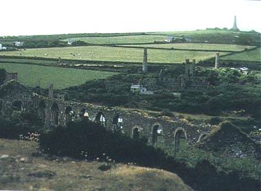
A 10.5km (6.5 mile) circular trail around Carn Brea hill, suitable for walkers, cyclists and equestrians. The section at Basset Mines is accessible for disabled visitors. The surrounding towns of Camborne and Redruth offer shops, places to eat and links to public transport, and many local buildings were built from mining wealth - well worth exploring via the area's own town trails.
By car: take the Camborne/Portreath/Pool exit from the A30, turn left towards Pool, then follow the brown signs for the "Mineral Tramways Centre," passing South Crofty Mine on your right.
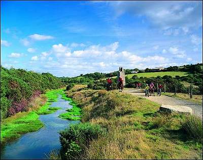
Distance: 11 miles / 17.5km Time: approx. 7 hours
Links the historic mining harbours of Portreath on the north coast and Devoran on the south, closely following two early horse-drawn tramroads. A more strenuous 2 mile (3km) link via Wheal Busy and Hawke's Engine House is steeper and rougher than the rest, but worth the effort for the views and history. The route is largely off-road, with granite waymarkers and interpretation boards along the way.
By car: from the A39 Truro-Falmouth road, follow the brown signs for cycle hire; the trail runs roughly parallel. Car parks along the route may charge; elsewhere roads are often narrow with little parking.
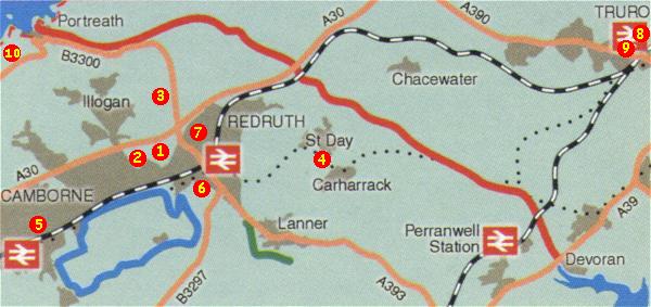
Agar Road, Pool. Tel: 01209 315027
Two Cornish beam engines - one for pumping, one for winding - either side of the main Camborne-Redruth road. A good starting point for the area, with an exhibition and shop. Owned by the National Trust.
Camborne School of Mines, Pool. Tel: 01209 714866
Mineral displays and monthly exhibitions by local artists.
Portreath Road, near Redruth. Tel: 01209 215185
Restoration of tin streaming works in progress, a joint project with Cornish Goldsmiths.
Near Redruth. Tel: 01209 613987
Once at the heart of the Gwennap mining industry, once described as "the richest square mile in the world." Three trails now explore their history.
The Cross, Camborne. Tel: 01209 713544
A small Cornish reference section, with a statue of Richard Trevithick outside.
Alma Place, Redruth, TR15 2AT. Tel: 01209 216760
The main Cornish reference collection - books, articles and photographs useful for mining, transport and family history research.
Cross Street, Redruth. Tel: 01209 215736
Home of William Murdoch, pioneer of the world's first practical piped gas lighting system in 1792. Now home to the Cornish-American Connection and Cornish Global Migration research projects.
5 Victoria Square, Truro. Tel: 01872 264044
Library and research centre for tracing family history, with a quarterly journal for members and a small daily fee for non-members.
County Hall, Truro. Tel: 01872 323127
Historical records for reference, held by Cornwall County Council.
Near Camborne. Tel: 01209 714494
House and gardens, with nine miles of woodland, lake and riverside paths and a regular events programme.
Hayle. Tel: 01872 322642
Extensive sand dunes with nationally important flora and fauna. Dynamite Towans, at Upton Towans, is the site of the old explosives factory. Free access.
The full Mineral Tramways network now spans six connected trails - the Coast to Coast Trail, the Great Flat Lode Trail, the Tresavean Trail, the Tehidy Trail, the Portreath Branchline Trail, and the Redruth & Chacewater Railway Trail. Cornwall Council publishes an official Mining Trails guide covering all six, including parking and points of interest along each route - view the guide on Cornwall Council's website.
For a detailed paper map, OS Explorer 104 "Redruth and St Agnes" (1:25,000) covers the whole area and is still in print, available from outdoor and map retailers.