Polzeath, North Cornwall – Surfing Beach, Pentire Walks & Holiday Guide

Polzeath in North Cornwall
North Cornwall Towns and Villages | Padstow | Wadebridge | The Camel Estuary | Rock | Daymer Bay | Polzeath | Port Isaac | Trebarwith Strand | Tintagel | Bossiney Cove | Rocky Valley | Boscastle | Crackington Haven | Bude | Launceston | Camelford | Altarnum | Bodmin |
HOLIDAYS IN POLZEATH
Polzeath is a small seaside village in the parish of St Minver on North Cornwall's Atlantic coast, beside the mouth of the Camel Estuary. Its wide, golden beach has made it one of Cornwall's best-loved surfing and family-holiday destinations, while the National Trust headlands of Pentire Point and The Rumps are only a short walk away.
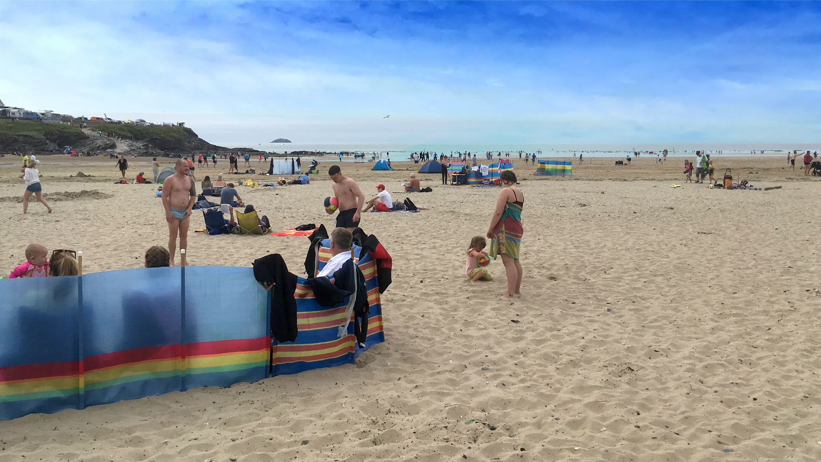
The beach is a large, west-facing triangle of flat, level sand, flanked by low cliffs on two sides, with rocky ledges that create sheltered alcoves for family days out. At high tide only a small patch of sand is left beside the road; as the tide goes out, a vast, gently shelving beach opens up, stretching for around 500 metres.
Polzeath is a popular choice for first-time surfers, with long, slow-breaking waves, surf schools and board hire on the beach. RNLI lifeguards patrol throughout the summer season, and the beach holds the Blue Flag for the 2026 season.
Behind the village, the South West Coast Path climbs onto Pentire Point and The Rumps, where an Iron Age cliff fort, wildflower meadows and big sea views reward a walk of a few hours. It was on these cliffs that Laurence Binyon is believed to have written ‘For the Fallen’ in 1914 – see Notable People.
The village has a relaxed surfer atmosphere, with beachside cafes, shops selling beach and surf kit, and the volunteer-run Polzeath Marine Centre, which organises rockpool rambles and beach cleans. On the hill to the north-east, New Polzeath – a twentieth-century addition to the village – has many of the holiday homes.
Polzeath makes a good base for the wider area. Rock and the foot ferry to Padstow are only a couple of miles south, the poet John Betjeman's Trebetherick and St Enodoc Church are close by, and Port Isaac lies along the coast to the east. Summer weekends and school holidays are busy, especially around high tide when the beach is at its narrowest, so plan ahead for parking.

On This Page

Along the southern side of Polzeath beach, below the coast path that runs along the edge of the Tristram car park, the low cliffs break into rocky ledges and outcrops. These rocks form natural family niches – sheltered corners where you can spread out the picnic, settle in for the whole day on the beach and enjoy the sunshine out of the breeze, with the sand and the surf just a few steps away.
POLZEATH BEACH
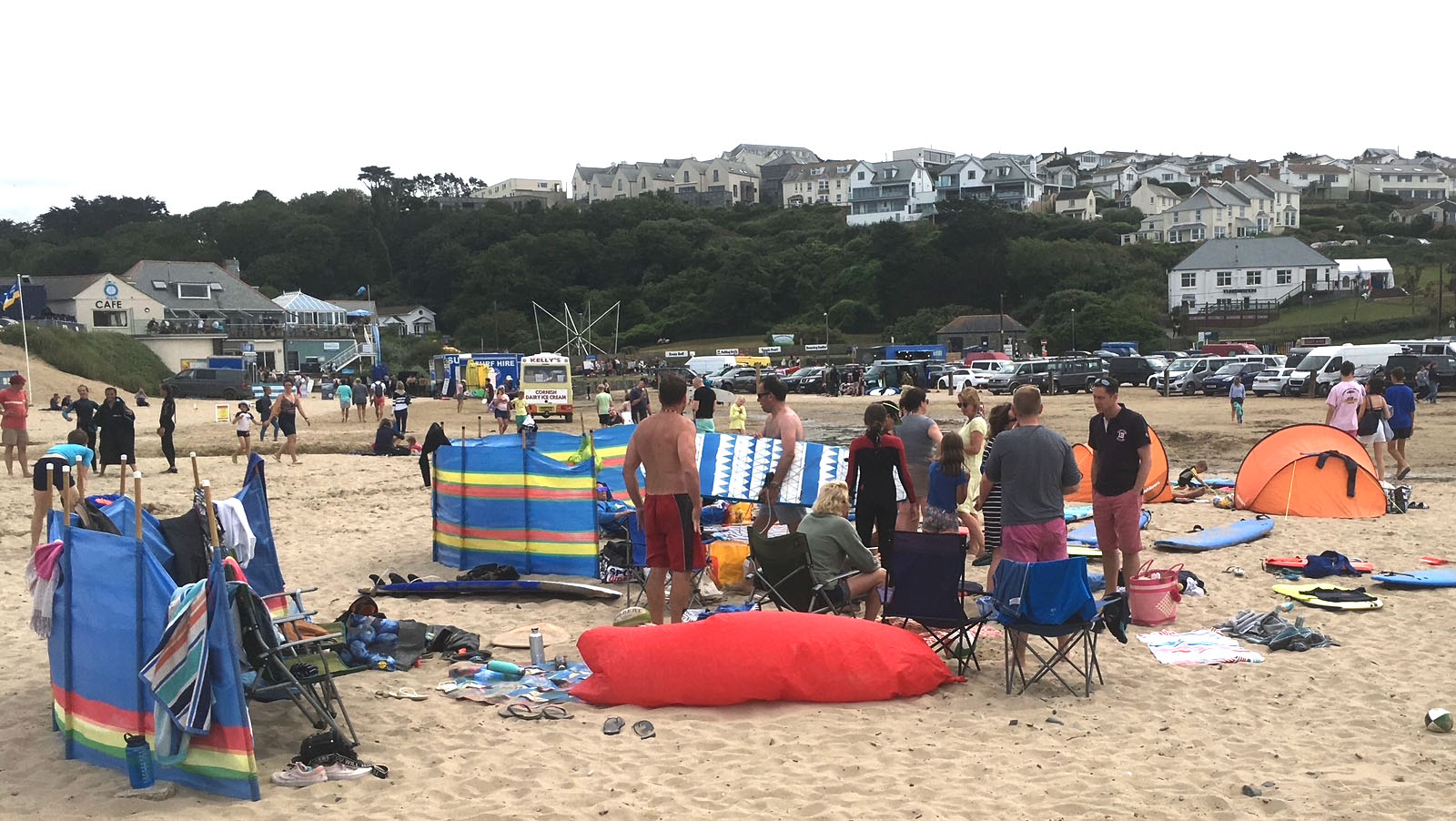
Polzeath and the surrounding coast are a paradise for beach lovers. Families head for the big main beach, with its safe flat sand, rock pools and seasonal RNLI lifeguards; surfers and bodyboarders come for the long, forgiving waves; and walkers find quieter coves around the Pentire headland. Whatever the weather and the tide, there is a beach to suit.
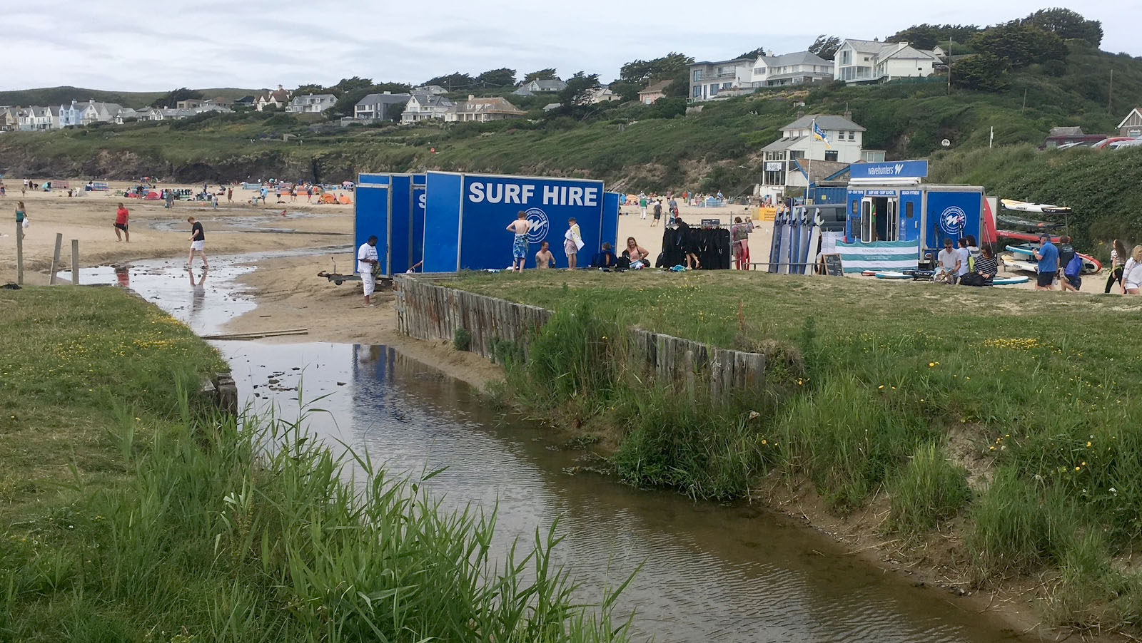
The main beach runs right up to the edge of the village, with the road and a small beachside car park forming the boundary. Two small streams, Polzeath Brook and the Trenant Stream, cross the sand, which children love, and the rocky ledges at the edges are good for rockpooling at low tide.


What's available at Polzeath
- Pay and display car parks beside the beach
- Toilets beside the beach
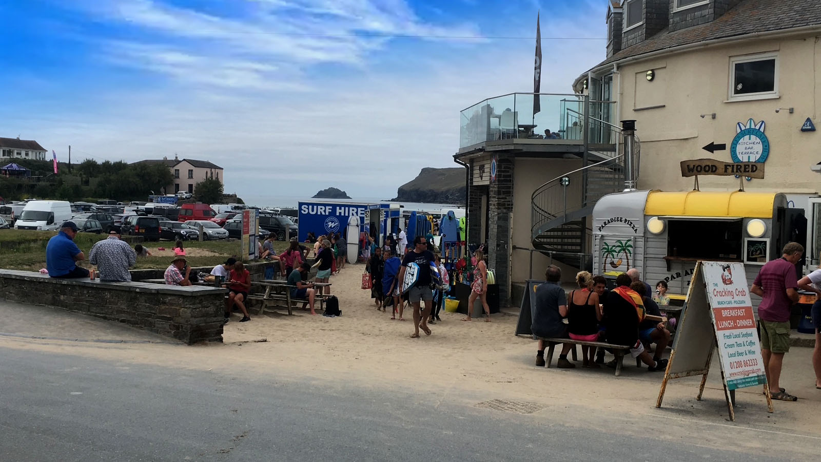
- Cafes, shops and surf shops adjacent to the beach
- RNLI lifeguards in the summer season
- Seasonal dog restrictions (see below)
Safety and lifeguards
Polzeath is a popular family beach, but its west-facing position means it is open to the Atlantic swell and rip currents can form, so take care at all times. RNLI lifeguards normally patrol daily from 10am to 6pm between early May and late September, with additional cover in the Easter school holidays and October half-term, and they use flags to mark separate areas for swimming and for surfboards. Remember: no flags means no lifeguards. Check current dates on the RNLI Polzeath page.
Polzeath is one of ten Cornish beaches awarded the Blue Flag for the 2026 season. Awards are renewed every year, so check the current status before you travel.
Dogs on the beach
Dogs are not permitted on Polzeath beach between 10am and 6pm from 15 May to 30 September. Outside those dates and hours, dogs are welcome. These rules are set by Cornwall Council and can change – see the council's dog restriction notice, and our dog-friendly holidays guide.
Polzeath Marine Conservation Area
Polzeath is a Voluntary Marine Conservation Area, supported by the Polzeath Marine Conservation Group, a volunteer-led group formed in 2012 and part of Cornwall Wildlife Trust's Your Shore network. Its Marine Centre, just across the road from the beach car park, runs rockpool rambles, beachcombing sessions and beach cleans through the summer; places on guided events usually need to be booked in advance. Please follow the Seashore Code and leave rock pool creatures where you find them.
Beaches near Polzeath
- Pentireglaze (Baby Bay) – a quieter beach at the northern end of Polzeath beach, cut off from the main beach at high tide by Slipper Point.
- Daymer Bay – a sheltered sandy beach on the estuary side of Trebetherick, a short distance south, with St Enodoc Church and golf links behind the dunes.
- Lundy Bay and Port Quin – remote National Trust coves along the coast path, each with a small car park.
For more, see our Polzeath beaches guide (including Polzeath beach, New Polzeath, Greenaway’s Beach and Rock), the Padstow beaches guide and the full Guide to Beaches in Cornwall.
↑ Back to topSURFING AT POLZEATH
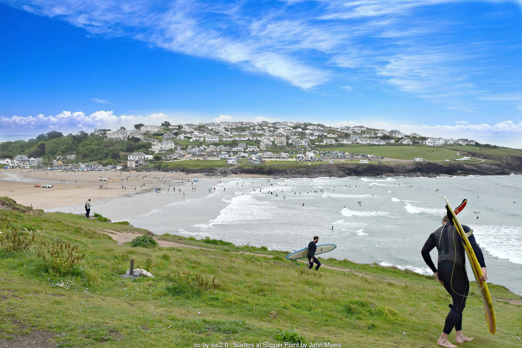
Polzeath is one of the best-known surfing beaches in Cornwall and is widely rated as one of the best learner beaches in the UK. The beach picks up Atlantic swell and breaks long and slowly over sand, which suits beginners and improvers, while experienced surfers can head to the more demanding breaks around the north coast.
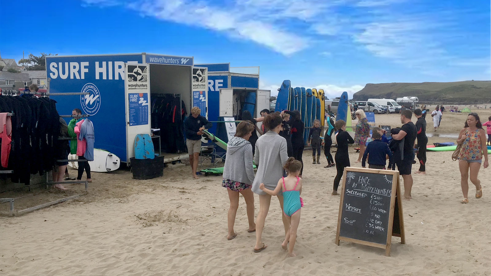
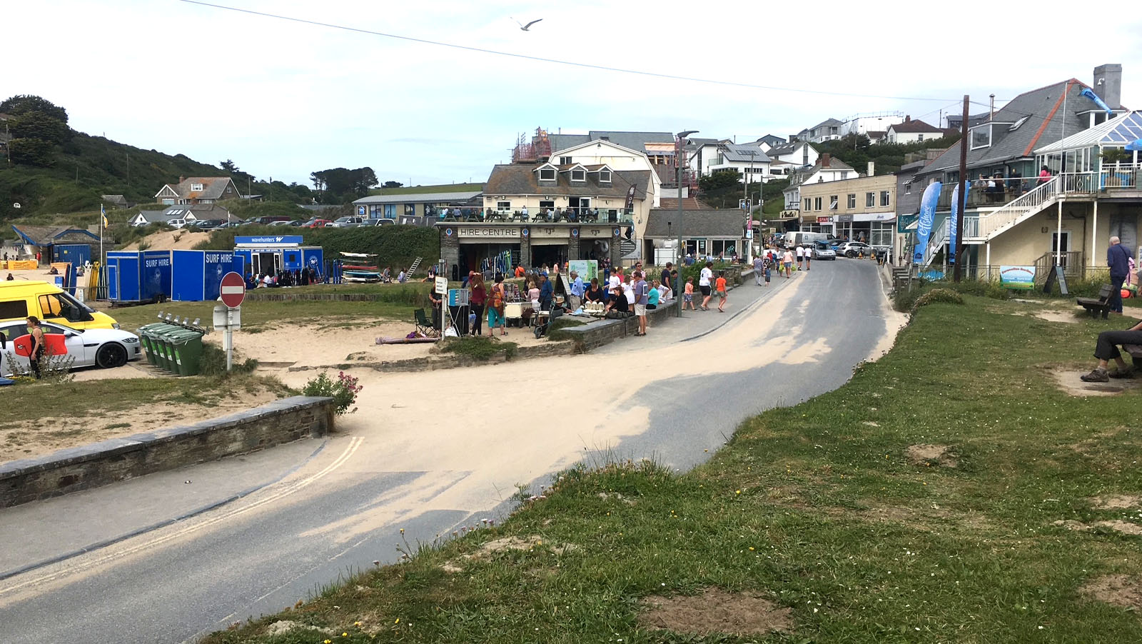
Surf schools and board and wetsuit hire operate from the beach and the village, and the shops around the seafront sell wetsuits, boards and beach kit. Our Polzeath & Padstow Surf Guide lists surf schools, hire and nearby breaks, and the Cornwall Surf Guide covers the whole county.
Polzeath also has a strong surfing community. The Polzeath Surf Life Saving Club, formed in 1990, trains children aged seven and over and adults on the beach from May to October, and the community-run Polzeath Surf Club has offered friendly, inclusive surf sessions since 2013.
Before you paddle out, check the tide, stay in the lifeguards' flagged areas and look at the Surfers Against Sewage Safer Seas & Rivers service for water-quality alerts. Surfing is possible all year round – summer brings smaller, gentler waves, while autumn and winter bring bigger swells and experienced surfers.


PARKING AT POLZEATH
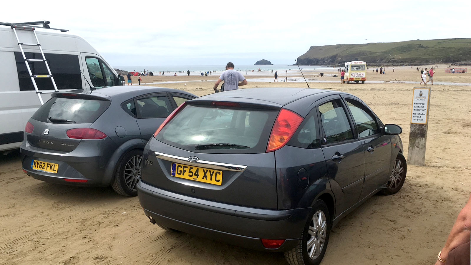
Polzeath has several car parks around the beach, and parking is one of the things that fills first on summer weekends and during school holidays.
- Polzeath Beach car park – a pay and display car park on the beach itself, just off Dunders Hill at the south end of the beach.
- Tristram car park – a large grass car park beside Tristram Camping and Caravan Park on the headland south of the beach, with views across to New Polzeath.
- National Trust Pentireglaze (PL27 6QY) – the main car park for Pentire headland, with toilets, a cafe, four electric vehicle charging points and Blue Badge parking. Parking is free for National Trust members and Blue Badge holders, and it is about a 25-minute walk from the beach. Small National Trust car parks also serve Lead Mines and Lundy Bay (PL27 6QZ); there is no overnight parking or camping.
See the National Trust's guide to where to park around Polzeath and Port Quin for current details.
THINGS TO DO IN POLZEATH
Polzeath is a place where the beach sets the rhythm of the day. Mornings are for surfing lessons, rockpooling or a swim between the flags; afternoons for ice creams, beach games and watching the surfers; and evenings for the sunsets that make this stretch of coast so popular.
Beyond the sand, the headlands offer some of the best clifftop walking in North Cornwall, and the coast path links Polzeath with Port Quin, Port Isaac and, to the south, Daymer Bay and Rock. On wet or windy days, the Marine Centre and the shops and cafes in the village are good places to shelter.
The wider Camel Estuary area has plenty more to explore within a few miles, from the foot ferry to Padstow to the Camel Trail cycle route from Wadebridge.
- Learn to surf – see our Polzeath surf guide.
- Go rockpooling – at low tide, or join a guided ramble from the Polzeath Marine Centre.
- Walk Pentire Point and The Rumps – our Pentire Point, The Rumps & Lundy Bay walk.
- Walk to Port Quin – see the Port Isaac to Port Quin circular walk and National Trust Port Quin.
- Take the foot ferry from Rock to Padstow – a pedestrian and cycle crossing of the Camel Estuary operated by Padstow Harbour Commissioners.
- Visit St Enodoc Church in Trebetherick and John Betjeman's grave.
- Play a round of golf on the links at Trebetherick – see our Cornwall golf guide.
- Cycle the Camel Trail from Wadebridge – see the Camel Trail guide.
- Explore nearby towns – Port Isaac, Rock, Padstow and Wadebridge.
WALKS FROM POLZEATH
The South West Coast Path passes through Polzeath, and the walk onto the Pentire headland is the finest short walk in the area. The headland is owned by the National Trust and farmed for nature, with wildflower-rich fields, seabirds and far-reaching views along the coast. Pentire Point itself is formed of ancient pillow lava, and nearby The Rumps is a twin-headed promontory with the ramparts of an Iron Age cliff fort.
- Distance: about 4 to 5 miles, depending on the route
- Time: about 2½ to 3 hours
- Grade: moderate – the path around Rumps Point is rocky and close to the cliff edge in places
- Start: National Trust car park at Pentireglaze, or from Polzeath beach and return by bus
Our own Pentire Point, The Rumps & Lundy Bay walk gives directions, parking and facilities, and you can browse all of our Cornwall walks and the South West Coast Path guide. Always keep to the path, stay well back from cliff edges and check the weather and tide times before you set out.
↑ Back to topHISTORY OF POLZEATH
The name Polzeath comes from the Cornish Polsegh (modern Pollsygh), usually translated as ‘dry pool’ or ‘dry creek’, and it was recorded as Polsegh in 1311. For centuries it was a small place in the parish of St Minver; the holiday village visitors know today grew up largely in the twentieth century, and New Polzeath on the hill is a twentieth-century development.
The headlands tell a far longer story. The Rumps, known in Cornish as Din Pentir (‘fort at Pentire’), is crossed by three ramparts dating from the late Iron Age, and excavations here in the 1970s found late Iron Age pottery and traces of round houses. Lead and silver mining on Pentire began in Tudor times and continued into the late nineteenth century – the old lead mines now form a National Trust car park – and Polzeath Consols worked copper and lead lodes close to the village between 1847 and 1856.
In the 1930s a speculator divided Pentire Point into building plots, but a public appeal raised the money for the National Trust to buy Pentire Farm and its headland in 1936, protecting it for good. In September 1914 the poet Laurence Binyon sat on these cliffs and wrote ‘For the Fallen’, a plaque to which was dedicated in 2003.
In the village itself, the main street crossed the stream by a ford, with a footbridge for pedestrians, until 1934, and the Methodist chapel was rebuilt in 1933 when the street was widened. As on many Cornish beaches, barbed wire was laid across the sand during the Second World War. Since then, Polzeath has grown into one of Cornwall's best-known surf beaches: the Polzeath Surf Life Saving Club was formed in 1990 and the Polzeath Marine Conservation Group in 2012.
↑ Back to topKEY BUILDINGS & LANDMARKS
Polzeath is a village of beach houses rather than grand buildings, but there are a handful of places with real character in and around it.
- Tubestation (Polzeath Community Church) – the village's former Methodist chapel on Trebetherick Hill. A chapel was built here in 1911, demolished in 1932 when the street was widened, and replaced by the present building, which opened on 15 April 1933. Since 2006 it has been known as the Tubestation, a church and community hub that is also a surfers' meeting place.
- Polzeath Marine Centre – the volunteer-run centre in the middle of the village, just across the road from the beach car park, where visitors can learn about local marine life.
- St Enodoc Church, Trebetherick – a small medieval church among the dunes and golf links, famous for its twisted spire. Wind-blown sand buried the church from the sixteenth century until the mid-nineteenth, and it was freed and restored in 1863–64. John Betjeman is buried just inside the churchyard gate.
- Doyden Castle, Port Quin – a clifftop folly built around 1827 by a wealthy local man and now a National Trust holiday cottage, reached on the coast path.
- The Rumps (Din Pentir) – the Iron Age promontory fort on Pentire headland, with ramparts across the neck of the headland and the offshore islet known as The Mouls.
NOTABLE PEOPLE
Laurence Binyon (1869–1943)
The poet and British Museum scholar Laurence Binyon wrote his best-known poem, ‘For the Fallen’, in September 1914 while visiting the cliffs between Pentire Point and The Rumps. The poem was published in The Times on 21 September 1914, and its famous fourth stanza is recited at Remembrance services across the UK and Commonwealth. A plaque on National Trust land, dedicated in 2003, marks the traditional location. A second plaque at Portreath also claims the poem, but Binyon himself named Polzeath in a 1939 interview.
Sir John Betjeman (1906–1984)
Poet Laureate John Betjeman spent childhood holidays at Trebetherick, a mile or so from Polzeath, and returned throughout his life. His poems ‘Trebetherick’ and ‘Greenaway’ describe the coast between Daymer Bay and Polzeath, and ‘Sunday Afternoon Service in St Enodoc Church, Cornwall’ celebrates the church among the dunes. He later bought a house in Daymer Lane, Trebetherick, where he died on 19 May 1984, and he is buried at St Enodoc.
↑ Back to topPOLZEATH ON SCREEN
Polzeath has a modest but genuine screen history. The original BBC adaptation of Winston Graham's Poldark (1975) filmed some scenes at Pentireglaze, on the Pentire headland, and the BBC's short Easter film Tresoddit (1991), set in cartoonist Posy Simmonds's fictional Cornish village, was filmed in and around Polzeath. For more screen-famous locations nearby, visit Port Isaac.
↑ Back to topLOCAL EVENTS
Polzeath's events are mostly community and beach based. Dates move from year to year, so check the organisers before you travel.
- National Marine Week (late July to early August) – the Polzeath Marine Conservation Group usually runs a beach clean, a rockpool ramble and beachcombing sessions from the Marine Centre, as part of Cornwall Wildlife Trust's events. Booking is often required for guided sessions.
- Summer surf sessions (June to August) – the community-run Polzeath Surf Club runs summer surf clubs and a Summer Solstice Surf around the longest day in June.
- Surf life saving (May to October) – Polzeath Surf Life Saving Club trains on the beach through the season and sometimes joins rescue demonstrations at marine events.
For events across the county, see Cornwall Events.
↑ Back to topMAP OF POLZEATH
Polzeath, North Cornwall – between Pentire Point and the mouth of the Camel Estuary
↑ Back to topVISITOR INFORMATION
Parking & EV Charging
Pay and display parking on the beach itself, a large car park beside Tristram Camping and Caravan Park on the headland south of the beach, and National Trust parking at Pentireglaze (PL27 6QY), about a 25-minute walk away. Car parks fill early on sunny summer days. See the parking section above for details.
Electric vehicle charging:
- National Trust Pentireglaze car park – four EV charging points, PL27 6QY
- Rock Village Institute, Rock Road – fast charger (7kW), PL27 6LQ
- Wadebridge – rapid chargers at the Jubilee Road old railway site and West Hill, about 7 miles away
Bus & Train
Go Cornwall Bus route 96 runs between Wadebridge and Delabole via Rock, Polzeath and Port Isaac, with stops at Polzeath Beach and Dunders Hill. The nearest railway station is Bodmin Parkway, about 18 miles away. The foot ferry from Rock crosses to Padstow.
Facilities
Toilets beside the beach and public toilets at New Polzeath, shops, cafés and surf shops in the village, and seasonal RNLI lifeguards. At Pentireglaze the National Trust has toilets, a café and electric vehicle charging. There are no facilities at the remote coves.
Cafés & Restaurants
A good choice of beachside cafés, surf-shop cafés, pubs and restaurants in the village, and a National Trust café beside the Pentireglaze car park (opening times vary). Many beach cafés are seasonal, so booking is wise for evening meals in summer.
Health
There is no hospital or minor injury unit in Polzeath. The nearest Minor Injury Units are at Bodmin and Newquay community hospitals. Call NHS 111 for urgent medical advice and 999 in an emergency – for emergencies at sea or on the cliffs, call 999 and ask for the Coastguard. The nearest major A&E is the Royal Cornwall Hospital in Truro.
Disabled Access
The beach is reached from the road and car park at the head of the beach, close to the shops and toilets. The National Trust car park at Pentireglaze has Blue Badge parking and the Trust notes several accessible routes on the Pentire headland. The coast path itself is steep, rocky and uneven in places.
Trips from Polzeath
Take surf lessons on the beach, join a Marine Centre rockpool ramble, walk the coast path to Pentire Point, The Rumps and Port Quin, or cross the Camel Estuary from Rock to Padstow on the foot ferry (pedestrians and cyclists only).
EXPLORE MORE
FAMILY HOLIDAYS & SHORT BREAKS IN POLZEATH
Family holidays in Polzeath are all about the beach. The wide, gently shelving sands, gentle surf and rock pools make it one of the best family beaches in Cornwall and one of the best places in the UK to learn to surf, with RNLI lifeguards on patrol through the season and the Blue Flag for 2026. Add the coast path to Pentire Point and The Rumps, the dunes of Daymer Bay and the ferry from Rock to Padstow, and there is something for every member of the family.
Most visitors choose one of the Polzeath holiday cottages. Beach houses and holiday cottages a short walk from the sand, apartments with sea views over Hayle Bay and family homes in New Polzeath, Trebetherick and St Minver give you space for surfboards and wetsuits, and the freedom to fit your days around the tides. Many Polzeath holiday cottages welcome dogs too.
Polzeath is just as rewarding for a short break or weekend getaway. Out of the school holidays the beach is quieter, the surf is often at its best and the clifftop walks are glorious, so a few nights in a B&B, hotel, holiday park or campsite nearby is the perfect escape. Booking direct with the owner means no agency fees.
Browse Polzeath holiday cottages, beach houses and apartments, or holidays and short breaks in Polzeath for every type of accommodation – B&Bs, hotels, holiday parks, camping and glamping – all listed on Cornwall Online by their owners.
↑ Back to topPOLZEATH FAQS
North Cornwall Towns and Villages | Padstow | Wadebridge | The Camel Estuary | Rock | Daymer Bay | Polzeath | Port Isaac | Trebarwith Strand | Tintagel | Bossiney Cove | Rocky Valley | Boscastle | Crackington Haven | Bude | Launceston | Camelford | Altarnum | Bodmin |